GPS satellite monitoring system and method
A monitoring system and satellite technology, used in satellite radio beacon positioning systems, radio wave measurement systems, instruments, etc., can solve problems such as inability to receive signals, and achieve the effect of reducing the risk index and the accident rate.
- Summary
- Abstract
- Description
- Claims
- Application Information
AI Technical Summary
Problems solved by technology
Method used
Image

Examples
Embodiment Construction
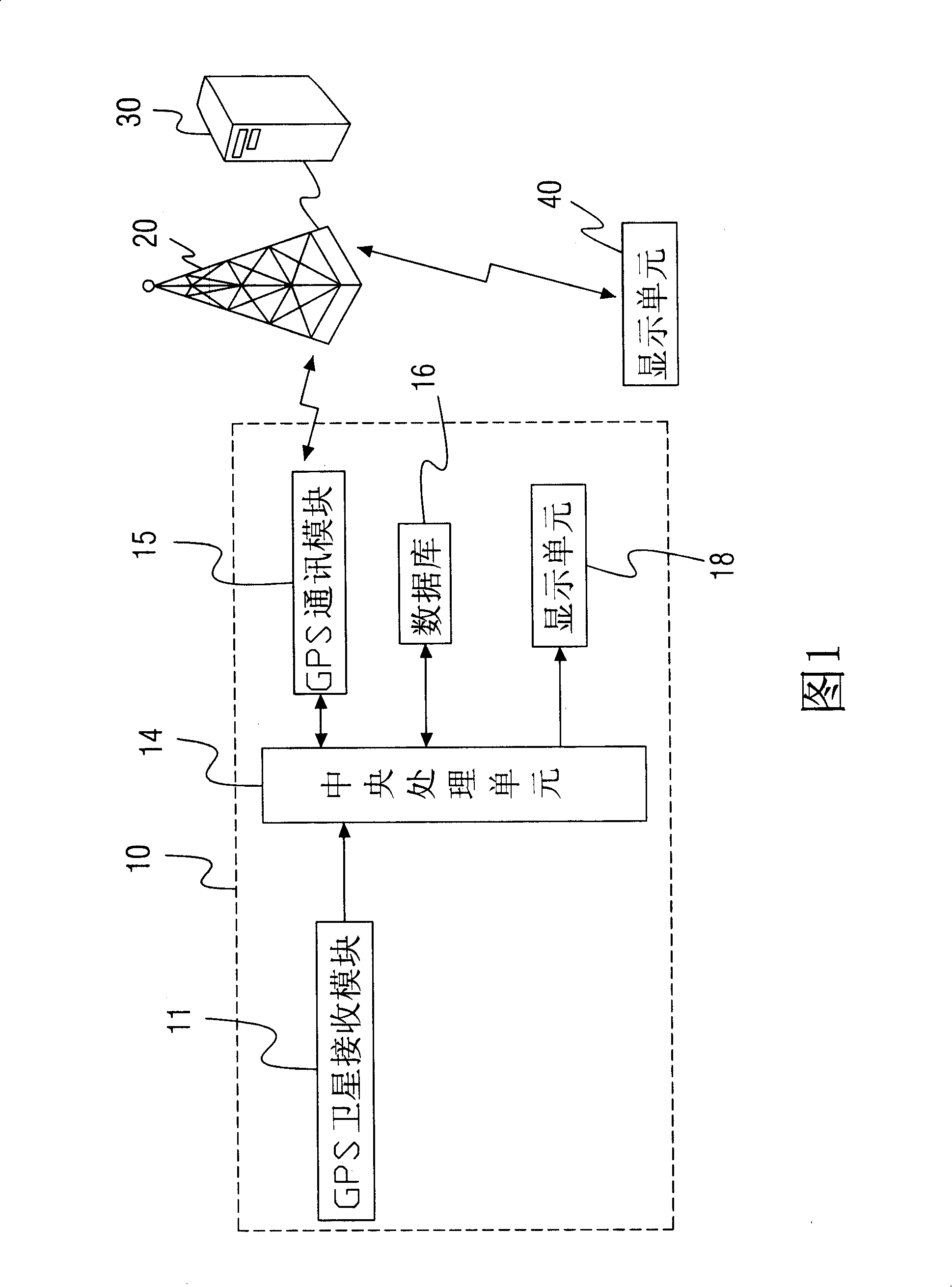
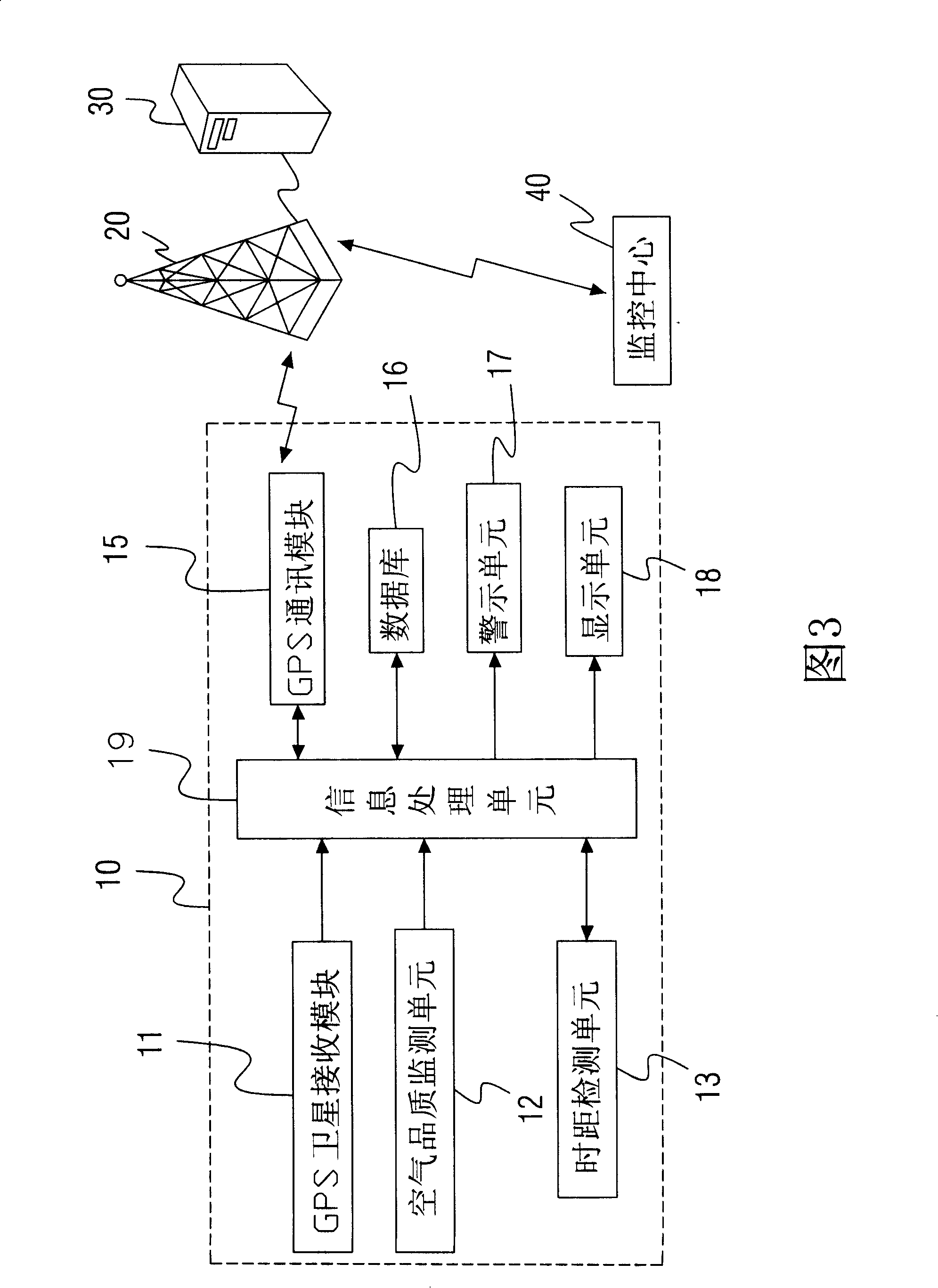
[0017] Fig. 3 discloses a satellite positioning monitoring system 10, which is used for safety warning of cars driving in a long tunnel, and the system includes: a GPS satellite receiving module 11 for receiving GPS satellite signals.
[0018] A database 16 has a number of safety warning data built in it; the data in the database 16 includes vehicle identification codes, air quality safety indicators, standard comparison values of signal interruption time, tunnel coordinates, etc.
[0019] A time distance detection unit 13, used to detect the interruption time of the GPS satellite signal received by the information processing unit 19, and transmit it to the information processing unit 19 for comparison to confirm whether it has not been received for too long and exceeds the preset time , to check whether the time to enter the tunnel is too long.
[0020] An information processing unit 19 is connected with the database 16 and the time distance detection unit 13 respectively, ...
PUM
 Abstract
Description
Claims
Application Information
 - Generate Ideas
- Intellectual Property
- Life Sciences
- Materials
- Tech Scout
- Unparalleled Data Quality
- Higher Quality Content
- 60% Fewer Hallucinations
Browse by: Latest US Patents, China's latest patents, Technical Efficacy Thesaurus, Application Domain, Technology Topic, Popular Technical Reports.
© 2025 PatSnap. All rights reserved.Legal|Privacy policy|Modern Slavery Act Transparency Statement|Sitemap|About US| Contact US: help@patsnap.com