A Landslide Extraction Method Based on Remote Sensing Image and Elevation Data
A remote sensing image and elevation data technology, applied in image data processing, image analysis, image enhancement, etc., can solve the problem of high sample data distribution, less research on large-scale research areas and complex background features, limited use efficiency and Practicality and other issues
- Summary
- Abstract
- Description
- Claims
- Application Information
AI Technical Summary
Problems solved by technology
Method used
Image

Examples
Embodiment Construction
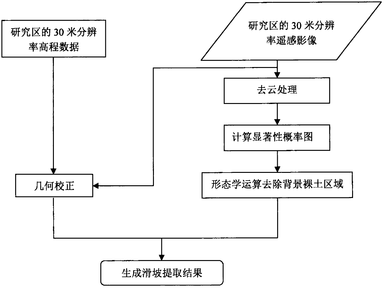
[0056] The technical solutions in the embodiments of the present application will be described below with reference to the drawings in the embodiments of the present application. Apparently, the described embodiments are only some embodiments of the present application, not all examples.
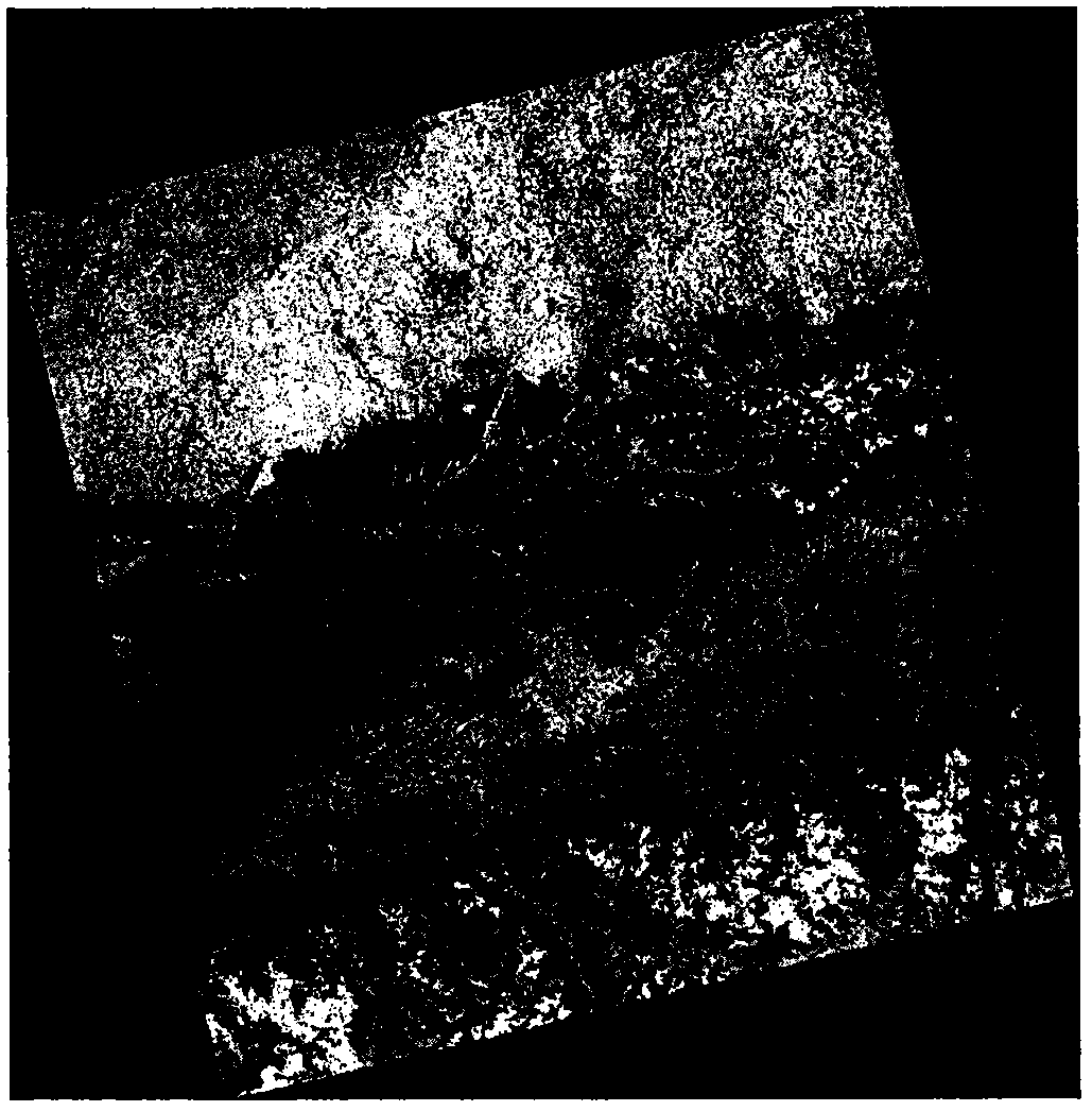
[0057] The embodiment of the present application takes Nepal as the research area near the Himalayas region, and selects a scene of Landsat8 image (covering space 2 ° x 2 °) on June 1, 2015 with a resolution of 30 meters (such as figure 2 shown) and the 30-meter resolution DEM data of the corresponding area are experimental data (such as image 3 shown). figure 2 The cloud shown can be removed by using the 9th band image of Landsat8 to generate a cloud mask, and then get Figure 4 .
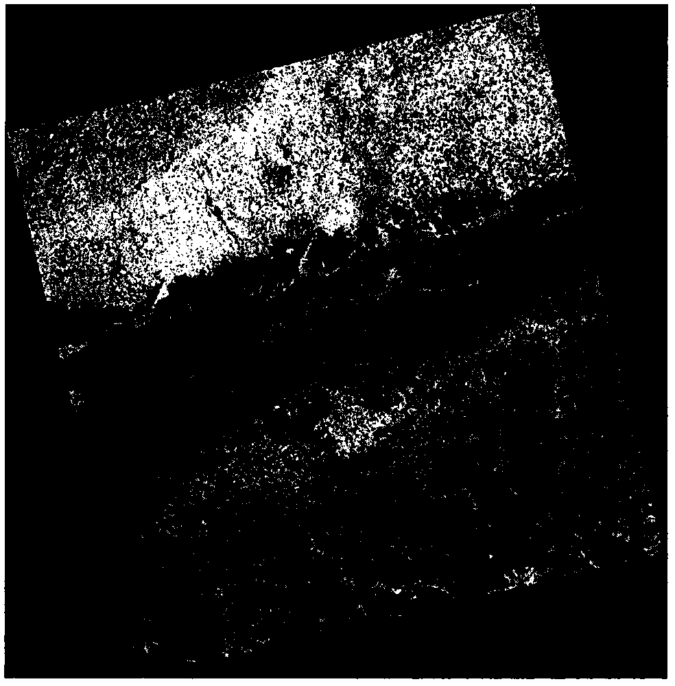
[0058] Such as Figure 5 As shown, the FASA method can better enhance the bare soil area information and weaken the vegetation and other information. However, most of the bare soil belongs to non-landsli...
PUM
 Abstract
Description
Claims
Application Information
 - R&D
- Intellectual Property
- Life Sciences
- Materials
- Tech Scout
- Unparalleled Data Quality
- Higher Quality Content
- 60% Fewer Hallucinations
Browse by: Latest US Patents, China's latest patents, Technical Efficacy Thesaurus, Application Domain, Technology Topic, Popular Technical Reports.
© 2025 PatSnap. All rights reserved.Legal|Privacy policy|Modern Slavery Act Transparency Statement|Sitemap|About US| Contact US: help@patsnap.com