Geodetic measurement system and operation method thereof
A geodetic and range finder technology, applied in the direction of measuring devices, measuring instruments, surveying and navigation, etc., can solve the problems of large errors in measurement results, and achieve the effects of reducing measurement errors, increasing gain, and increasing accuracy
- Summary
- Abstract
- Description
- Claims
- Application Information
AI Technical Summary
Problems solved by technology
Method used
Image

Examples
Embodiment Construction
[0039] A specific embodiment of the present invention will be described in detail below in conjunction with the accompanying drawings, but it should be understood that the protection scope of the present invention is not limited by the specific embodiment.
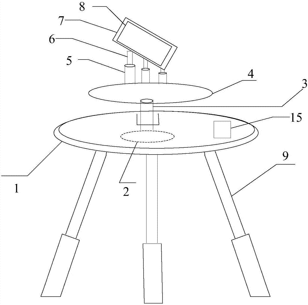
[0040] figure 1 It exemplarily shows a schematic view of the appearance of a geodetic system provided by an embodiment of the present invention, the geodetic system includes a bracket, the bracket includes at least two support legs 9, and the support legs 9 are telescopic support legs, The top of the support leg 9 is fixedly connected with a connecting seat 1, the connecting seat 1 is provided with a drive motor 2, the top of the drive motor 2 is provided with a motor shaft, and the top of the motor shaft is provided with a loading platform 4, so that the drive The motor 2 drives the motor shaft to drive the loading platform 4 to rotate. The top of the loading platform 4 is fixedly connected with at least two fixed rods 5,...
PUM
 Abstract
Description
Claims
Application Information
 - Generate Ideas
- Intellectual Property
- Life Sciences
- Materials
- Tech Scout
- Unparalleled Data Quality
- Higher Quality Content
- 60% Fewer Hallucinations
Browse by: Latest US Patents, China's latest patents, Technical Efficacy Thesaurus, Application Domain, Technology Topic, Popular Technical Reports.
© 2025 PatSnap. All rights reserved.Legal|Privacy policy|Modern Slavery Act Transparency Statement|Sitemap|About US| Contact US: help@patsnap.com