Check patentability & draft patents in minutes with Patsnap Eureka AI!

A road marking damage detection method based on UAV aerial road images

A damage detection and aerial image technology, applied in the field of image processing, can solve the problems of long running time and limited recognition accuracy, and achieve the effect of fast running speed, strong practicability and simple algorithm

Active Publication Date: 2021-04-13
南京中设航空科技发展有限公司
View PDF6 Cites 0 Cited by
  • Summary
  • Abstract
  • Description
  • Claims
  • Application Information

AI Technical Summary

Problems solved by technology

But the recognition accuracy is limited and the running time is long

Method used


Image

  • A road marking damage detection method based on UAV aerial road images
  • A road marking damage detection method based on UAV aerial road images
  • A road marking damage detection method based on UAV aerial road images

Examples


Embodiment Construction

[0039] The present invention will be further described below in conjunction with specific examples.

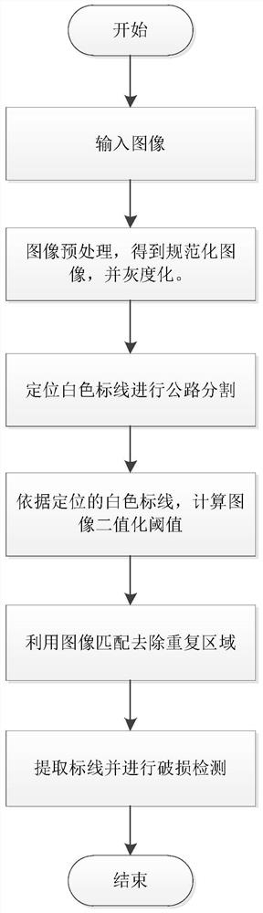
[0040] The invention belongs to the technical field of image processing, and in particular relates to a road marking damage detection method based on a UAV aerial road image, especially a positioning and segmentation algorithm for roads realized by edge detection, and a detection algorithm for damaged road markings .

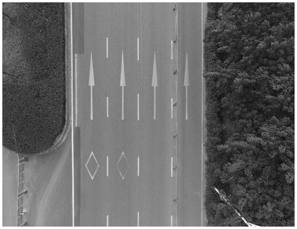
[0041] Step 1, use UAV aerial photography to obtain the aerial image of the road, and preprocess the aerial image to obtain the normalized image to be detected. The normalized image is as follows: figure 2 shown;

[0042] (1) The image input is an image in RGB format.

[0043] (2) The image is proportionally scaled to an image width of 2000 pixels.

[0044] (3) The image grayscale formula is Gray = (306*R + 601*G + 117*B)>>10.

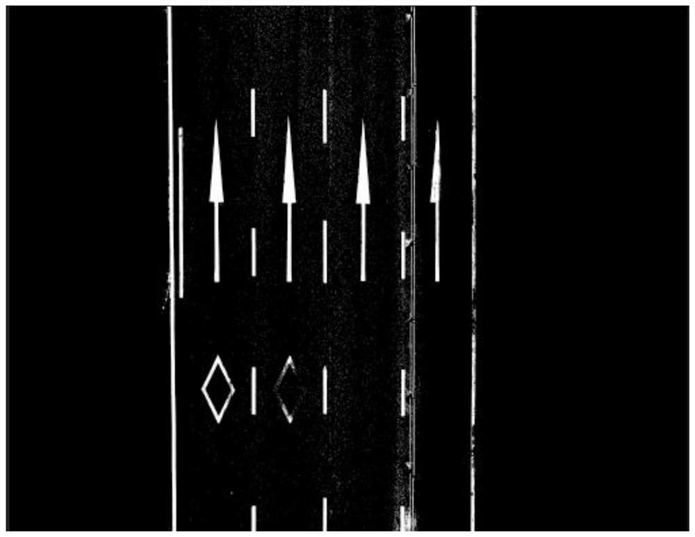
[0045] Step 2, use the straight line detection method to detect the white marking lines on both sides of the road, and divide the ...


PUM


Abstract

The present invention relates to a road marking damage detection method based on a UAV aerial road image. The present invention first adopts the method of Hough transform to detect straight lines to locate the white markings on both sides of the road on the preprocessed picture, and then locates the position of the road, and then Calculate the threshold to binarize the image, and use image matching to remove the repeated areas of adjacent images, and finally extract the road markings, and perform damage detection on the markings. This method implements a road marking damage detection method based on UAV aerial road images, which effectively solves the problems of low efficiency and waste of resources in traditional manual viewing methods, and solves the problem of road color changes under different lighting conditions. It has high practicability and is not limited by time and space, and has good applicability and reliability.

Description

technical field [0001] The invention belongs to the technical field of image processing, and in particular relates to a road marking damage detection method based on a UAV aerial road image, in particular to a positioning and segmentation algorithm for roads, a road surface threshold calculation algorithm and a damage detection method realized by using Hough transform to detect straight lines. Algorithm for detection of highway markings. Background technique [0002] The traditional method of damage detection of highway markings mainly adopts manual methods, which is relatively backward, and the detection results are not quantitatively analyzed and stored, which has limitations. If drones can be used for automatic damage detection of marking lines, it will greatly reduce road management. Reduce the workload of the staff, improve work efficiency, and improve accuracy. [0003] At present, research on road marking detection mainly focuses on road marking image preprocessing, ...

Claims


Application Information

Patent Timeline
Patent Type & Authority Patents(China)
IPC IPC(8): G06T7/00G06T7/11G06T7/13G06T7/136G06T7/174
CPCG06T7/0002G06T2207/20061G06T2207/30204G06T7/11G06T7/13G06T7/136G06T7/174
Inventor 周敏刘宁钟朱志超王立春王勇
Owner 南京中设航空科技发展有限公司
Features
  • R&D
  • Intellectual Property
  • Life Sciences
  • Materials
  • Tech Scout
  • Unparalleled Data Quality
  • Higher Quality Content
  • 60% Fewer Hallucinations
Learn More