Onboard LiDAR data based dike damage detecting method
A detection method and embankment technology, applied in radio wave measurement systems, instruments, etc., can solve the problems of large workload and low efficiency, and achieve the effect of reducing workload and improving detection accuracy.
- Summary
- Abstract
- Description
- Claims
- Application Information
AI Technical Summary
Problems solved by technology
Method used
Image


Examples
Embodiment Construction
[0045] The technical solutions in the present invention will be clearly and completely described below in conjunction with the accompanying drawings in the present invention.
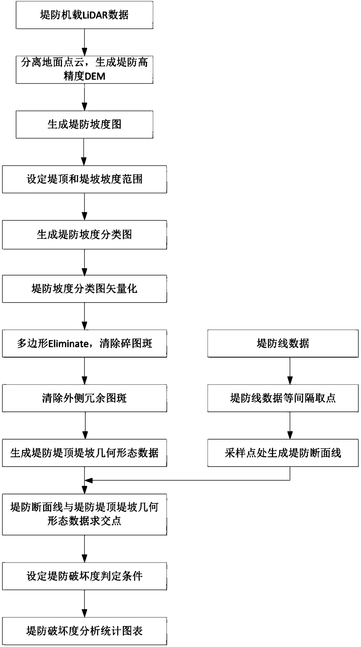
[0046] figure 1 Shown is a schematic flow chart of one embodiment of the method for detecting embankment damage based on airborne LiDAR data of the present invention, figure 2 An example of airborne LiDAR data of an embankment in a certain place is given, image 3 An example of imagery and DEM data of an embankment in a certain area is given. The imagery is mainly used to compare and illustrate the current situation of the embankment. The spatial resolution of the DEM data is 1 meter, the width from east to west is nearly 50km, the width from north to south is 20km, and the length of the embankment is 120km. Figure 4 A schematic diagram of the elevation anomaly in the DEM due to the damage of the dike due to human activities, erosion, etc. is given. This invention is to use the airborne LiDAR to gene...
PUM
 Abstract
Description
Claims
Application Information
 - R&D
- Intellectual Property
- Life Sciences
- Materials
- Tech Scout
- Unparalleled Data Quality
- Higher Quality Content
- 60% Fewer Hallucinations
Browse by: Latest US Patents, China's latest patents, Technical Efficacy Thesaurus, Application Domain, Technology Topic, Popular Technical Reports.
© 2025 PatSnap. All rights reserved.Legal|Privacy policy|Modern Slavery Act Transparency Statement|Sitemap|About US| Contact US: help@patsnap.com