Method for calculating coordinates of intersection point D of optical axis and celestial surface based on star sensor

A technology of star sensor and calculation method, which is applied in the field of astronomical navigation, can solve the problems that it is difficult to overcome the reference vector, and it is difficult to establish the attitude determination mode of the flying body, so as to simplify the calculation, realize the high-precision attitude measurement, and improve the accuracy.

CN111521173AInactive Publication Date: 2020-08-11HUBEI UNIV
9 Cites 0 Cited by

Patent Information

Authority / Receiving Office
CN · China
Patent Type
Applications(China)
Current Assignee / Owner
Publication Date
2020-08-11
Estimated Expiration
Not applicable · inactive patent

Smart Images

  • Figure 1
    Figure 1
  • Figure 2
    Figure 2
  • Figure 3
    Figure 3
Patent Text Reader

Abstract

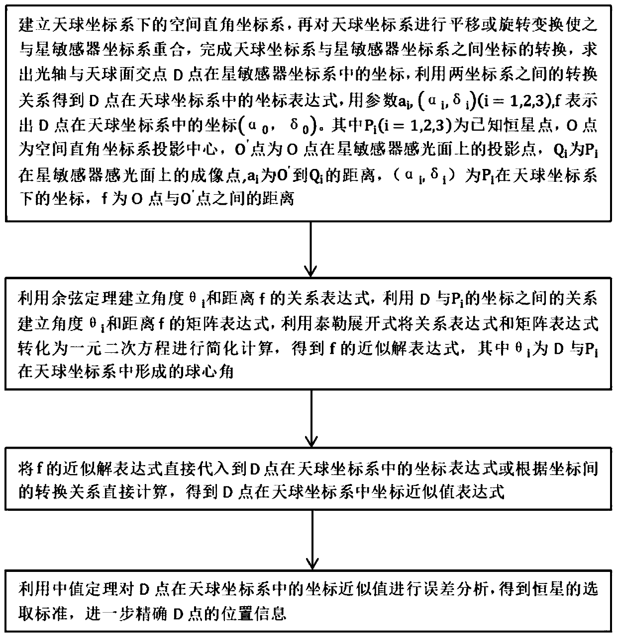
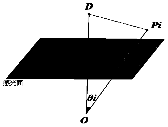
The invention relates to a method for calculating coordinates of an intersection point D of an optical axis and a celestial surface based on a star sensor. The method comprises the steps of establishing a space rectangular coordinate system under a celestial coordinate system, performing translation or rotation transformation on the space rectangular coordinate system to enable the space rectangular coordinate system to coincide with a star sensor coordinate system to obtain a transformation relationship between the two coordinate systems, and representing a coordinate expression of the pointD in the celestial coordinate system by using each parameter; obtaining the relationship among the coordinates according to the cosine law, and obtaining an approximate expression of the distance f from the projection center to the projection point on the star sensor light-sensitive surface by using a Taylor expansion formula; substituting the approximate expression into the coordinate expressionof the point D in the celestial coordinate system to obtain a celestial coordinate approximate value expression of the point D; performing error analysis in combination with a median theorem, and obtaining a fixed star selection standard to further improve the coordinate precision of the point D. The invention aims to establish a mathematical model, solve the coordinates of the intersection pointD of the optical axis and the celestial surface, enables coordinates of the point D to be accurate through an optimization algorithm, and improve the attitude measurement precision of the star sensor.
Need to check novelty before this filing date? Find Prior Art

Description

technical field

[0001] The invention relates to the field of celestial navigation, in particular to a calculation method based on the D coordinate of the intersection point of the optical axis of a star sensor and the celestial sphere. Background technique

[0002] Celestial navigation is based on the natural celestial body with known accurate spatial position, and realizes the autonomous attitude measurement of the vehicle through the star sensor. The attitude here refers to the orientation element of the image space coordinate system of the vehicle in a given reference system. In this way, the navigation information of the carrier where the measurement point is determined is calculated. Since the star sensor uses the astronomical information of the stars, it has the characteristics of good autonomy, high precision, and reliable operation, and has broad application prospects in spaceflight. At present, the star sensor has been able to achieve completely autonomous attitude...

Examples

Embodiment Construction

[0020] The principles and features of the present invention are described below in conjunction with the accompanying drawings, and the examples given are only used to explain the present invention, and are not intended to limit the scope of the present invention.

[0021] Such as figure 1 As shown, a calculation method based on the D coordinate of the intersection point of the optical axis of the star sensor and the celestial sphere comprises the following steps:

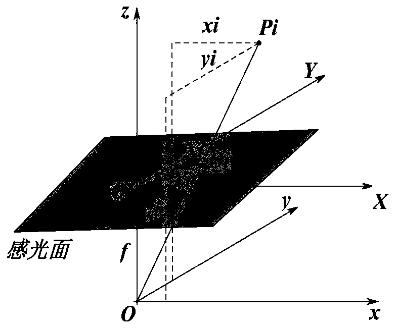
[0022] Step S1, establish a space Cartesian coordinate system under the celestial coordinate system, then translate or rotate the celestial coordinate system so that it coincides with the star sensor coordinate system, and complete the coordinate conversion between the celestial coordinate system and the star sensor coordinate system, Calculate the coordinates of point D in the star sensor coordinate system, use the conversion relationship between the two coordinate systems to obtain the coordinate expression of poi...