

Targeted localization method for spatial localization and enhanced color matching of geophysical prospecting pulse wave data
A technology of spatial positioning and positioning method, applied in the field of surveying, mapping and surveying, can solve problems such as unchangeable, complex, fixed solution form, etc., and achieve the effect of enhancing color display and visual expression.
- Summary
- Abstract
- Description
- Claims
- Application Information
AI Technical Summary
Problems solved by technology
Method used
Image


Examples
Embodiment Construction
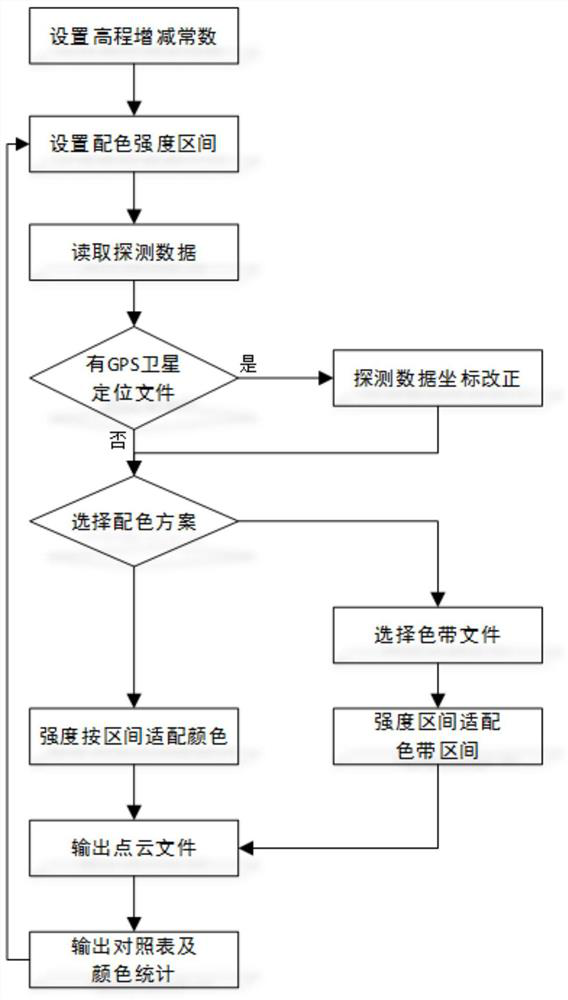
[0033] The spatial positioning of geophysical pulse wave data and the targeted positioning method for enhanced color matching of the present invention will be further described in detail in conjunction with the accompanying drawings and specific embodiments.
[0034] Such as figure 1 As shown, the spatial positioning of geophysical pulse wave data and the targeted positioning method of enhanced color matching include the following steps:
[0035] Step 1. Set the elevation increase and decrease constant according to the difference between the instrument detection depth and the actual detection depth. If there is no deviation in the actual detection depth, the elevation increase and decrease constant is set to 0 meters (when the radar detection instrument is detecting, the recorded positioning depth There is a certain deviation from the actual detection depth, reading the data directly according to the detection data will lead to inaccurate depth values).
[0036] Step 2. Set t...
PUM
 Abstract
Description
Claims
Application Information