
Vector traffic numerical map correction method based on floating car data
A floating car data and digital map technology, applied in the directions of maps/plans/charts, educational appliances, instruments, etc., can solve the problems of heavy workload, time-consuming, and influence on the accuracy of calibration point distribution and calibration, and achieves guaranteed accuracy, The effect of improving accuracy and speed
Patent Information
- Authority / Receiving Office
- CN · China
- Patent Type
- Patents(China)
- Current Assignee / Owner
- Publication Date
- 2012-02-08
- Estimated Expiration
- Not applicable · inactive patent
Smart Images
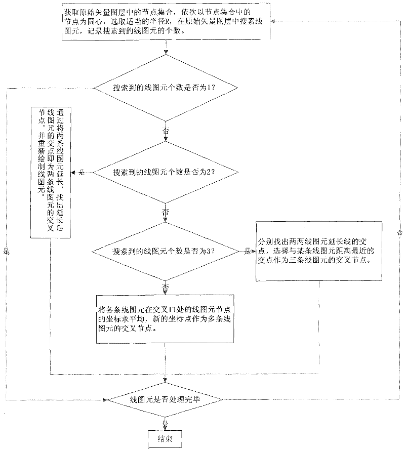
Figure 1 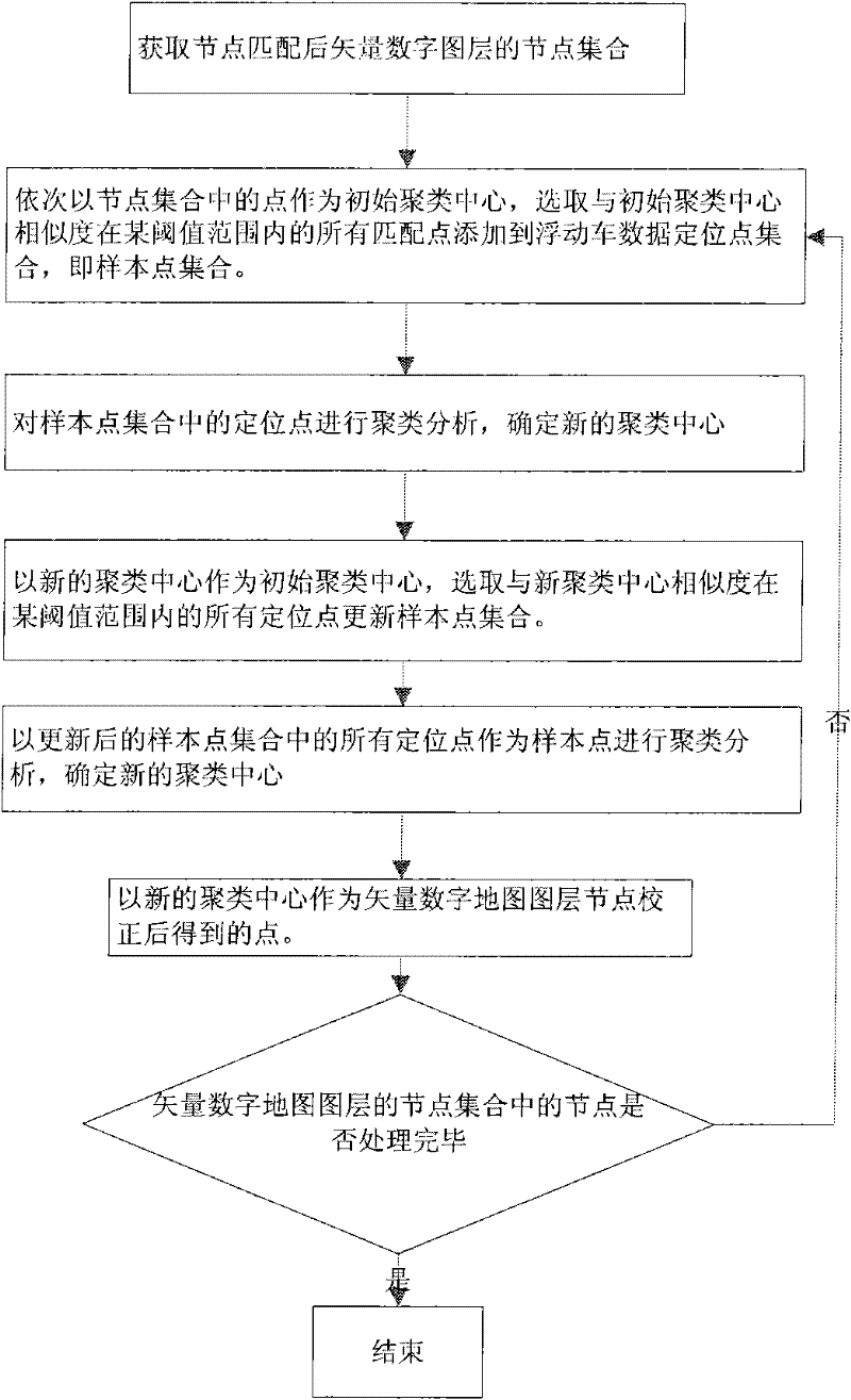
Figure 2 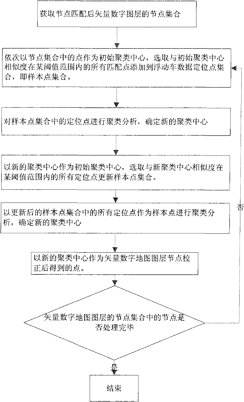
Figure 3
Abstract
Description
technical field
[0001] The invention relates to the technical field of traffic geographic information, in particular to a method for correcting a vector map. Background technique
[0002] At present, as an extension of geographic information system in the field of intelligent transportation, transportation geographic information system has been widely used in transportation planning, transportation construction and traffic management and other fields. The traffic geographic information system is an information system based on the spatial database based on the vector traffic digital map. The accuracy of the vector traffic digital map data is directly related to the performance of the traffic geographic information system. Due to various errors in the surveying and mapping process, the accuracy of the existing vector traffic digital map data is not high. Therefore, it is necessary to improve the accuracy of the vector traffic digital map data through scientific correction meth...
Examples
Embodiment Construction
[0032] Hereinafter, preferred embodiments of the present invention will be described in detail with reference to the accompanying drawings.
[0033] The vector traffic digital map correction method based on floating car data comprises the following steps:
[0034] 1) Match the line graph element nodes in the original vector traffic digital map layer to correct the connectivity of adjacent line graph elements; see figure 1 , including the following steps:
[0035] 11) Obtain the line graphic element node set in the original traffic digital map layer, take the line graphic element node in the line graphic element node set as the center of the circle in turn, set the radius R, the determination of the radius R is mainly based on the accuracy of the electronic map used , set R as the maximum error value of the electronic map, so as to ensure that all relevant line primitives can be processed correctly, search for line primitives in the original traffic digital map layer within th...