
Cors-based gps control measurement method for long-distance pipeline
A long-distance pipeline and control measurement technology, applied in the field of GPS control measurement, can solve the problems of low efficiency and low precision of GPS control measurement technology, and achieve the effects of improving data accuracy, standardizing data processing, and flexible and convenient operation.
Patent Information
- Authority / Receiving Office
- CN · China
- Patent Type
- Patents(China)
- Current Assignee / Owner
- Publication Date
- 2016-09-07
Smart Images
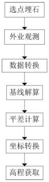
Figure 1 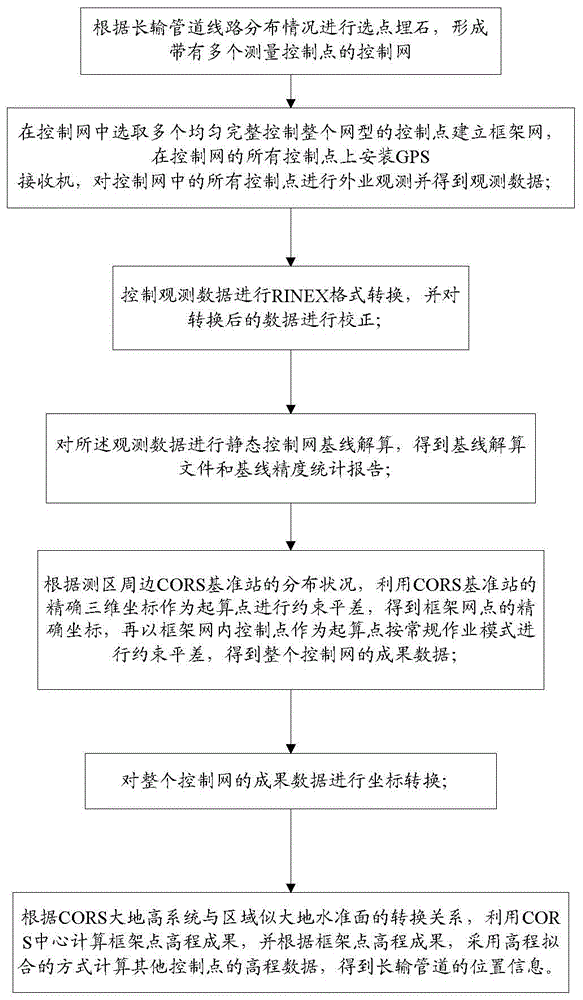
Figure 2
Abstract
Description
technical field
[0001] The invention belongs to the field of GPS control measurement, in particular to a CORS-based GPS control measurement method for long-distance pipelines. Background technique
[0002] GPS (Global Positioning System) surveying work is similar to classic geodetic surveying work, and can be divided into two parts: field work and office work according to its nature. Among them: field work mainly includes point selection (that is, selection of observation site), establishment of observation marks, field observation operations, and quality inspection of results, etc.; office work mainly includes technical design of GPS measurement, post-measurement data processing, and technical summary Wait. According to the working procedure implemented by GPS measurement, it can be roughly divided into the following stages: technical design, point selection and establishment of signs, field observation, result verification and processing.
[0003] The implementation of c...
Examples
Embodiment Construction
[0030] In order to make the technical problems, technical solutions and beneficial effects solved by the present invention clearer, the present invention will be further described in detail below in conjunction with the accompanying drawings and embodiments. It should be understood that the specific embodiments described here are only used to explain the present invention, not to limit the present invention.
[0031] CORS (Comprehensive System for Continuously Operating Satellite Positioning Services) is the product of network technology and GNSS (Global Navigation Satellite System) positioning technology, modern geodesy, and geodynamics. By establishing one or more continuously operating GNSS systems covering a certain area Reference stations, using computer network technology, provide users with a variety of data in real time or on time, including different types of GNSS observations (carrier phase, pseudo-range, etc.), various GNSS error correction numbers such as tropospher...