
Plane figure relation determining method and system in geographical information system
A technology of geographic information system and plane graphics, applied in the field of plane graphics relationship determination method and system, can solve the problems of inaccurate determination of plane graphics relationship, reduced query efficiency, increased system burden, etc., so as to avoid increased system burden, improve efficiency and Accuracy, the effect of ensuring accuracy
Patent Information
- Authority / Receiving Office
- CN · China
- Patent Type
- Patents(China)
- Current Assignee / Owner
- Publication Date
- 2015-05-13
Smart Images
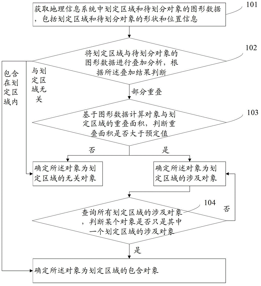
Figure 1 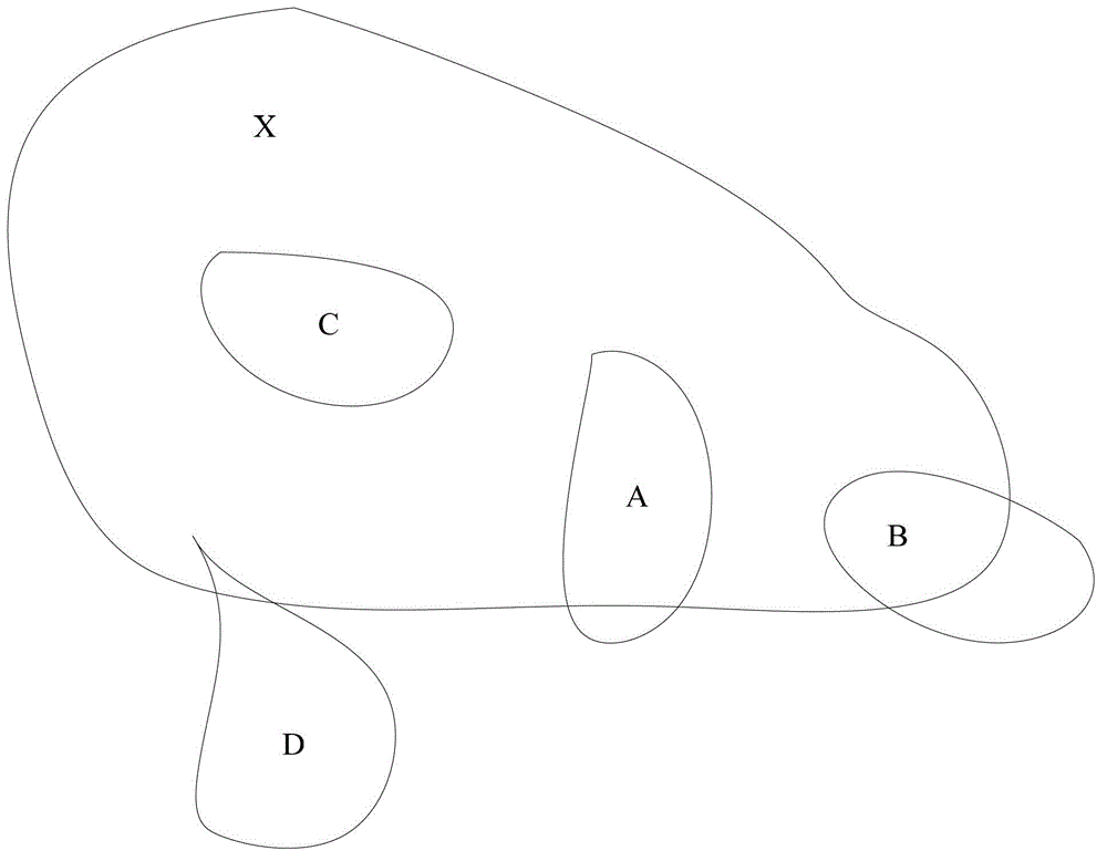
Figure 2 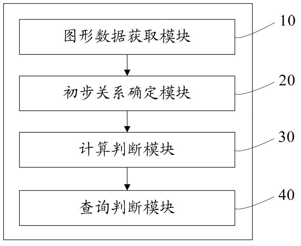
Figure 3
Abstract
Description
technical field
[0001] The present application relates to the technical field of geographic information systems, in particular to a method and system for determining the relationship of plane graphics in geographic information systems. Background technique
[0002] As an important spatial information system, geographic information system provides help to more and more people. Geographic information system is mainly supported by computers to collect, store, store, and store various geospatial entity data and their relationships in the entire or part of the earth's surface space, including spatial positioning data, graphic data, remote sensing image data, attribute data, etc. Technical systems for management, computation, analysis and description. A large amount of vector data will be used in the geographic information system, because the vector data structure can intuitively express the geographical space, and can accurately represent the spatial position and attributes of t...
Examples
Embodiment 1
[0043] refer to figure 1 , which shows a first embodiment of a method for determining a plane graphic relationship in a geographic information system of the present application, including the following steps:
[0044] Step 101, acquiring graphic data of a defined area and an object to be divided in a geographic information system, the graphic data including shape and position information of the defined area and the object to be divided.
[0045] The designated area can be a certain city, county, district, or a river basin, etc., or it can be an area within a specified location range, such as an area within a certain range of accuracy and dimension.
[0046] The object to be divided can be determined according to the actual situation, for example, it can be a village, township, or town to be divided.
[0047] The shape and position information of the demarcated area and the object to be divided refers to information that can indicate the shape and size of the demarcated area an...