

Modeling method and system for controlling initial wave impedance by use of earthquake attributes
A technology of seismic attributes and modeling methods, which is applied in seismology and seismic signal processing for logging records, and can solve problems such as difficulty in simulating sedimentary facies changes, and achieve the effect of improving accuracy.
Patent Information
- Authority / Receiving Office
- CN · China
- Patent Type
- Applications(China)
- Current Assignee / Owner
- Publication Date
- 2016-01-06
- Estimated Expiration
- Not applicable · inactive patent
Smart Images
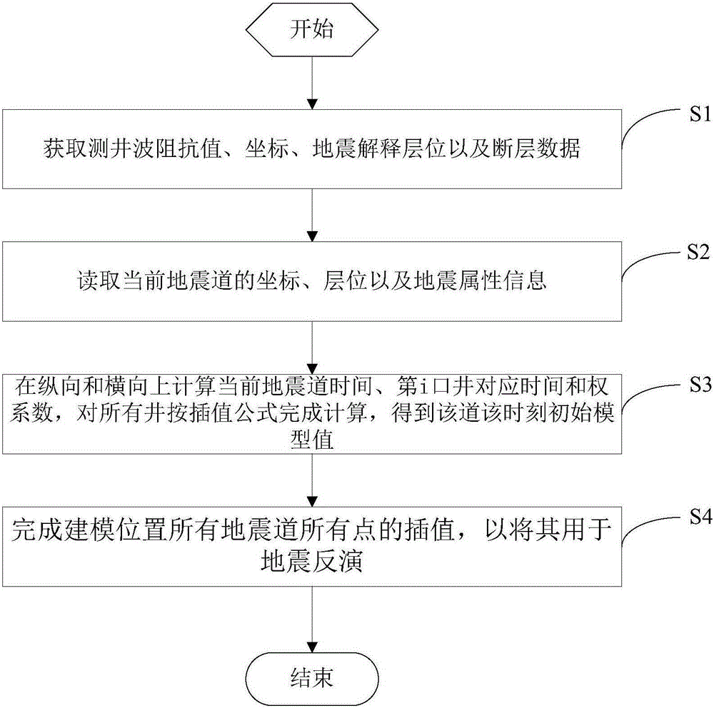
Figure 1 
Figure 2 
Figure 3
Abstract
Description
Technical field
[0001] The invention relates to the technical field of seismic oil and gas exploration, in particular to a modeling method and system for controlling initial wave impedance by using seismic attributes. Background technique
[0002] Traditional modeling methods generally adopt the reciprocal of the distance to the well (inverse distance method, weight i =1. / dis i ), this is a linear interpolation method, and it is generally difficult to simulate sedimentary facies changes. As a result, circles are often drawn around the well, and the boundary of the geological body is not accurately reflected. Summary of the invention
[0003] The technical problem to be solved by the present invention is: in view of the defect that traditional interpolation method is difficult to simulate sedimentary facies changes in the lateral direction in the prior art, it provides a method that can reflect changes in sedimentary facies laterally and can improve the accuracy of seismic inversio...
Examples
Embodiment Construction
[0029] In order to make the objectives, technical solutions and advantages of the present invention clearer, the following further describes the present invention in detail with reference to the accompanying drawings and embodiments. It should be understood that the specific embodiments described here are only used to explain the present invention, but not to limit the present invention.
[0030] Seismic inversion needs to establish an initial wave impedance model, and the quality of the initial model is related to the accuracy of seismic inversion.
[0031] Such as figure 1 As shown, the modeling method of using seismic attributes to control the initial wave impedance in the embodiment of the present invention mainly includes the following steps:
[0032] S1. Obtain logging wave impedance value, coordinates, seismic interpretation horizon and fault data;
[0033] S2, read the coordinates, horizon and seismic attribute information of the current seismic trace;
[0034] S3. In the longi...