
Remote sensing image super resolution method based on dictionary learning
A remote sensing image, super-resolution technology, applied in the field of remote sensing image super-resolution based on dictionary learning, can solve the problem of slow reconstruction speed and so on
Patent Information
- Authority / Receiving Office
- CN · China
- Patent Type
- Applications(China)
- Current Assignee / Owner
- Publication Date
- 2016-11-23
Smart Images
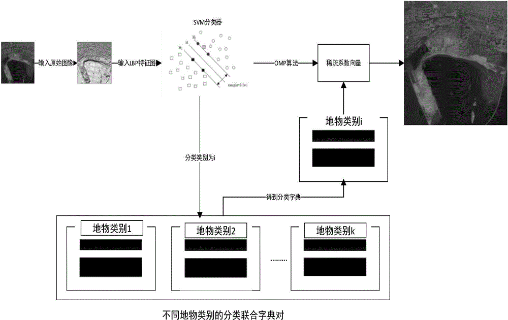
Figure 1 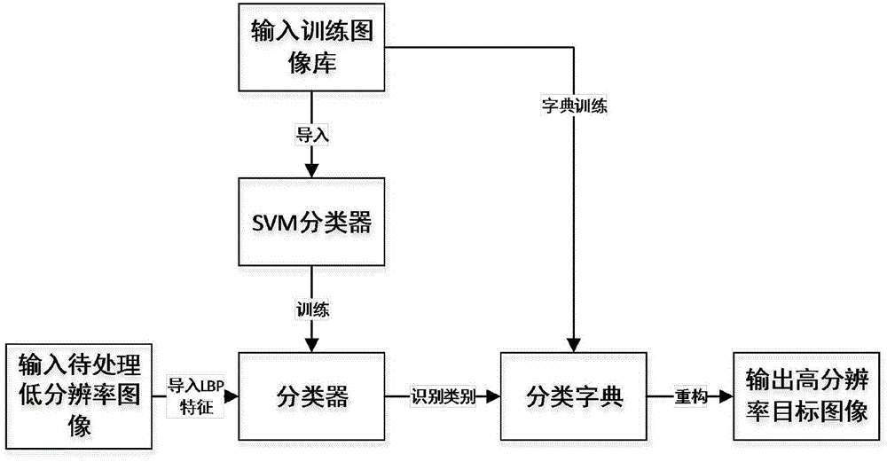
Figure 2 
Figure 3
Abstract
Description
technical field
[0001] The invention relates to the technical field of remote sensing imaging, in particular to a method for super-resolution of remote sensing images based on dictionary learning. Background technique
[0002] With the development of computer science and space science, remote sensing technology, especially remote sensing imaging, has developed rapidly. Image spatial resolution is a key index for evaluating the quality of remote sensing images, and also an important parameter in the application of remote sensing imaging, which is crucial in the acquisition and application of images. Compared with traditional low-resolution remote sensing images, high-resolution remote sensing images can clearly express the characteristic distribution and spatial correlation of ground objects, and can distinguish the more detailed structural composition of ground objects, providing a basis for interpretation and analysis. Excellent condition and foundation. In recent years, ...
Examples
Embodiment Construction
[0057] In order to better understand the technical content of the present invention, specific embodiments are given together with the attached drawings for description as follows.
[0058] Aspects of the invention are described in this disclosure with reference to the accompanying drawings, which show a number of illustrated embodiments. Embodiments of the present disclosure are not necessarily intended to include all aspects of the invention. It should be appreciated that the various concepts and embodiments described above, as well as those described in more detail below, can be implemented in any of numerous ways, since the concepts and embodiments disclosed herein are not limited to any implementation. In addition, some aspects of the present disclosure may be used alone or in any suitable combination with other aspects of the present disclosure.
[0059] This disclosure uses the idea of object classification to propose a super-resolution method based on a classificati...