
Tensor-based land utilization simulation method, system and device and storage medium
A simulation method and land technology, applied in the field of geographic information science, can solve problems such as advanced algorithms, multi-computer knowledge and experience
Patent Information
- Authority / Receiving Office
- CN · China
- Patent Type
- Applications(China)
- Current Assignee / Owner
- Publication Date
- 2020-10-23
Smart Images
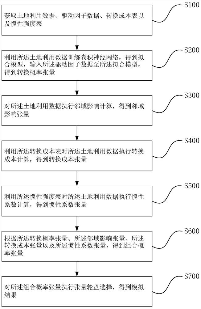
Figure 1 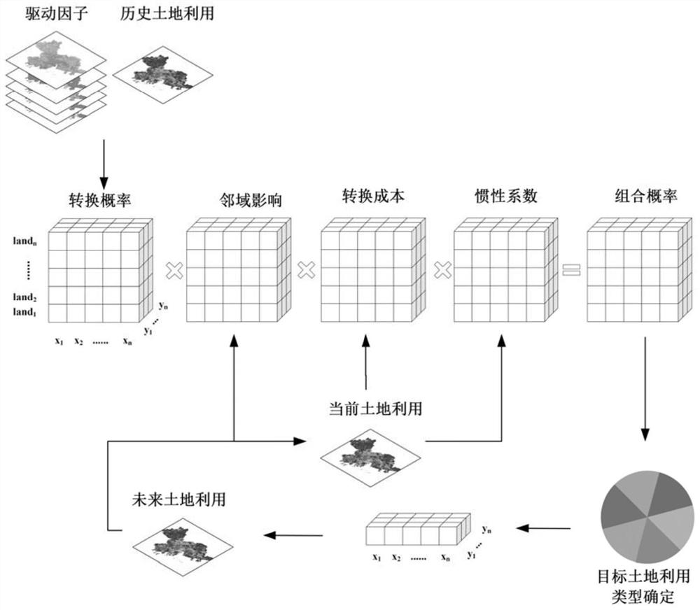
Figure 2 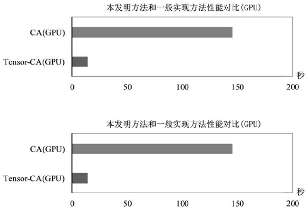
Figure 3
Abstract
Description
[0001] technology neighborhood
[0002] The invention relates to the field of geographical information science, in particular to a tensor-based land use simulation method, system, device and storage medium. Background technique
[0003] With the further development of society, the concept of land planning also changes with the change of industrial structure; therefore, the study of the spatial and temporal change trend of land in a specific area has important reference significance for future planning.
[0004] Cellular automata, also known as CA, as a space-time discrete dynamic model with strong spatial computing capabilities, plays an important role in complexity science; the multi-class land use simulation method based on cellular automata, according to Neighborhood state and a series of conversion rules to simulate the complex temporal and spatial changes of land use have become an important tool for studying land use change and its socio-economic and natural environmenta...
Examples
Embodiment Construction
[0063] The idea, specific structure and technical effects of the present invention will be clearly and completely described below in conjunction with the embodiments and accompanying drawings, so as to fully understand the purpose, scheme and effect of the present invention.
[0064] In order to enable people in the technical field to better understand the solutions of the present invention, the technical solutions in the embodiments of the present invention will be clearly and completely described below in conjunction with the accompanying drawings in the embodiments of the present invention. Obviously, the described embodiments It is only some embodiments of the present invention, but not all embodiments. Based on the embodiments of the present invention, all other embodiments obtained by persons of ordinary skill in the art without making creative efforts shall fall within the protection scope of the present invention.
[0065] The terms "first", "second", "third" and "four...