
Blue hole three-dimensional scanning and environment monitoring system
An environmental monitoring system and three-dimensional scanning technology, applied in the direction of testing water, measuring devices, surveying and navigation, etc., can solve the problems of high cost, incapable of long-term dynamic monitoring, and short observation time, so as to achieve low working cost and long-term dynamic Simple and reasonable effect of monitoring and structure
Patent Information
- Authority / Receiving Office
- CN · China
- Patent Type
- Applications(China)
- Current Assignee / Owner
- Publication Date
- 2022-02-25
Smart Images
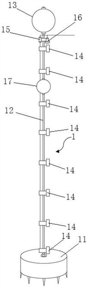
Figure 1 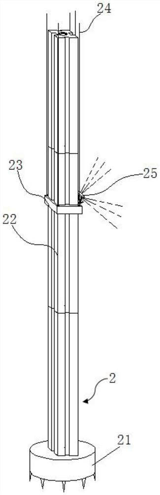
Figure 2 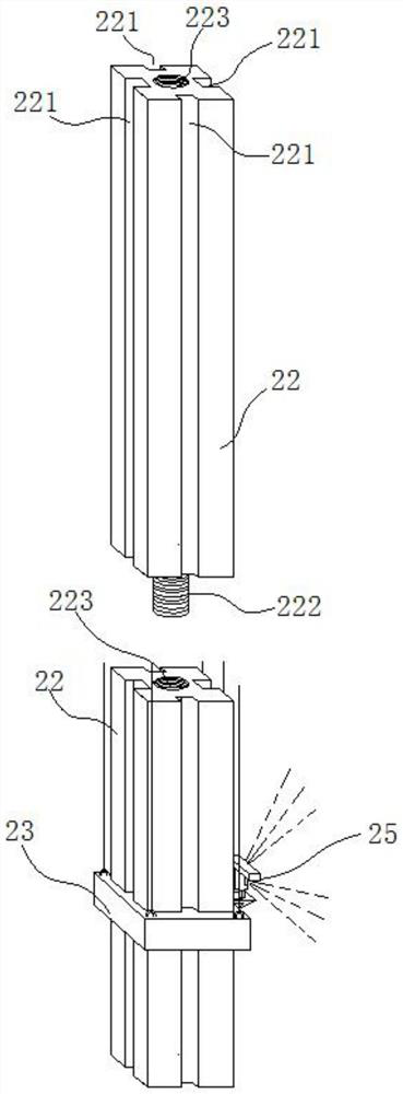
Figure 3
Abstract
Description
technical field
[0001] The invention relates to the technical field of blue hole detection equipment, in particular to a blue hole three-dimensional scanning and environmental monitoring system. Background technique
[0002] Oceanic blue holes are karst caves that exist on the bottom of the sea. The discovered oceanic blue holes are generally located in shallow sea water, and the water depth around the hole is much shallower than the water depth inside the hole. Therefore, the blue hole shows a different dark blue color from the surrounding waters when viewed from the sea surface. , the deepest oceanic blue hole that has been discovered in the world so far is the Yongle Blue Hole in Xisha, my country, with a depth of more than 300m. The more famous blue holes in the world include Deans Blue Hole in Long Island, Bahamas, Hadab Blue Hole in Egypt, and the Great Blue Hole in Belize, Honduras. , Gozo Blue Hole, Malta, etc.
[0003] The cause of the oceanic blue hole may be relate...
Examples
Embodiment
[0033] see figure 1 , figure 2 , image 3 , Figure 4 , Figure 5 , Image 6 , a blue hole three-dimensional scanning and environmental monitoring system provided by an embodiment of the present invention, such as figure 1 , figure 2 , image 3 , Figure 4 , Figure 5 , Image 6 As shown, the monitoring system can include:
[0034] A data acquisition system 1, the data acquisition system 1 comprising a first self-weight anchor 11, a cable 12, a first buoy 13, at least one ocean element sensor 14, a temperature, salt and depth profiler 15, and an acoustic Doppler current profiler 16; The cables 12 are respectively connected to the first self-weight anchor 11 and the first buoyant ball 13, at least one of the ocean element sensors 14, the temperature, salinity and depth profiler 15 and the acoustic Doppler current profiler 16 is connected with described cable 12;
[0035] Underwater three-dimensional panoramic imaging sonar system 2, described underwater three-dime...