
Real time rendering multi-thread distribution and control method of three-dimensional geographical information system
A technology of geographic information system and real-time rendering, which is applied in the field of multi-thread allocation and control of real-time rendering of three-dimensional geographic information system, and can solve problems such as difficulty in dynamic scheduling of model data.
Patent Information
- Authority / Receiving Office
- CN · China
- Current Assignee / Owner
- Publication Date
- 2016-01-20
Smart Images
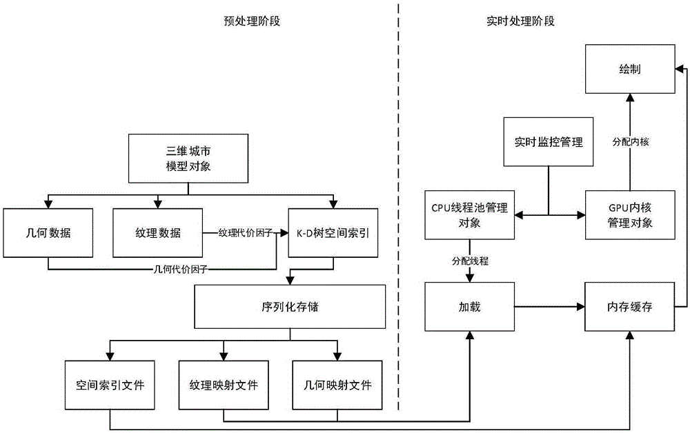
Figure 1 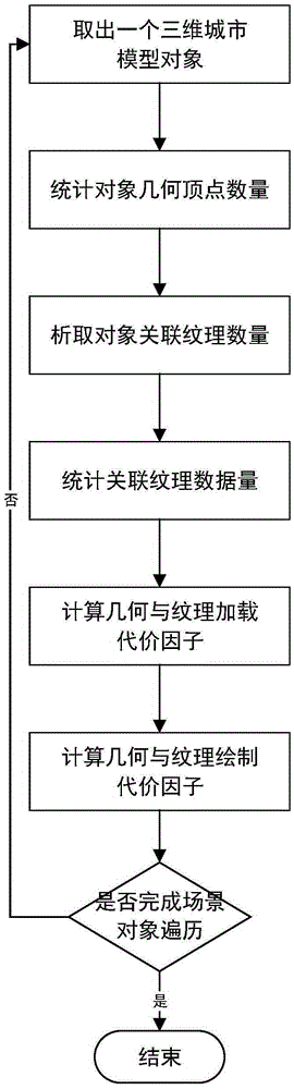
Figure 2 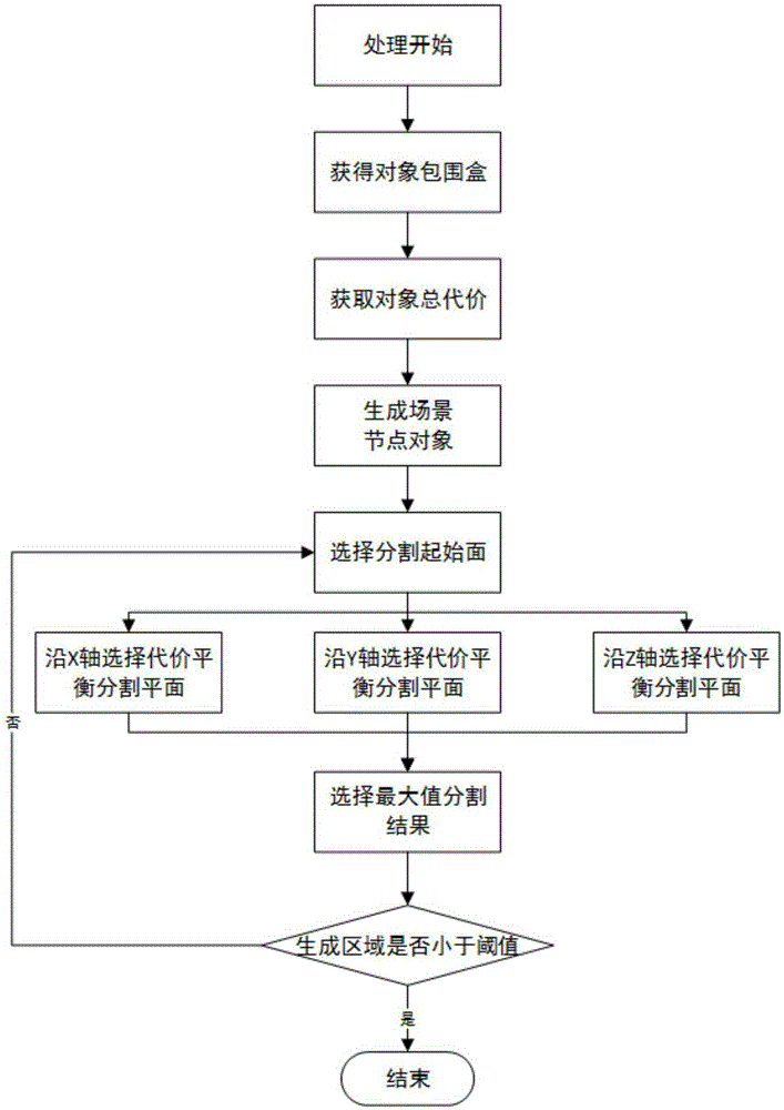
Figure 3
Abstract
Description
technical field
[0001] The invention belongs to the technical field of geospatial information systems, and more specifically relates to a multi-thread allocation and control method for real-time rendering of a three-dimensional geographic information system. Background technique
[0002] When people use tools such as GoogleEarth, NASAWorldWind, and MicrosoftVirtualEarth to roam the earth images, a new way of browsing has shocked ordinary people, allowing people to get to know the world we live in without leaving home. Screen to see what that dream spot looks like. However, with the development of human activities, seeing our world only from images, due to the limitations of its limited viewing angle, shadows, buildings and other factors, gradually cannot meet people's requirements. People are more expecting that various objects in daily life will be reproduced in virtual reality, so that people will have an immersive feeling. And it requires people to be able to interact w...
Examples
Embodiment Construction
[0027]In order to make the object, technical solution and advantages of the present invention clearer, the present invention will be further described in detail below in conjunction with the accompanying drawings and embodiments. It should be understood that the specific embodiments described here are only used to explain the present invention, not to limit the present invention. In addition, the technical features involved in the various embodiments of the present invention described below can be combined with each other as long as they do not constitute a conflict with each other.
[0028] Such as figure 1 As shown, the real-time rendering multi-thread allocation and control method of the 3D geographic information system of the present invention considers the loading cost and rendering cost of the 3D city model object, and through spatial organization, forms a spatial index tree with node cost balance as a basis to reorganize the data storage; during real-time operation, by...