
Four-dimensional geophysical prospecting method based on natural electric field
A natural electric field, four-dimensional technology, applied in the field of four-dimensional geophysical exploration based on natural electric field, can solve the problems of different time and space conditions, complicated wiring, difficult to solve geological engineering and other problems, and achieve the effect of less storage space
Patent Information
- Authority / Receiving Office
- CN · China
- Current Assignee / Owner
- Publication Date
- 2018-08-17
Smart Images
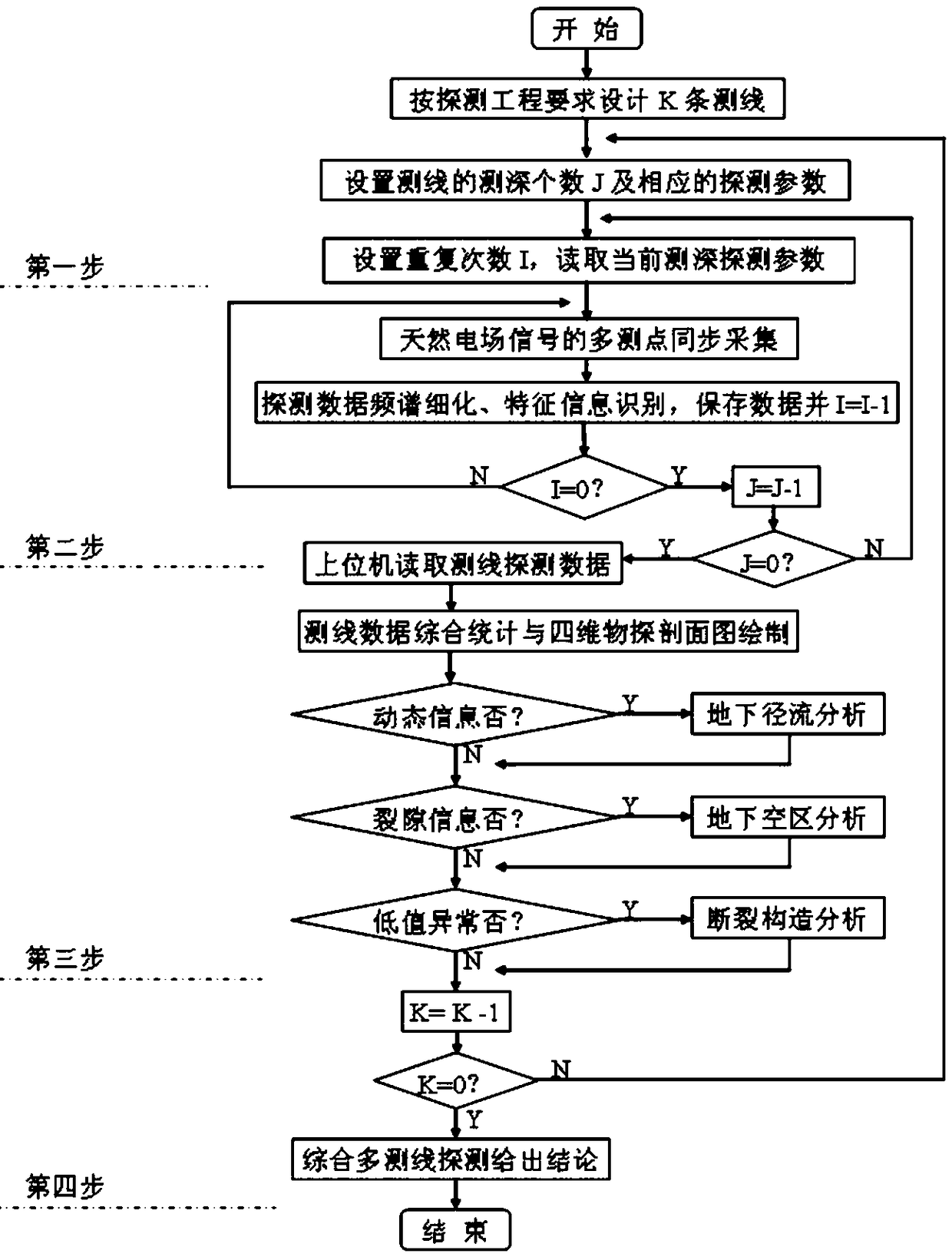
Figure 1 
Figure 2 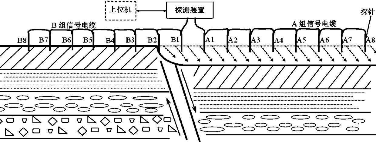
Figure 3
Abstract
Description
technical field
[0001] The invention belongs to geophysical detection technology, in particular to a four-dimensional geophysical detection method based on natural electric field. Background technique
[0002] The natural electric field method is one of the Magnetotelluric Sounding (MT for short). The MT method is proposed by the Soviet scholar Tikhonov (1950) and the French scholar Cagniard (1953) in the early 1950s to study the earth using natural alternating electromagnetic fields. A geophysical exploration method of electrical structure; because it does not need artificial power supply, low cost, convenient work, not shielded by high-resistance layers, high resolution for low-resistivity layers, and the exploration depth varies with the frequency of the electromagnetic field, shallow It can be tens of meters deep and hundreds of kilometers deep. Therefore, it has been successfully applied in many fields in recent years, which has aroused widespread interest and great att...
Examples
Embodiment Construction
[0024] The solutions of the present invention will be further described in detail below in conjunction with the accompanying drawings and embodiments.
[0025] See attached figure 1 , a four-dimensional geophysical prospecting method based on natural electric field, which introduces time-varying characteristic parameters on the basis of three-dimensional geophysical prospecting in the frequency domain, and collects the natural electromagnetic wave penetration received by multiple probes on each survey line synchronously on the ground through the detection instrument The distributed electric field signal formed on the ground surface after the stratum structure is real-time spectrum refined, and the characteristic information is identified and saved. The host computer reads the detection data and draws the four-dimensional geophysical profile of the survey line after comprehensive statistics. Qualitative and quantitative analysis, and then integrate the detection analysis resul...