

A height limit early warning method based on binocular stereo vision
A technology of binocular stereo vision and height limitation, which is applied in the directions of instruments, character and pattern recognition, scene recognition, etc., to achieve the effect of simplifying calculation steps, ensuring accuracy and speeding up calculation efficiency
Patent Information
- Authority / Receiving Office
- CN · China
- Patent Type
- Applications(China)
- Current Assignee / Owner
- Publication Date
- 2019-03-01
- Estimated Expiration
- Not applicable · inactive patent
Smart Images
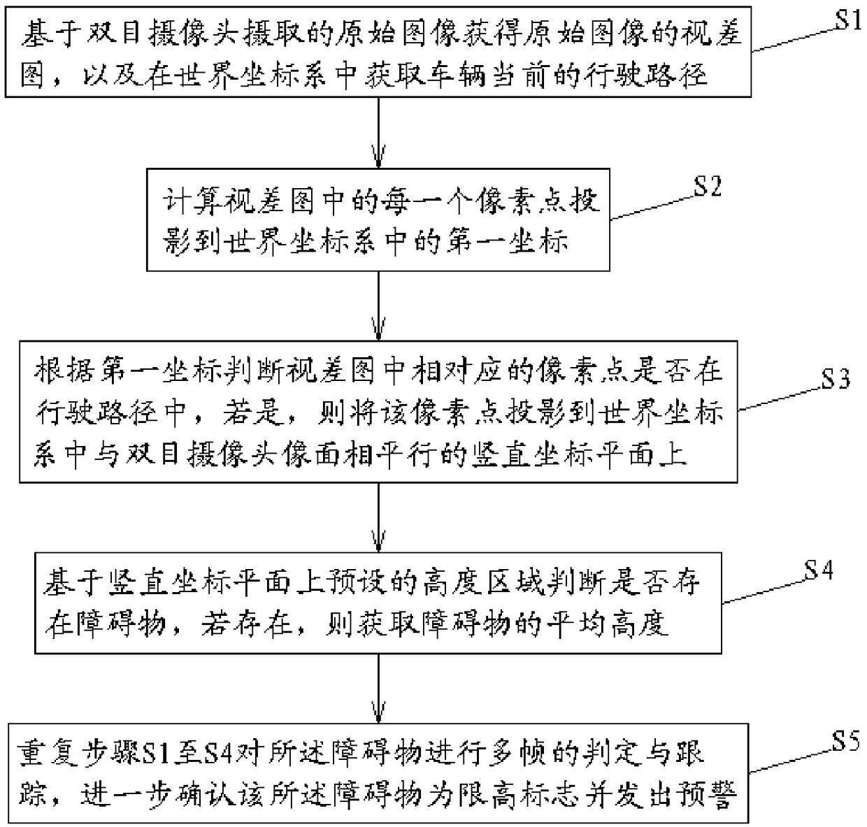
Figure 1 
Figure 2 
Figure 3
Abstract
Description
technical field
[0001] The invention relates to a height limit early warning method, in particular to a height limit early warning method based on binocular stereo vision. Background technique
[0002] With the development of the economy, urban transportation is also booming. On some roads in urban traffic, in order to restrict the passage of super-high vehicles, height-limiting obstacles are often added to avoid accidents such as over-high vehicles getting stuck on bridges and crashing into bridges. occurrence, to ensure the normal passage of the road. However, such traffic accidents still occur from time to time. At present, there is still no effective device for accurately detecting the height-limiting obstacles in front of the vehicle. Accidents, but also prone to driver negligence.
[0003] For example, the application publication number is CN105915846A, and the Chinese patent titled "a method and system for monitoring intrusions with single and binocular multiplexing...
Examples
Embodiment approach
[0039] Such as figure 1 As shown, according to an embodiment of the present invention, a height limit early warning method based on binocular stereo vision of the present invention includes:
[0040] S1. Obtain the disparity map of the original image based on the original image captured by the binocular camera, and obtain the current driving path of the vehicle in the world coordinate system;
[0041] S2. Calculate the first coordinate of each pixel in the disparity map projected to the world coordinate system;
[0042] S3. According to the first coordinate, judge whether the corresponding pixel point in the disparity map is in the driving path, if so, project the pixel point onto the vertical coordinate plane parallel to the head plane of the binocular camera in the world coordinate system;
[0043] S4. Judging whether there is an obstacle based on the preset height area on the vertical coordinate plane, and if so, obtaining the average height of the obstacle;
[0044] S5. ...