

Spatial information aided unmanned aerial vehicle video big data multi-temporal association analysis method
A technology of spatial information and correlation analysis, applied in the field of video analysis, can solve problems such as incompetence in multi-temporal video correlation analysis tasks, and achieve the effect of low cost
- Summary
- Abstract
- Description
- Claims
- Application Information
AI Technical Summary
Problems solved by technology
Method used
Image

Examples
Embodiment Construction
[0019] In order to facilitate those of ordinary skill in the art to understand and implement the present invention, the present invention will be described in further detail below in conjunction with the accompanying drawings and embodiments. It should be understood that the implementation examples described here are only used to illustrate and explain the present invention, and are not intended to limit this invention.
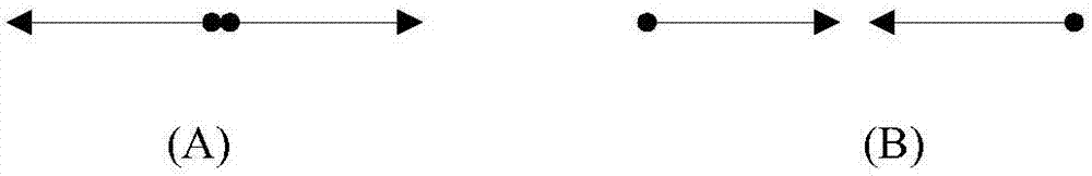
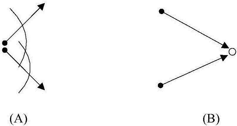
[0020] Whether there are common scenes between multi-temporal videos depends not only on the shooting location, but also on the shooting orientation. For example, there is no coverage area between videos shot in reverse at the same location (such as figure 1 As shown in (A), there are coverage areas between the videos shot at different positions (such as figure 1 (B) shown). Further analysis, such as figure 2 As shown in (A), the coverage area between two shots at the same location depends on the relationship between the azimuth angle and the field of view...
PUM
 Abstract
Description
Claims
Application Information