

Spatial information aided unmanned aerial vehicle video big data multi-temporal association analysis method
A technology of spatial information and correlation analysis, applied in the field of video analysis, can solve problems such as incompetence in multi-temporal video correlation analysis tasks, and achieve the effect of low cost
Patent Information
- Authority / Receiving Office
- CN · China
- Patent Type
- Applications(China)
- Current Assignee / Owner
- Publication Date
- 2017-07-18
Smart Images

Figure 1 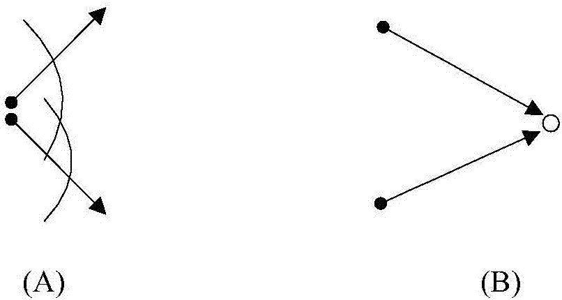
Figure 2 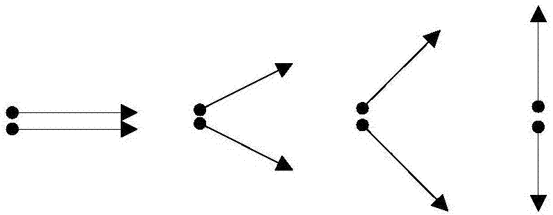
Figure 3
Abstract
Description
technical field
[0001] The invention belongs to the technical field of video analysis, and relates to a video analysis method of an unmanned aerial vehicle, in particular to a multi-time correlation analysis method for big data of unmanned aerial vehicle video assisted by spatial information.
[0002] technical background
[0003] In recent years, natural disasters have occurred frequently, posing serious threats to social economy and security. Low-altitude drones have quickly become an effective platform for quickly obtaining geographic data due to their advantages of flexibility, real-time performance, and low cost. The UAV disaster emergency measurement system quickly detects the disaster situation, grasps the spatial information of the damaged ground objects, can complete the tasks of geological disaster monitoring, emergency rescue and disaster assessment, and provides accurate basis for the rapid formulation of geological disaster prevention and rescue plans.
[0004] ...
Examples
Embodiment Construction
[0019] In order to facilitate those of ordinary skill in the art to understand and implement the present invention, the present invention will be described in further detail below in conjunction with the accompanying drawings and embodiments. It should be understood that the implementation examples described here are only used to illustrate and explain the present invention, and are not intended to limit this invention.
[0020] Whether there are common scenes between multi-temporal videos depends not only on the shooting location, but also on the shooting orientation. For example, there is no coverage area between videos shot in reverse at the same location (such as figure 1 As shown in (A), there are coverage areas between the videos shot at different positions (such as figure 1 (B) shown). Further analysis, such as figure 2 As shown in (A), the coverage area between two shots at the same location depends on the relationship between the azimuth angle and the field of view...