
Road extraction and indexing method based on multi-sensor fusion of global and local raster images
A multi-sensor fusion and road extraction technology, applied in still image data indexing, still image data retrieval, instruments, etc., can solve the problems of single semantic information, low efficiency and high degree of specialization, and achieve efficient data processing, compressed data, Efficient store and recall effects
Patent Information
- Authority / Receiving Office
- CN · China
- Patent Type
- Patents(China)
- Current Assignee / Owner
- Publication Date
- 2022-03-25
Smart Images
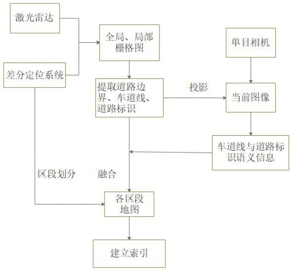
Figure 1 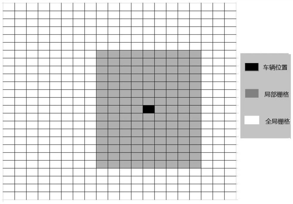
Figure 2 
Figure 3
Abstract
Description
technical field
[0001] The invention belongs to the technical field of automatic driving, and relates to an efficient and high-precision semantic road map construction method and a visualization method thereof. Background technique
[0002] High-precision maps are of great significance in the field of autonomous driving. High-resolution maps, also known as high-resolution maps, are maps specially designed for unmanned driving. Compared with traditional maps, high-precision maps can not only provide road-level navigation information, but also provide lane-level positioning and navigation information.
[0003] In the current high-precision map mapping scheme, a large number of steps such as laser point cloud conversion, splicing, labeling and indexing are required, and the process is very complicated and depends on professional technicians. This makes high-precision maps expensive, highly specialized, and inefficient to produce. In addition, in the production process of the...
Examples
Embodiment Construction
[0058] The technical solutions in the embodiments of the present invention will be clearly and completely described below with reference to the accompanying drawings in the embodiments of the present invention. Obviously, the described embodiments are only a part of the embodiments of the present invention, rather than all the embodiments. Based on the embodiments of the present invention, all other embodiments obtained by persons of ordinary skill in the art without creative efforts shall fall within the protection scope of the present invention.
[0059] see figure 1 , the present invention proposes a method for road extraction and indexing based on global and local grid map multi-sensor fusion, including the following steps:
[0060] Step 1. Establish a global and local grid map, and establish the association between the local grid map and the global grid map according to the vehicle positioning information;
[0061] Step 2. Extract the laser point cloud raster with the av...