
Exploitation and harnessing method for multi- sand broad-river reach, trench, beach and reservoir
A technology for river sections and channels, applied in the field of development and management of channels, channels and beach reservoirs in wide sandy river sections, can solve the problems that cannot be realized, water energy resources cannot be developed and utilized, etc., to achieve convenient water supply, low cost, and save treatment costs Effect
Patent Information
- Authority / Receiving Office
- CN · China
- Patent Type
- Applications(China)
- Current Assignee / Owner
- Publication Date
- 2008-09-10
- Estimated Expiration
- Not applicable · inactive patent
Smart Images
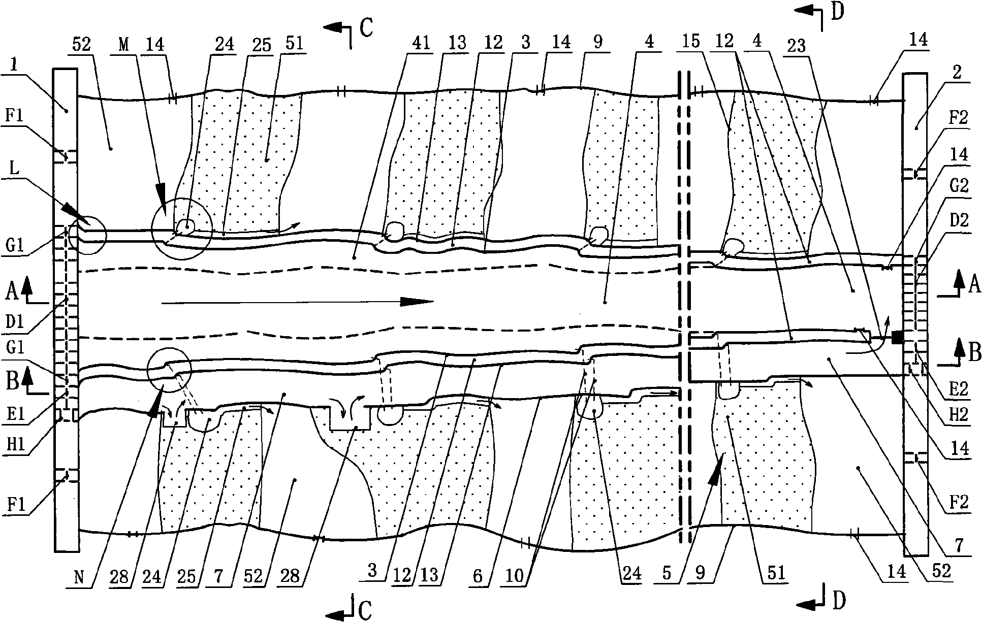
Figure 1 
Figure 2 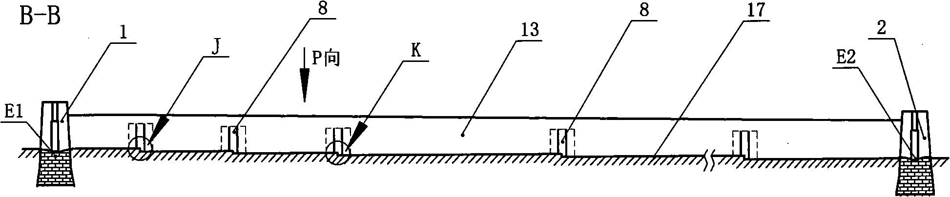
Figure 3
Abstract
Description
1. Technical field:
[0001] The invention relates to a method for development and management of sandy river sections in the technical field of water conservancy engineering, in particular to a method for development and management of canal channels and beach reservoirs in wide sandy river sections. 2. Background technology:
[0002] In 1855, the lower reaches of the Yellow River diverted at the Tongwaxiang breach, taking the Daqing River into the Bohai Sea in Kenli County, Shandong Province to form the current channel. The channel is 878km long, with a drop of about 118m. The river channel is wide at the top and narrow at the bottom, the gradient is steep at the top and slow at the bottom, and the flood discharge capacity is large at the top and small at the bottom. There are 3544km of beaches in the river 2 , Accounting for 84% of the river area, more than 1.8 million people live in Henan and Shandong provinces. Over the past 150 years, when the Yellow River was still a na...
Examples
Embodiment 1
[0054] Embodiment one: see figure 1 , figure 2 , image 3 , Figure 4 , Figure 5 , Figure 6 , Figure 7 , Figure 8 , Figure 9 , Figure 10 , Figure 11 , Figure 12 , Figure 13 , Figure 14 , a method for the development and management of channel channels and beach reservoirs in wide sandy river sections. The original flood control dike 9 is built at a certain width on both sides of the sandy river section, and two main dikes 3 are built along the direction of the river in the center of the original flood control dike 9 to form a narrow River channel 4, building dams 1 and 2 on the upper and lower reaches of the sandy river section, gate groups D1 and D2 are respectively provided at the intersections of the narrow river channel 4 and the upper and lower dams 1 and 2, A water supply and sand diversion canal 12 is built on the outside of each main dike 3, and a single water supply and sand diversion canal 12 shares a main embankment 3 with the narrow channel 4,...
Embodiment 2
[0063] Embodiment two: see Figure 15 , Figure 16 , Figure 17 , Figure 18 , Figure 19 , numbering is identical with embodiment one, and meaning is the same, does not repeat, and difference is: water delivery and shipping canal 7 and narrow river channel 4 are split type or partial split type, and water delivery and navigation canal 7 has both sides dikes (shipping dikes) 6. There is a part of reserved area 26 between the shipping embankment 6 on one side and the water and sand diversion channel embankment 13. This embodiment is mainly suitable for river courses that may bend and turn due to the terrain, but the water delivery and shipping channel 7 should be kept as flat as possible. It is advisable to be straight, so the water delivery and shipping canal 7 is not necessarily completely parallel to the narrow river channel 4, that is, the water delivery and navigation canal 7 can be kept straight with the narrow river channel 4 as a whole, and partially adjacent to the ...
Embodiment 3
[0065] Embodiment three: the figure is not drawn, meaning is basically the same as embodiment one, and the similarities are not repeated. The difference is that the water supply and sand diversion channel is built on the inside of the two main embankments of the narrow river channel, so that the water delivery and navigation channel and the narrow river channel A common embankment.