
A method of location analysis
An analysis method and technology of geographic location information, which is applied in the field of user home and work location analysis and location analysis, can solve the problems of long time-consuming location analysis, heavy network IO load, and decreased data access speed, so as to reduce network IO load and efficiency High and reduce the effect of capital risk
Patent Information
- Authority / Receiving Office
- CN · China
- Patent Type
- Patents(China)
- Current Assignee / Owner
- Publication Date
- 2019-05-03
Smart Images
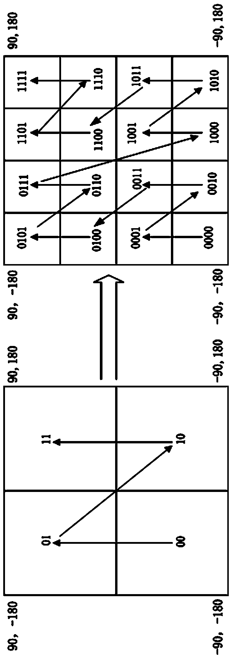
Figure 1 
Figure 2 
Figure 3
Abstract
Description
technical field
[0001] A location analysis method of the present invention relates to the field of LBS analysis, in particular to a user family and work location analysis method based on MapReduce and GeoHash algorithms under big data. Background technique
[0002] With the continuous development of science and technology, people carry more and more positioning tools, including mobile phones, professional handheld positioning terminals, wearable devices and personal vehicles with positioning terminals, etc. These positioning terminals will generate a large amount of two-dimensional geographic location information. By collecting and analyzing the generated two-dimensional geographic location information, the risk of financial leasing can be reduced (for example, a user purchases an electric vehicle through financial leasing, If the user cuts off the supply, the location of the user’s home or work can be found through positioning to avoid loss) or to improve the accuracy of ad...
Examples
Embodiment Construction
[0035] figure 1 As shown, GeoHash is an address encoding that can convert two-dimensional latitude and longitude into a one-dimensional string. Let's take (39.92324, 116.3906) as an example to introduce the GeoHash encoding algorithm: First, divide the latitude range (-90,90) into two intervals (-90, 0) and (0, 90). If the target latitude is in the front An interval, coded as 0, otherwise coded as 1. Since 39.92324 belongs to (0, 90), it is coded as 1. Then divide (0, 90) into two intervals (0, 45), (45, 90), and 39.92324 is located at (0, 45), so the code is 0; and so on until the accuracy meets the requirements, and the latitude is obtained The code is 1011 1000 1100 0111 1001;
[0036] The same algorithm is used for longitude, subdividing (-180, 180) in turn, and the code of 116.3906 is 11010010 1100 0100 0100; next, the codes of longitude and latitude are combined, the odd number is latitude, and the even number is longitude, and the code is obtained 11100 11101 00100 ...