
A full spatial information expression method and a full spatial information system
An information expression and full-space technology, applied in the field of spatial expression of surveying and mapping geographic information, can solve problems such as difficult data fusion, inconsistent multi-source spatial data, lack of geographic reference system, etc., and achieve the effect of increasing time attributes
Patent Information
- Authority / Receiving Office
- CN · China
- Patent Type
- Patents(China)
- Current Assignee / Owner
- Publication Date
- 2020-07-17
Smart Images
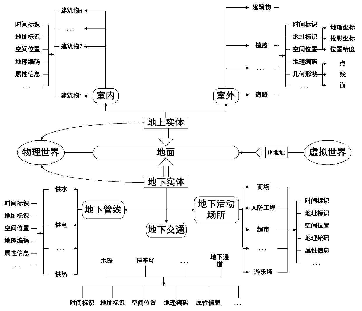
Figure 1 
Figure 2 
Figure 3
Abstract
Description
technical field
[0001] The invention relates to the technical field of spatial expression of surveying and mapping geographic information, in particular to a full-spatial information expression method and a full-spatial information system. Background technique
[0002] In recent years, with the development and popularization of information and communication technology, many achievements have been made in the construction of digital cities in China, and the construction of smart cities is the current upsurge. The development and construction of smart cities has brought unprecedented opportunities and challenges to my country's urban planning and management. In the field of surveying and mapping geographic information, the basic space-time concept of traditional urban planning and management objects has developed to a new stage.
[0003] There are two challenges in the new stage: First, in terms of time, the current time interval is greatly shortened, and the demand for real-t...
Examples
Embodiment 1
[0034] like figure 1 As shown, in the embodiment of the present invention, a method for expressing full spatial information includes the following content:
[0035] Full space information includes the following two meanings: (1) "Full space" refers to the three-dimensional space based on the earth's surface, including traditional open space, such as the space of cultivated land, rivers, vegetation, buildings and other ground entities, as well as The space of underground entities such as underground transportation, underground pipelines, and underground civil air defense that meets the needs of urban development; includes both outdoor space and indoor space, and realizes the integration of indoor and outdoor, above-ground and underground; (2) "full information" includes both spatial entities The three-dimensional information of space, time, and attributes, as well as other thematic information fused through place names and addresses with location as a link, mainly expressed in ...