
Three-dimensional virtual map visualization engine technology and device based on geographic position
A three-dimensional virtual and geographic location technology, applied in the field of virtual maps, can solve the problems of navigation accuracy defects, recognition defects, large data flow, etc., and achieve the effect of improving navigation accuracy, improving navigation efficiency, and reducing data flow.
Patent Information
- Authority / Receiving Office
- CN · China
- Patent Type
- Applications(China)
- Current Assignee / Owner
- Publication Date
- 2020-08-25
- Estimated Expiration
- Not applicable · inactive patent
Smart Images
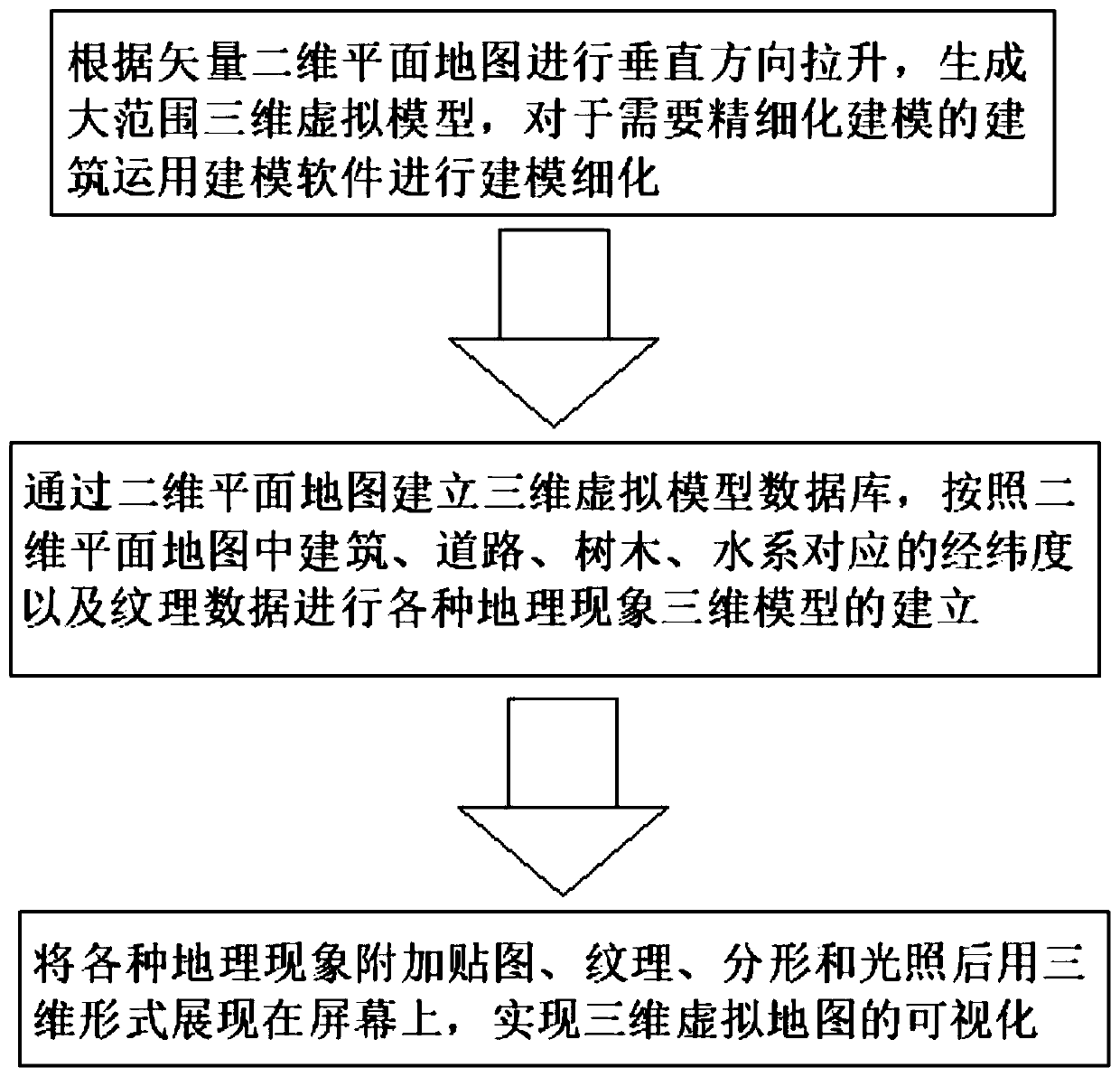
Figure 1 
Figure 2 
Figure 3
Abstract
Description
technical field
[0001] The present invention relates to the technical field of virtual maps, and more specifically, relates to a geographic location-based three-dimensional virtual map visualization engine technology and device. Background technique
[0002] Database (Database) is a warehouse that organizes, stores and manages data according to the data structure. It was produced more than 60 years ago. With the development of information technology and the market, especially after the 1990s, data management It is no longer just storing and managing data, but has transformed into various data management methods that users need. There are many types of databases, ranging from the simplest tables storing various data to large database systems capable of storing massive amounts of data, which have been widely used in various aspects. In the information society, fully and effectively managing and utilizing various information resources is a prerequisite for scientific research ...
Examples
Embodiment 1
[0037] see figure 1 , a three-dimensional virtual map visualization engine technology based on geographic location, comprising the following steps:
[0038] S1. According to the vector two-dimensional planar map, the vertical direction is pulled up to generate a large-scale three-dimensional virtual model, and the modeling software is used to refine the modeling of the buildings that require refined modeling;
[0039] S2. Establish a three-dimensional virtual model database through a two-dimensional planar map, and establish three-dimensional models of various geographical phenomena according to the latitude, longitude and texture data corresponding to buildings, roads, trees, and water systems in the two-dimensional planar map;
[0040] S3. Add maps, textures, fractals and lighting to various geographical phenomena and display them on the screen in three-dimensional form to realize the visualization of three-dimensional virtual maps.
[0041] S1 and S2 are based on the two-w...