
Small river flood forecasting method
A flood forecasting and river technology, applied in forecasting, image data processing, structured data retrieval, etc., can solve the problems of inability to calibrate confluence parameters, lack of data, low forecasting accuracy, etc., and achieve the effect of automatic and flexible construction
Patent Information
- Authority / Receiving Office
- CN · China
- Current Assignee / Owner
- Publication Date
- 2020-05-12
Smart Images
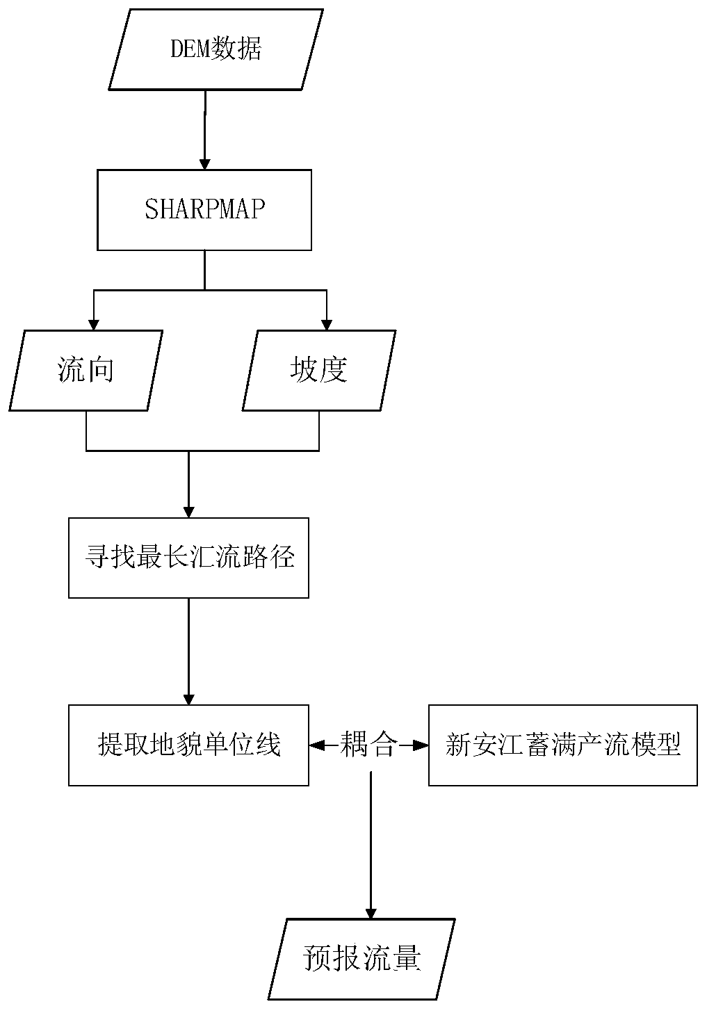
Figure 1 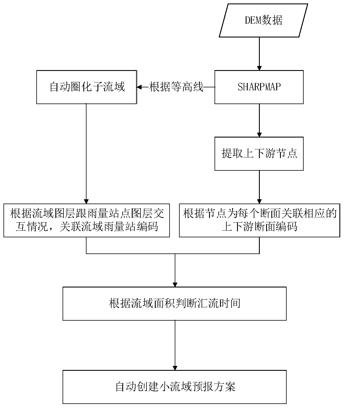
Figure 2 
Figure 3
Abstract
Description
technical field
[0001] The invention relates to the technical field of water conservancy and hydropower engineering, in particular to a small river flood forecasting method. Background technique
[0002] Most of the central and western regions of my country are mountainous and hilly areas, where mountain torrent disasters occur frequently, and the affected areas are relatively scattered, with small watershed area, short confluence time, and lack of data. The construction scheme has the characteristics of low efficiency and inconvenient parameter adjustment.
[0003] The process of the traditional small and medium-sized river forecasting method is mainly as follows: select the Xin'an River three water source model or other hydrological models (including lumped and distributed hydrological models), etc., use existing watershed layers or use commercial GIS tools such as ARCGIS to import DEM data extraction Relevant elements such as the watershed layer; then enter the informatio...
Examples
Embodiment Construction
[0025] The specific implementation process of the method of the present invention will be described below in conjunction with the accompanying drawings.
[0026] 1. Select the test basin.
[0027] The station is located in the upper reaches of Baishui, a first-class tributary of the Xiangjiang River. It is a representative station in the southern mountainous area of central Hunan, with a drainage area of 795km 2 , Since January 1959, hydrological tests have been carried out, and the test items include water level, precipitation, evaporation, and flow.
[0028] According to the analysis of rainfall data, there are Jindong, Huangtang, Baiguoshi, Miaobeichong, Modaoling, Neixia, Sanwanjiao, Xijiang, Xiayang, Saibeitan, and Baisha in the area above the Jindong hydrological station and the surrounding areas. The rainfall data from 11 stations, among them, 6 rainfall stations in Neixia, Sanwanjiao, Xijiang, Xiayang, Saibeitan, and Baishayuan have incomplete data in recent years...