
A morphological layout method of artificial intelligence urban design to improve the wind environment
A technology of urban design and artificial intelligence, applied in design optimization/simulation, geometric CAD, special data processing applications, etc., can solve problems such as adjustment difficulties, large error coefficients, and lack of efficiency, so as to simplify cumbersome processes and reduce complexity , Improve the effect of accuracy and efficiency
Patent Information
- Authority / Receiving Office
- CN · China
- Patent Type
- Patents(China)
- Current Assignee / Owner
- Publication Date
- 2021-03-16
Smart Images
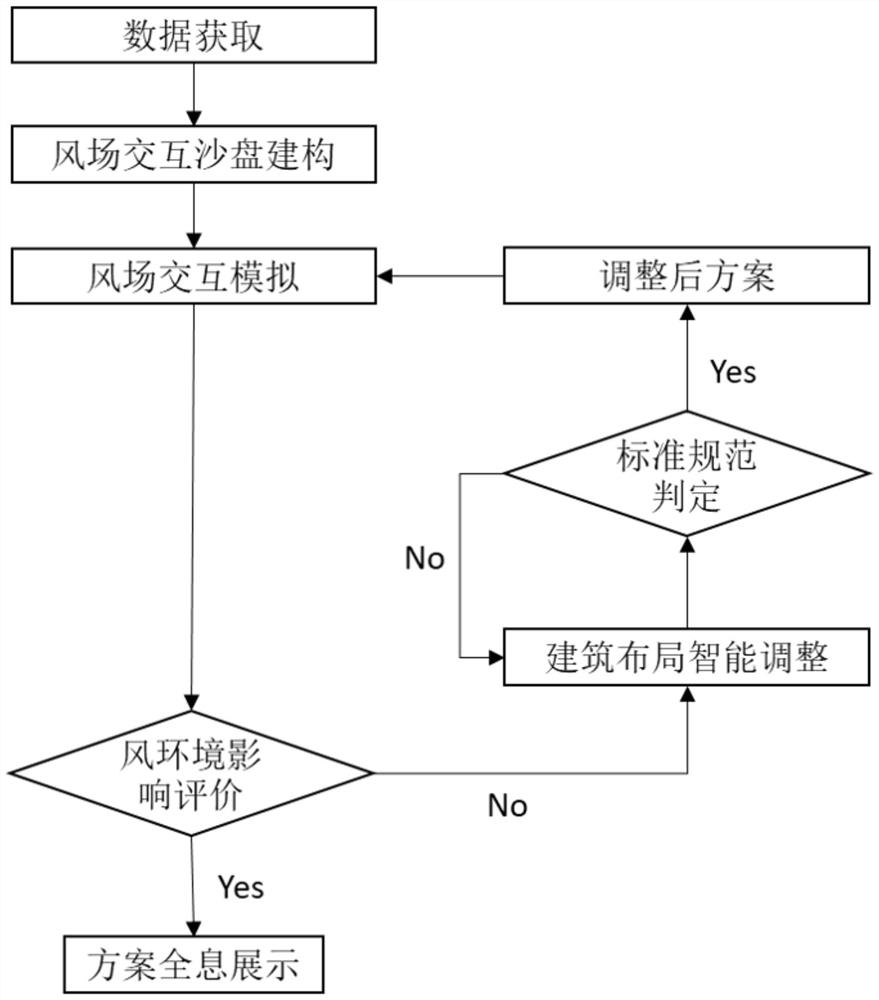
Figure 1 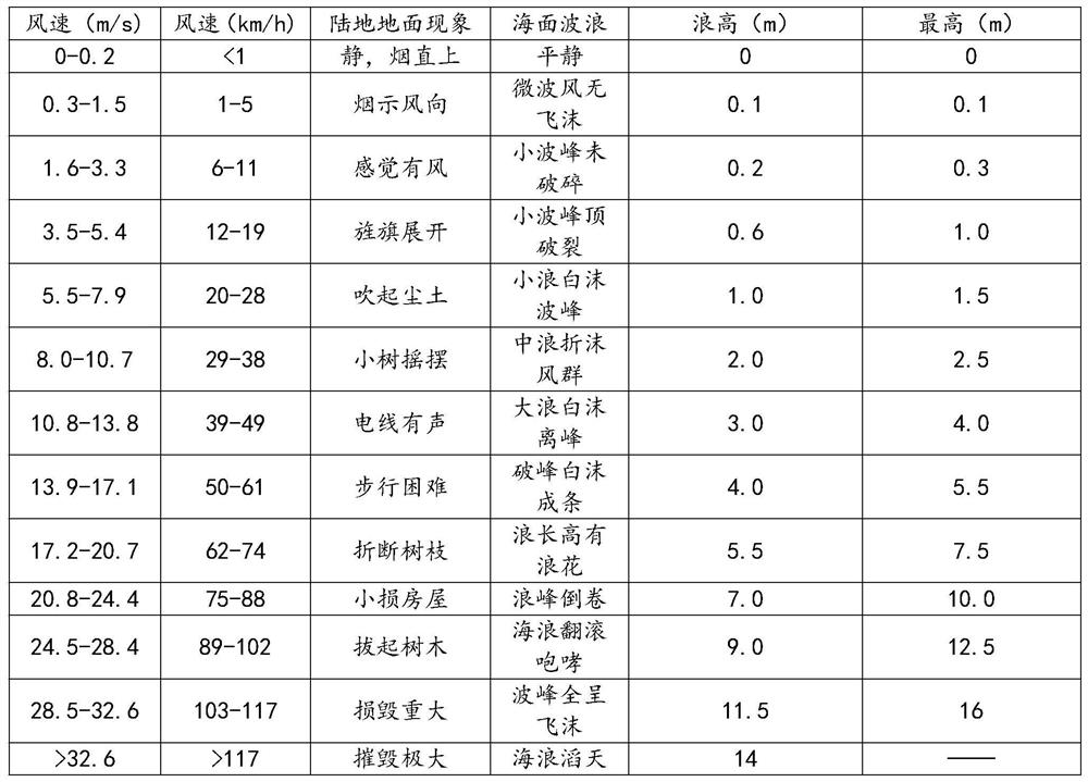
Figure 2 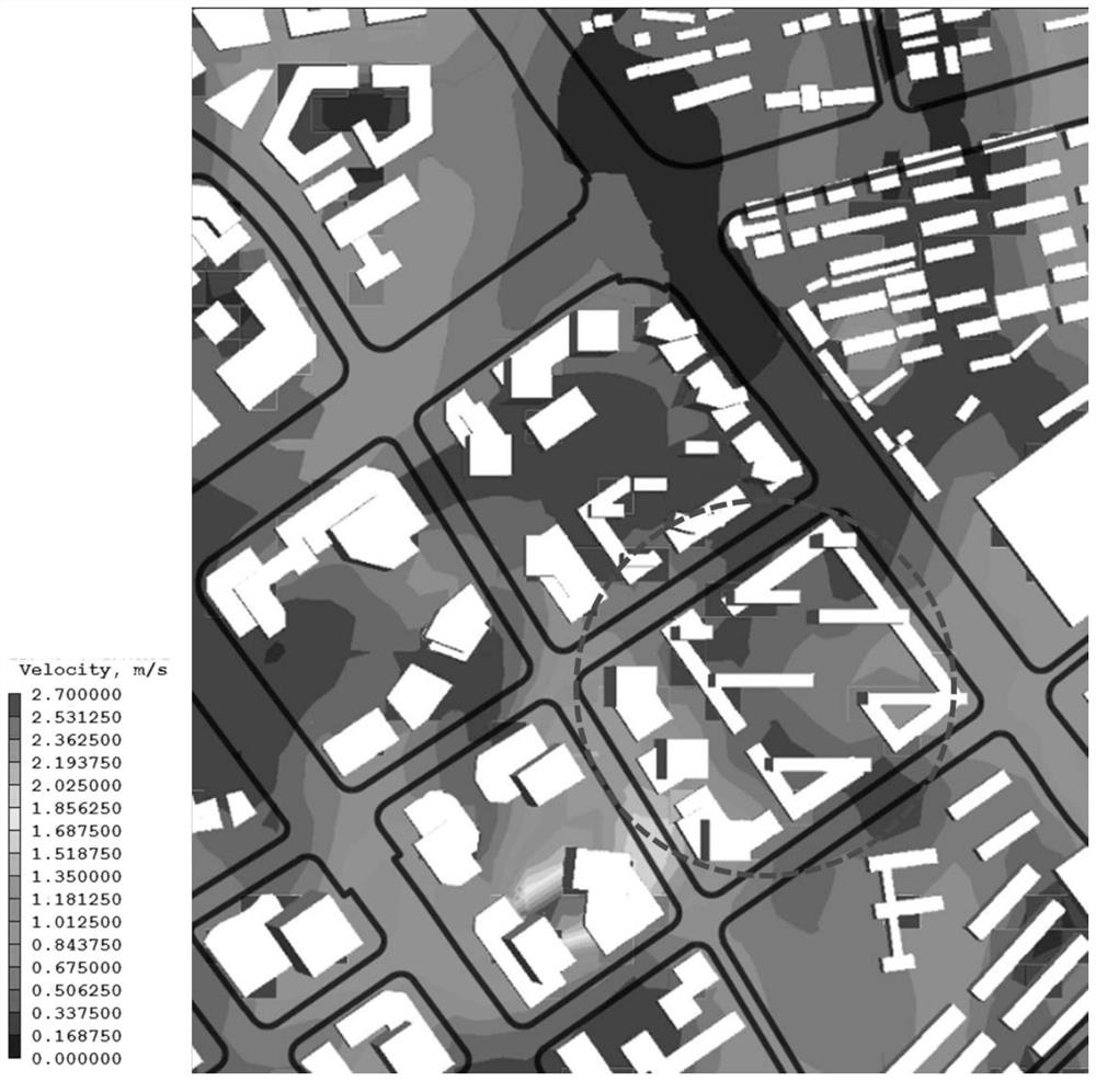
Figure 3
Abstract
Description
technical field
[0001] The invention relates to the field of urban planning, in particular to an artificial intelligence urban design form layout method for improving the wind environment. Background technique
[0002] Wind environment is one of the important research contents of urban planning discipline, which refers to the affected wind field formed by outdoor natural wind under the influence of urban topography or natural topography. Good urban wind environment quality can not only improve the indoor and outdoor comfort of urban residents, reduce the energy consumption of urban buildings for heating in winter and cooling in summer, but also slow down the pollution caused by automobile exhaust near the underlying surface of the city in a timely manner. air pollution caused. The traditional urban form design does not consider the wind environment, and cannot detect whether the wind speed standard requirements are met during the layout, nor can it adjust the local layout f...
Examples
Embodiment
[0072] The technical solution of the present invention will be described in detail below by taking the urban design of a certain area in Changzhou City as an example.
[0073] (1) Taking a certain area in Changzhou as the target block, obtain the 3D vector data, urban design plan data, and urban design standard specification data of Changzhou, and obtain the wind direction and speed data of Changzhou at random fixed points, including:
[0074] (1.1) Obtain the 3D vector data, urban design plan data and urban design standard specification data of Changzhou City through the Changzhou City Planning Department, including the current situation of Changzhou City and the closed block CAD / SHP file of the design plan, and the CAD of the current closed land plot / SHP file, CAD / SHP file of the current closed building and the number of floors (height), elevation data and water body data, building spacing and building retreat line data in the urban design standard specification.
[0075] (...