
A Drought Remote Sensing Monitoring Method Suitable for High Altitude Areas
A remote sensing monitoring and high-altitude technology, applied in the field of environmental remote sensing applications, can solve problems such as differences and difficulty in implementation, inability to represent the overall meteorological situation, and less distribution of meteorological stations, and achieve the effect of reducing the uneven distribution of point data.
Patent Information
- Authority / Receiving Office
- CN · China
- Patent Type
- Patents(China)
- Current Assignee / Owner
- Publication Date
- 2021-03-16
Smart Images
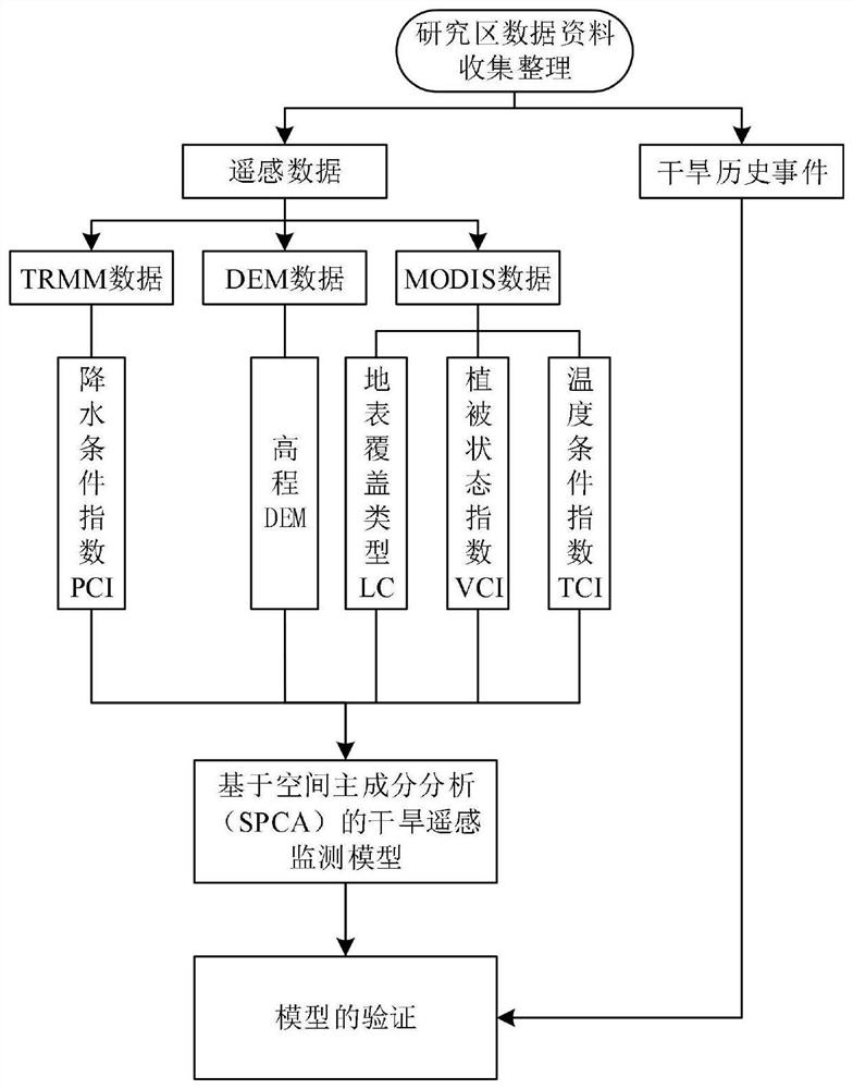
Figure 1 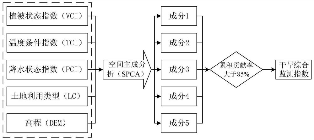
Figure 2 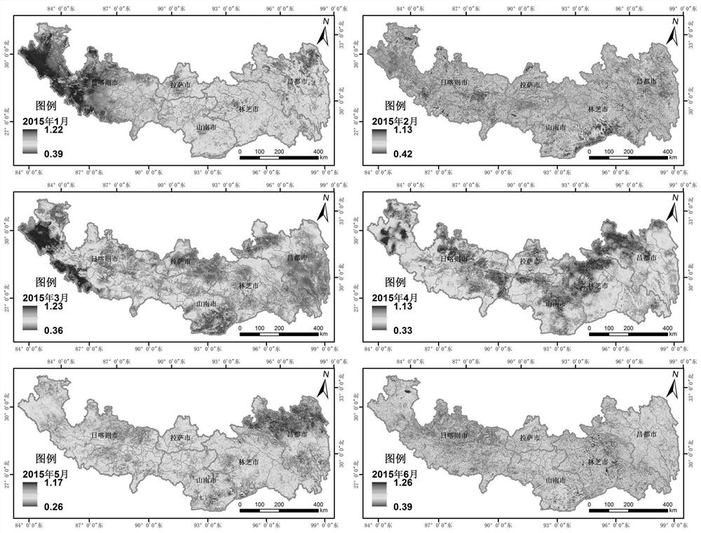
Figure 3
Abstract
Description
technical field
[0001] The invention belongs to the application field of environmental remote sensing, and in particular relates to a drought remote sensing monitoring method suitable for high-altitude areas. Background technique
[0002] Drought remote sensing monitoring is based on the information of various drought-causing factors in the process of drought, and establishes a comprehensive monitoring model of drought remote sensing and carries out drought monitoring. As a common and frequent disaster, drought has always caused serious threats to agricultural production, food security, ecological environment, and economic and social development. China is a large agricultural country, and the rise and fall of agriculture has a very serious impact on the national economy. For agriculture, droughts are more serious than floods. Droughts account for more than half of the farmland area and crop production losses suffered by various natural disasters every year. Therefore, impr...
Examples
Embodiment 1
[0128] Taking Lhasa City, Shigatse City, Qamdo City, Shannan City and Nyingchi City in the southeast of Tibet in high-altitude areas as the research area, the method of the present invention is used to carry out comprehensive drought remote sensing monitoring on the research area.
[0129] The research area is located in the two major regions of the Tibet Autonomous Region, the valley of southern Tibet and the valley of eastern Tibet, including Lhasa, Qamdo, Nyingchi, Shannan and Shigatse, and 56 counties (districts). The research area is mainly distributed in Tibet The eastern and southern parts of the autonomous region cover an area of about 516,900 km 2 , accounting for about 42.37% of the area's land area. This area is the main agricultural area in Tibet. Lhasa’s agriculture is mainly distributed in Yangbajing and Duilongdeqing in the Lhasa Valley. Shigatse City has the largest cultivated soil area in the region. Shannan City is known as the “Tibet Granary” and mainly gr...