
Undersea seismic monitoring network
Patent Information
- Authority / Receiving Office
- US · United States
- Current Assignee / Owner
- Publication Date
- 2011-02-10
- Estimated Expiration
- Not applicable · inactive patent
Smart Images
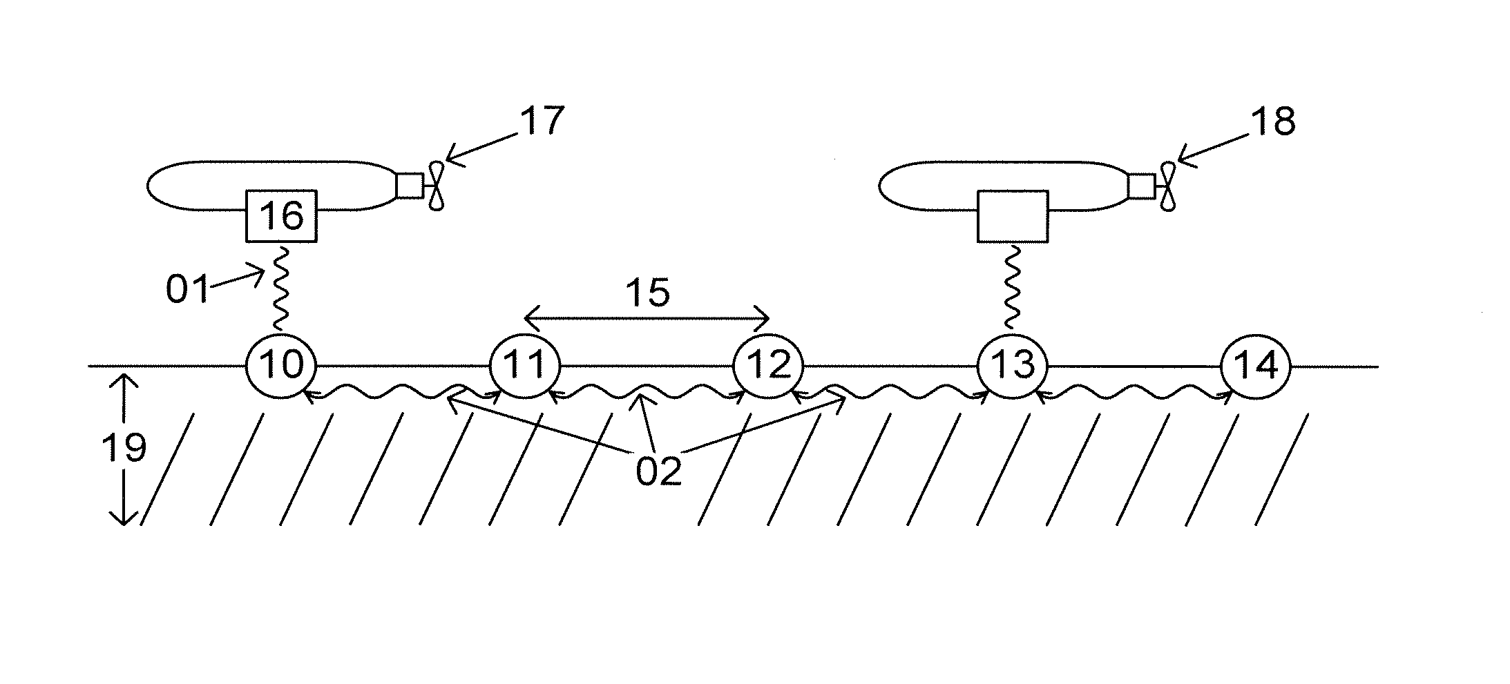
Figure 1 
Figure 2 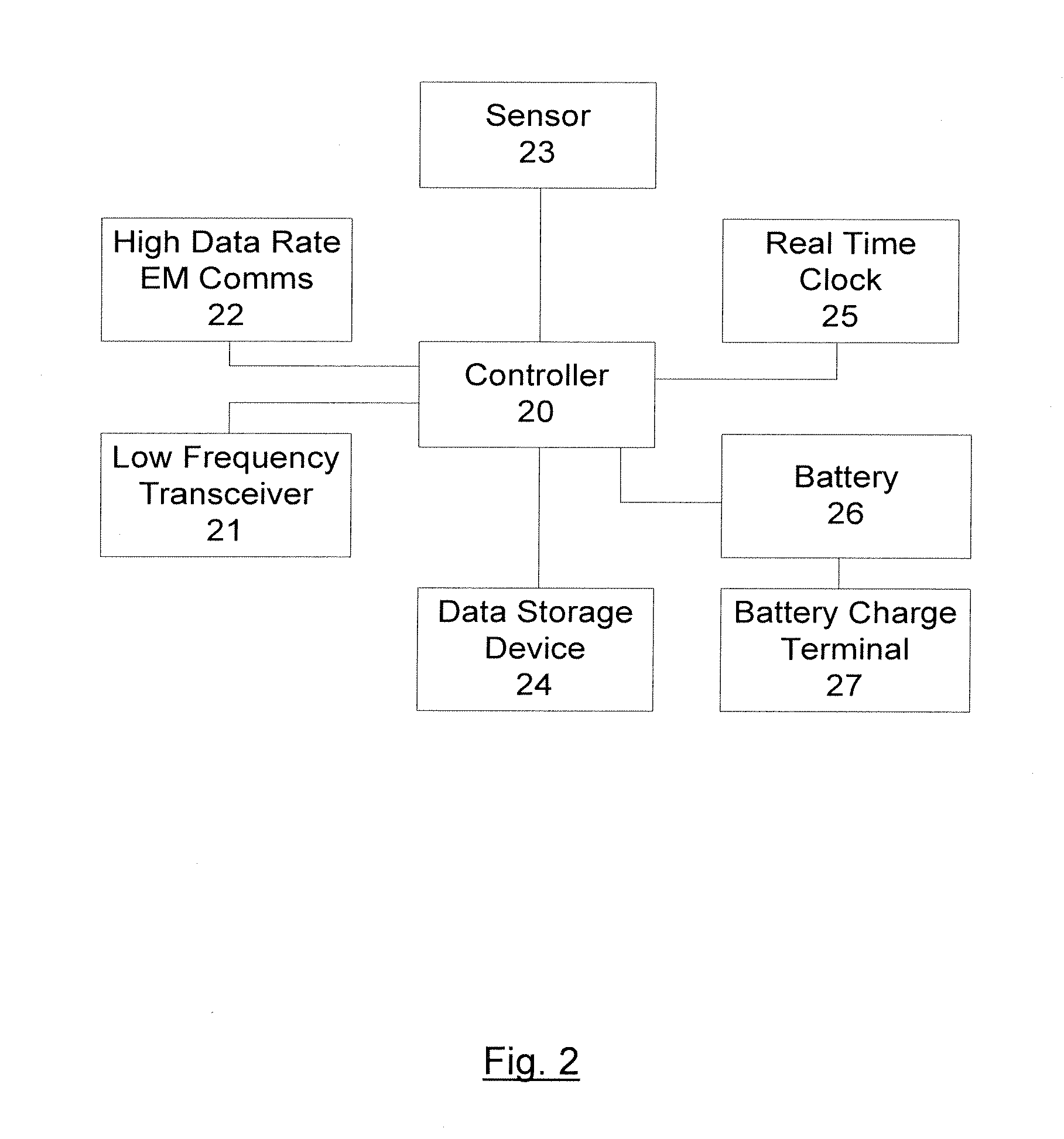
Figure 3
Abstract
Description
CROSS-REFERENCE TO RELATED APPLICATION
[0001] This application claims the benefit of U.S. 61 / 231,723 filed Aug. 6, 2009 and GB-0913710.0 filed Aug. 6, 2009, which applications are fully incorporated herein by reference.FIELD OF USE
[0002] The present invention relates to a wireless underwater network of sensors for the monitoring of seismic data and signals and the related systems for the gathering and processing of such data.DESCRIPTION OF THE RELATED ART
[0003] In the field of oil and gas exploration, seismic imaging over a large area of the seabed is an important method for optimization of oil and gas production, and for the assessment of the capacity of a particular field. The article entitled “Breakthrough for repeated seismic” by Halfdan Carstens, Geo ExPro; September 2004; pp 26-29, http: / / www.geoexpro.com / sfiles / 8 / 21 / 6 / file / Valhall—26-29.pdf outlines a system for the gathering of seismic imaging data over a large area of the seabed.
[0004] The system for undersea seismic imaging tau...
Examples
Embodiment Construction
[0033]FIG. 1 shows a drawing of an undersea seismic monitoring network according to an embodiment of present invention. The undersea seismic monitoring network of FIG. 1 comprises an underwater vehicle 17, onto which a radio modem 16 is mounted, and an array of undersea monitoring stations 10, 11, 12, 13, and 14, spaced at regular intervals 15 on the seabed 19. Depending on the specific implementation, monitoring stations 10, 11, 12, 13, and 14, may be mounted on the surface of the seabed, or may be trenched; the choice is based principally on the conditions of the local environment, and the nature of the seabed.
[0034]FIG. 2 shows a block diagram of the integral components of an undersea monitoring station 10, 11, 1213 and 14 of the undersea seismic monitoring network of FIG. 1. Undersea seismic monitoring stations 10, 11, 13 and 14 each comprise a sensor 23 for measuring seismic data, which is connected to controller 20. Controller 20 comprises a programmable integrated circuit and...