
Synchronous Orbit Radar Imaging Method Based on Range Migration Fine-tuning and Subband Segmentation
A technology of geosynchronous orbit and distance migration, which is applied in the field of geosynchronous orbit synthetic aperture radar GEO-SAR data processing, geosynchronous orbit synthetic aperture radar imaging, and geosynchronous orbit radar imaging based on range migration fine-tuning and sub-band segmentation, which can solve the problem of synchronous orbit Synthetic Aperture Radar Research Lag and Other Issues
Patent Information
- Authority / Receiving Office
- CN · China
- Patent Type
- Patents(China)
- Current Assignee / Owner
- Publication Date
- 2017-04-12
Smart Images
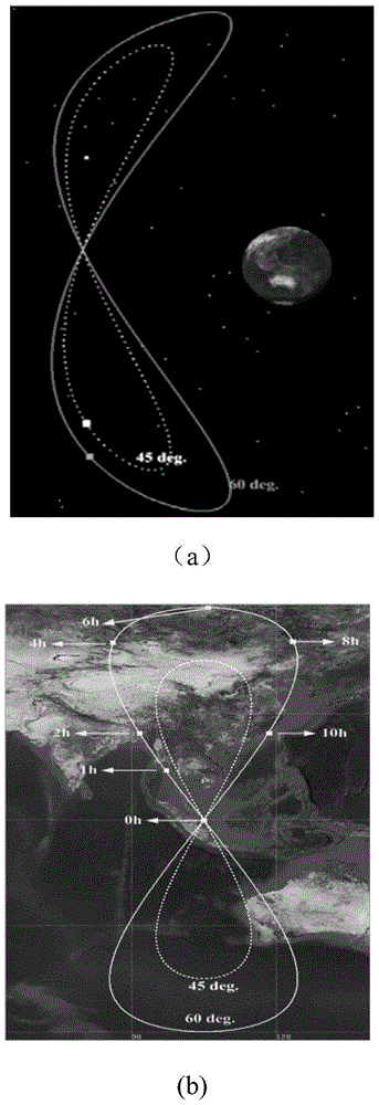
Figure 1 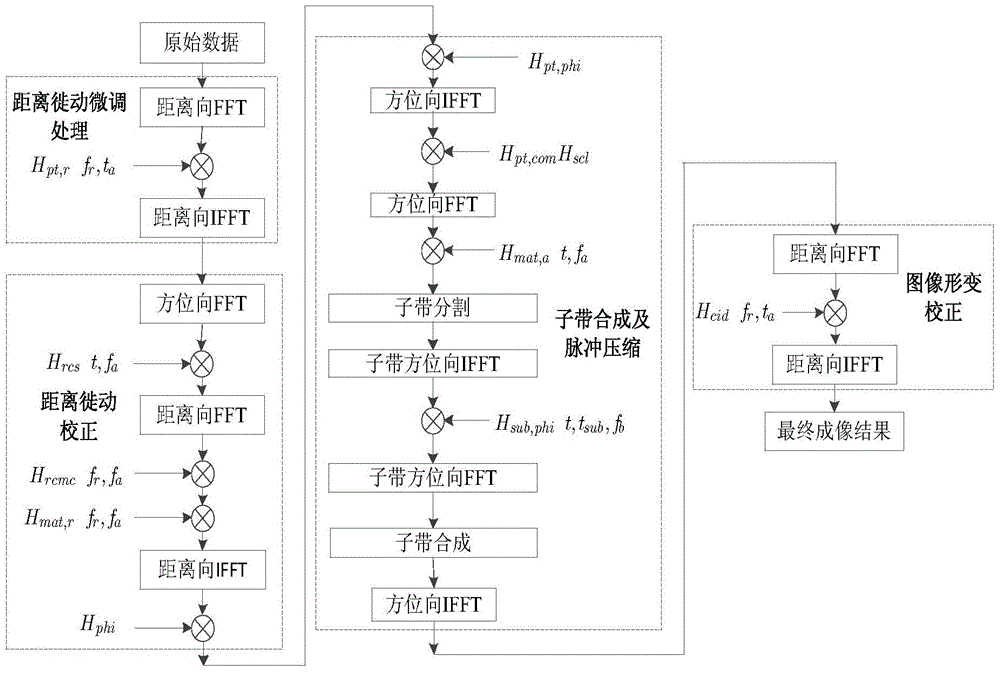
Figure 2 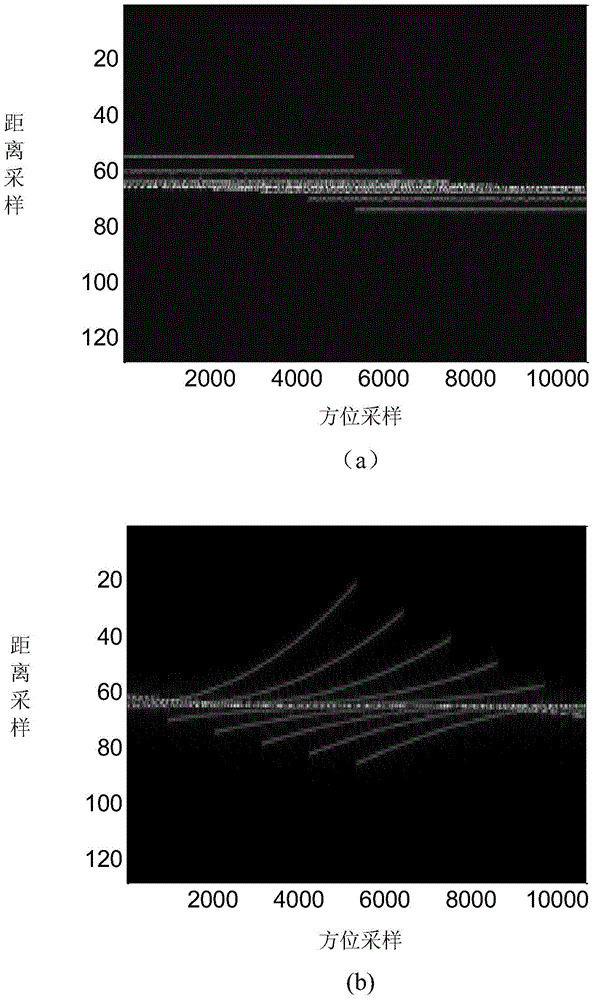
Figure 3
Abstract
Description
technical field
[0001] The invention belongs to the field of radar signal processing, and relates to geosynchronous orbit synthetic aperture radar imaging (Geosynchronous Synthetic Aperture Radar, GEO-SAR), in particular to a geosynchronous orbit radar imaging method based on range migration fine-tuning and sub-band segmentation, which is applied to geosynchronous orbit synthetic aperture Radar GEO-SAR data processing. Background technique
[0002] Synthetic Aperture Radar (SAR) has the advantages of all-weather, all-weather, high resolution, long range, mapping bandwidth and strong anti-interference. Under complex combat conditions, synthetic aperture radar SAR can complete tasks that conventional surveillance systems (optical, infrared imaging, etc.) , detection, tracking, identification and precision strike capabilities. In civil affairs, synthetic aperture radar SAR can be used in soil resource monitoring, ecological management, urban planning, and marine information e...
Examples
Embodiment Construction
[0087] refer to figure 2 , the synchronous orbit radar imaging method based on range migration fine-tuning and sub-band segmentation of the present invention is illustrated, and the present invention is applied to synchronous orbit synthetic aperture radar GEO-SAR data processing, and its steps include the following contents.
[0088] Step 1. Synchronous Orbit Synthetic Aperture Radar SAR includes a radar transmitter and a radar receiver. The radar transmitter transmits signals, and the radar receiver receives target echo signals.
[0089] In the present invention, the distance from the target to the radar transmitter and the distance from the target to the radar receiver are set to be far greater than the distance between the transmitter and the receiver.
[0090] Step 2, set the distance between the position and the target when the radar transmitter transmits the signal as R T (t a), the distance between the position and the target when the radar receiver receives the sig...