
GNSS-CCD-integrated zenith telescope high-precision vertical deflection fast measurement method
A vertical line deviation and measurement method technology, applied in special data processing applications, instruments, electrical digital data processing, etc., can solve the problems that the baseline cannot be too long, cannot be obtained effectively, and the measurement is difficult, so as to meet the requirements of measurement accuracy and No geographical restrictions, high measurement accuracy and no geographical restrictions, the effect of reducing time consumption
Patent Information
- Authority / Receiving Office
- CN · China
- Current Assignee / Owner
- Publication Date
- 2015-09-16
Smart Images
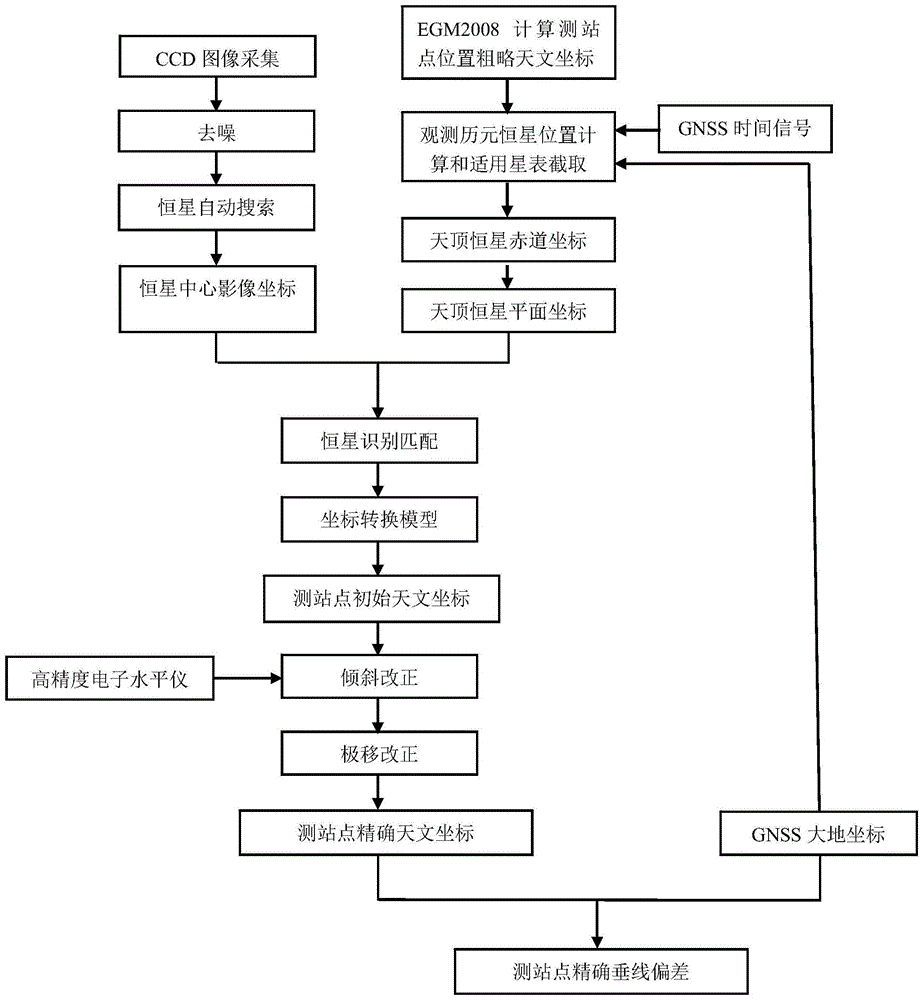
Figure 1 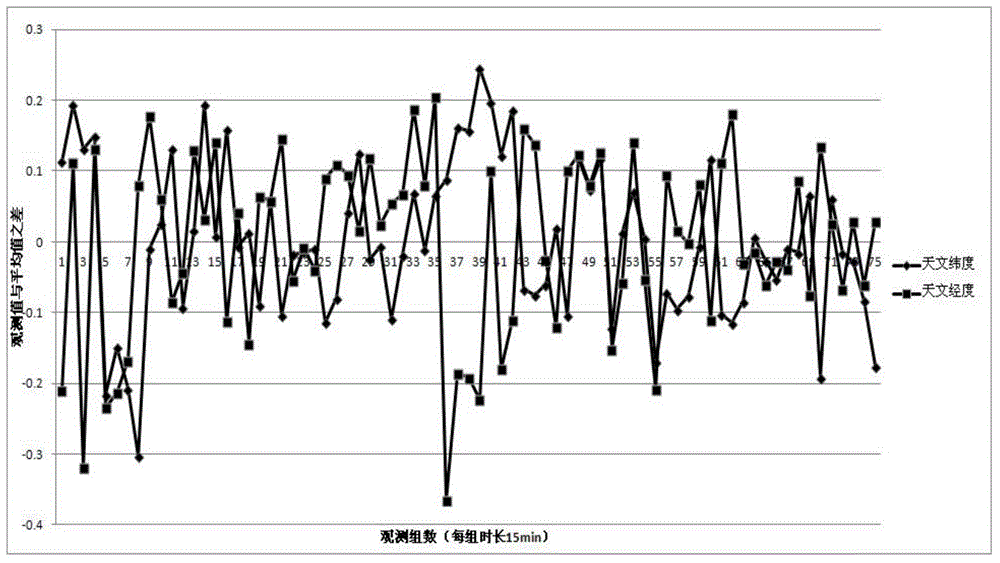
Figure 2 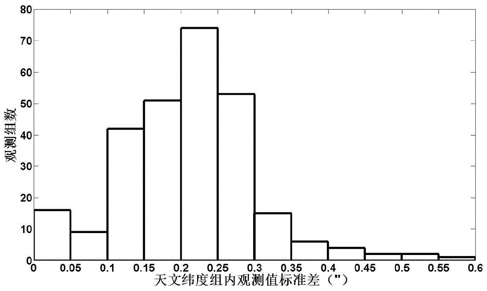
Figure 3
Abstract
Description
technical field
[0001] The invention relates to an astronomical geodetic measurement method for vertical line deviation, in particular to a high-precision vertical line deviation rapid measurement method integrating GNSS and CCD zenith tube. Background technique
[0002] The angle between the gravity vector g of a point on the ground and the normal vector n on the corresponding ellipsoid is defined as the vertical deviation of the point. The vertical line deviation represents the direction of gravity, and is a necessary geophysical quantity for geodetic reduction, the refinement of the earth's gravity field and geoid model, and the study of the shape of the earth. It has important uses in geodetic surveying and space technology.
[0003] The vertical deviation is the performance of the mass distribution inside the earth, which can be used to invert the abnormal refraction of the atmosphere, monitor the mass migration and energy accumulation inside the earth, monitor natural ...
Examples
Embodiment 1
[0245] Taking a university campus as an example, the above-mentioned high-precision vertical line deviation rapid measurement method integrated with GNSS and CCD zenith tube is used to quickly measure the vertical line deviation of the university campus.
[0246] The specific measurement process is as follows:
[0247] From June 6, 2013 to December 19, 2013, during the experiment, 34 nights with good weather conditions and suitable observation environment were selected to collect and process the data of the integrated GNSS and CCD zenith. The total number of observation groups is 275, the average observation time of each group is 15 minutes, the average number of observations per group is 26 times, the average number of stars used in each group is 724, and the average observation accuracy within the group is 0.246" (astronomical latitude), 0.269" (astronomical longitude), the average number of observation groups throughout the night is 11 groups, and the average observation accu...