
Robot autonomous localization and navigation based on image-text recognition and semantic meaning
A robot and graphic technology, applied in navigation, surveying and navigation, character and pattern recognition, etc., can solve the problems of robot position and track drift, cannot support autonomous navigation and navigation, etc., achieve high accuracy and promote human-machine communication , the effect of improving the accuracy
Patent Information
- Authority / Receiving Office
- CN · China
- Patent Type
- Applications(China)
- Current Assignee / Owner
- Publication Date
- 2018-04-27
Smart Images
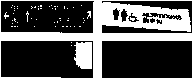
Figure 1 
Figure 2 
Figure 3
Abstract
Description
technical field
[0001] The present invention relates to the field of autonomous positioning and navigation of mobile smart devices such as service robots, unmanned aerial vehicles, automatic guided vehicles, and indoor 3D modeling equipment, and in particular to the positioning and navigation of smart mobile devices when there is no GPS signal indoors , this kind of positioning and navigation does not need to provide the floor plan of the environment in advance, and does not need to deploy wireless networks such as UWB and ZIGBEE networks indoors. Background technique
[0002] The demand for high-precision positioning comes from the booming and rapidly developing field of robots and wearable devices. For example, robots include housekeeping robots, sweeping robots, and logistics robots. Compared with human positioning, positioning is just needed for these devices, and The diversity of application scenarios cannot be realized by special equipment such as UWB base stations and...
Examples
Embodiment Construction
[0054] The present invention will be further described below in conjunction with embodiment.
[0055] The system designed by the invention is divided into an offline part and an online system.
[0056] Offline part:
[0057] It is mainly to complete the collection of various signs, especially indoor direction signs and warning signs, which are manually labeled (labelled) and stored in the database. Through the machine learning scheme, the algorithm memorizes the graphics, image features and features of these signs. semantic information. it includes:
[0058] 1) Collection: It can be collected on the network or manually on-site
[0059] 2) Labeling: Manually label the attributes and semantics of the collected signs, such as the shape and meaning of the direction signs, signs of passage and signs of prohibition, etc.
[0060] 3) Training: through machine learning methods, the algorithm can obtain the knowledge of these signs (attributes, concepts, semantics, etc.)
[0061] ...