
Sub-pixel positioning method and system based on spatial gravity and pixel aggregation
A positioning method and sub-pixel technology, applied in the field of remote sensing, can solve the problems of neglecting spatial correlation, inability to obtain, high sub-pixel positioning accuracy, etc., to break through the limitation of spatial resolution, improve sub-pixel positioning accuracy, The effect of high spatial correlation
Patent Information
- Authority / Receiving Office
- CN · China
- Patent Type
- Patents(China)
- Current Assignee / Owner
- Publication Date
- 2020-08-11
Smart Images
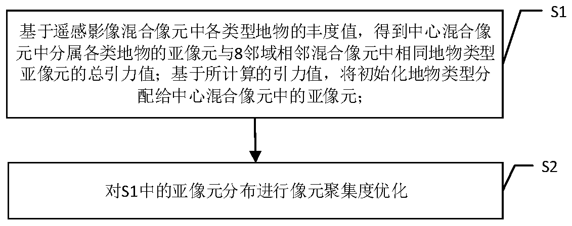
Figure 1 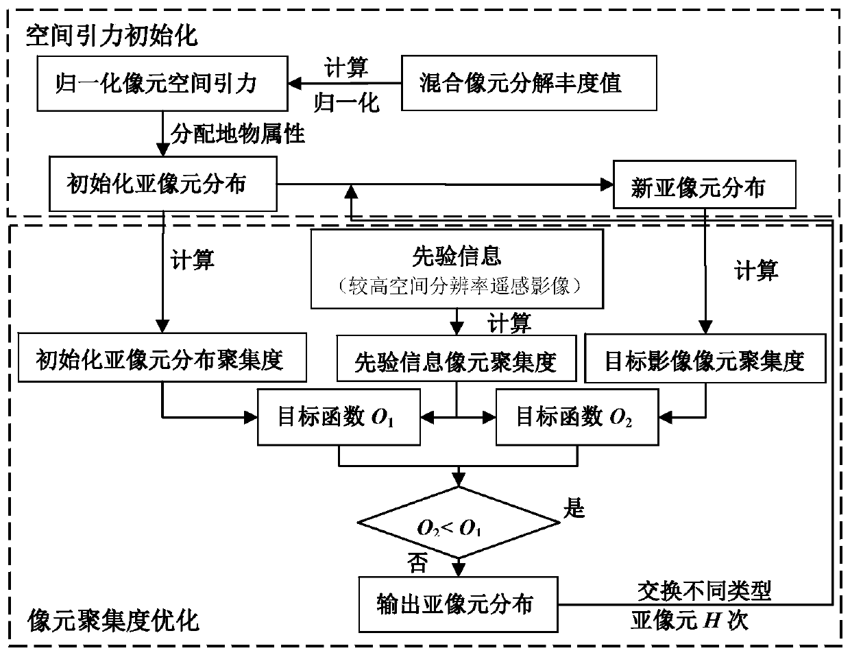
Figure 2 
Figure 3
Abstract
Description
technical field
[0001] The present invention relates to remote sensing technology, and more specifically, to a sub-pixel positioning method. Background technique
[0002] The common phenomenon of mixed pixels in remote sensing images has become one of the main obstacles to further improve the accuracy of object recognition and remote sensing classification. For the decomposition of mixed pixels, it is necessary to study the properties, abundance and spatial distribution of the pixels in the mixed pixels. The corresponding technologies are endmember extraction technology, mixed pixel decomposition technology and sub-pixel positioning technology. Judging from the existing research, there are many and in-depth studies on the first two technologies. However, only relying on endmember extraction technology and mixed pixel decomposition technology can only obtain the proportion information of each endmember in the mixed pixel, but cannot obtain the distribution of various ground ...
Examples
Embodiment Construction
[0028] Embodiments of the present invention are described below with reference to the drawings, in which like parts are denoted by like reference numerals. In the case of no conflict, the following embodiments and the technical features in the embodiments can be combined with each other.
[0029] The method of the invention includes two parts: space gravity initialization and pixel aggregation degree optimization. The principle diagram of the method of the present invention is as Figure 1-2 shown.
[0030] Step S1, based on the abundance values of various types of ground objects in the mixed pixel of the remote sensing image, the sub-pixels belonging to various types of ground objects in the central mixed pixel and the sub-pixels of the same type of ground objects in the 8 adjacent mixed pixels are obtained. The total gravitational value of the pixel is normalized to calculate the normalized gravitational value of each type of surface object in the remote sensing image in...