
Method of visualization of the traffic around of a reference aircraft in a non-compliant display zone, associated computer product program and visualization system
a technology of aircraft and display zone, which is applied in the field of method of visualization of the traffic around the reference aircraft, can solve the problems of difficult pilot evaluation of the altitude and approach dynamics of the surrounding aircraft, and the use of one or the other of the above-mentioned display system or even both systems at the same time is not convenient for the pilot, so as to improve the perception of the traffic state and improve the altitude and the approach speed of the surrounding aircra
Patent Information
- Authority / Receiving Office
- US · United States
- Patent Type
- Applications(United States)
- Current Assignee / Owner
- Publication Date
- 2018-11-01
Smart Images
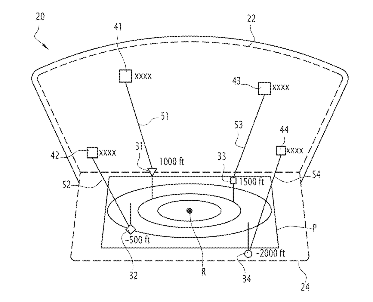
Figure 1 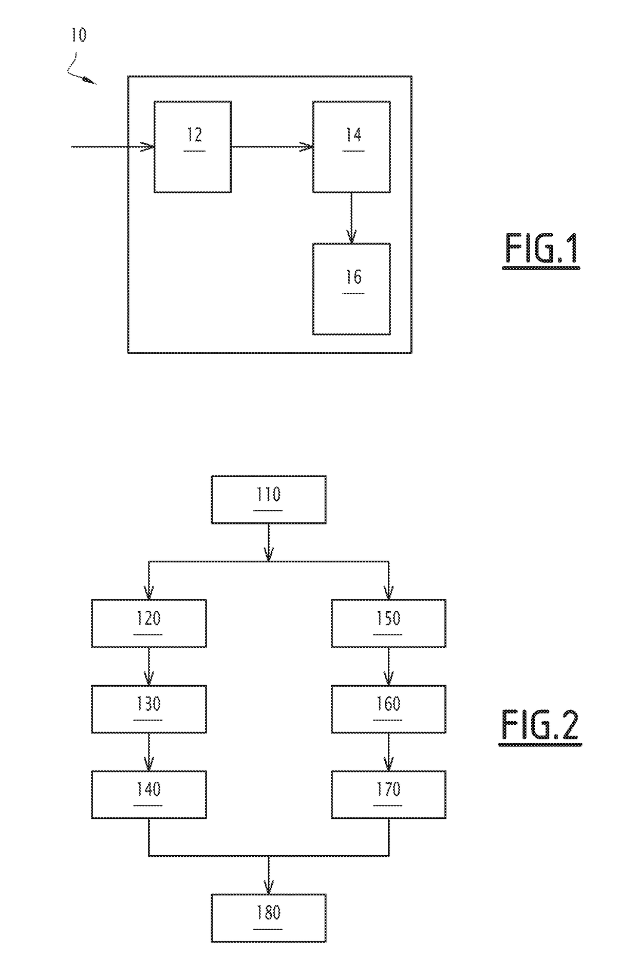
Figure 2 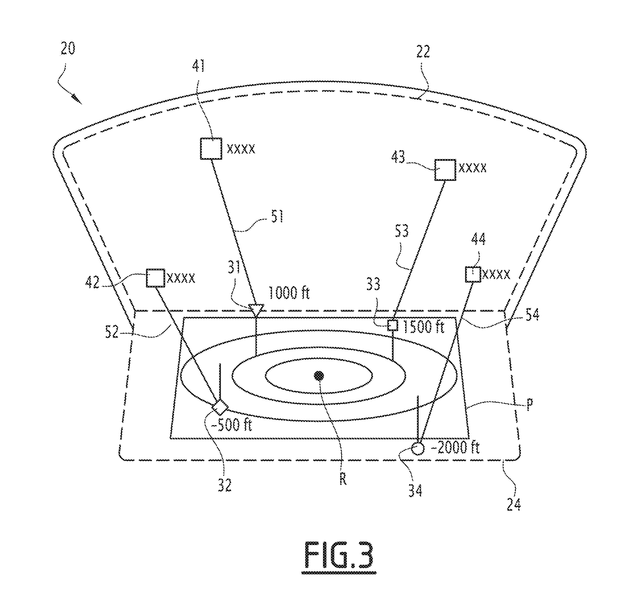
Figure 3
Abstract
Description
CROSS-REFERENCE TO RELATED APPLICATIONS
[0001] This application claims the benefit of French Application No. 17 00457, filed on Apr. 26, 2017, which is incorporated herein by reference in its entirety.FILED OF THE INVENTION
[0002] The present invention relates to a method for visualizing traffic in the vicinity of a reference aircraft.
[0003] The present invention also relates to a computer program product and an associated display system.BACKGROUND OF THE INVENTION
[0004] Various systems for visualizing the state of traffic in the vicinity of an aircraft already exist in the prior art.
[0005] Thus, for example, the Traffic alert and Collision Avoidance System (TCAS) provides a two-dimensional graphical representation of surrounding aircraft based on their horizontal distance to the given aircraft.
[0006] In particular, in such a representation, each of the surrounding aircraft is represented by a symbol placed on a radius emanating from a symbol representing the given aircraft, and in proporti...
Examples
Embodiment Construction
[0036]The display system 10 of FIG. 1 is on board an aircraft, hereinafter referred to as the reference aircraft, and makes it possible to display the traffic state around this reference aircraft.
[0037]The term “reference aircraft” here refers to any aircraft or helicopter or any other flying machine pilotable by a pilot from this device.
[0038]According to another exemplary embodiment, the reference aircraft is a remotely controllable drone. In this case, the display system 10 is located in a control center, for example terrestrial, from which the piloting of the drone is performed.
[0039]With reference to FIG. 1, the display system 10 comprises an acquisition module 12, a processing module 14 and a display module 16.
[0040]The acquisition module 12 is for example an electronic module for acquiring positions of aircraft in the vicinity of the reference aircraft. These aircrafts are subsequently described as surrounding aircraft.
[0041]As in the case of the reference aircraft, the term ...