
A dual-source seismic exploration method and system for offshore seismic exploration
A technology of marine seismic exploration and seismic exploration, which is applied in the field of marine geophysical exploration, can solve the problems of not being able to meet the needs of deep seismic exploration, and the number of seismic data coverage is small, so as to achieve good economic benefits and practicability, increase the number of coverage, increase The effect of excitation density
Patent Information
- Authority / Receiving Office
- CN · China
- Patent Type
- Patents(China)
- Current Assignee / Owner
- Publication Date
- 2015-12-23
Smart Images
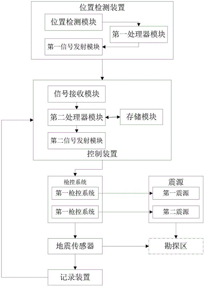
Figure 1 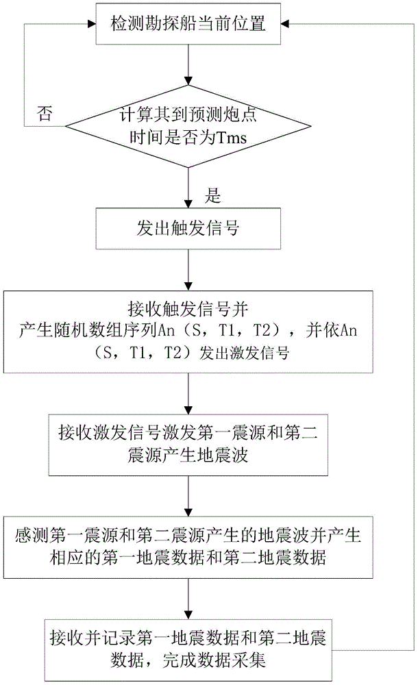
Figure 2
Abstract
Description
technical field
[0001] The invention relates to the field of marine geophysical exploration, in particular to a dual-source seismic exploration method and system for marine seismic exploration. Background technique
[0002] The marine geophysical surveying system is a system used to collect geophysical data from the strata below the bottom of the water body of a lake or ocean, such as marine seismic data acquisition systems, marine seismic survey systems, and electromagnetic survey systems. A marine seismic survey system typically includes a seismic survey vessel with onboard navigation, seismic energy control, and geophysical data recording equipment. Seismic survey vessels typically tow one or more sensor streamers aft of the vessel. The seismic energy control device activates one or more seismic energy sources at selected times. Signals generated by individual sensors on the sensor streamers in response to the detected seismic energy are ultimately conducted to recordin...
Examples
Embodiment Construction
[0031] In order to have a clearer understanding of the technical features, purposes and effects of the present invention, the specific implementation manners of the present invention will now be described in detail with reference to the accompanying drawings.
[0032] Currently used in offshore seismic exploration systems, the underwater equipment towing method of the offshore seismic exploration operation ship is to tow left and right air gun sources and multiple digital cables behind the exploration ship, and the sources are excited alternately every S meters or so, that is, when the source When excited, the energy passes through the seawater, propagates through the seabed to the deep part of the formation, part of the energy propagates downward through the formation, and part of the energy is reflected by the formation interface and propagates upward, and is loaded by a sensor streamer placed at a certain depth in seawater. Seismic sensors spaced apart pick it up and record ...