
A large-scale detection method for forest fires based on spatial context features
A technology of spatial context and detection method, applied in the field of remote sensing, can solve the problems of fire point detection and fire extinguishing adverse effects, and achieve the effect of improving forest fire point detection accuracy and spatial sensitivity
Patent Information
- Authority / Receiving Office
- CN · China
- Patent Type
- Patents(China)
- Current Assignee / Owner
- Publication Date
- 2022-07-29
Smart Images
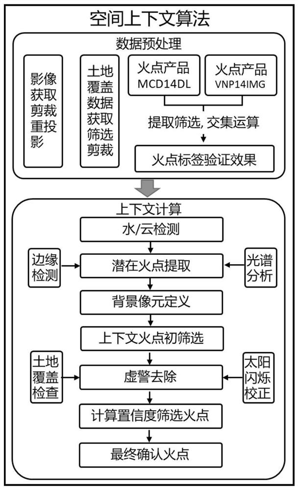
Figure 1 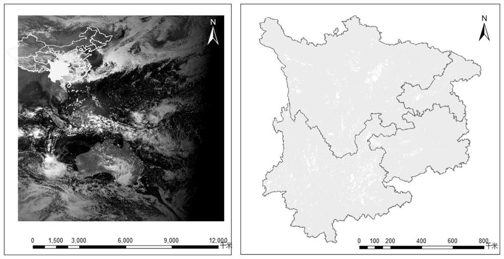
Figure 2 
Figure 3
Abstract
Description
technical field
[0001] The invention belongs to the field of remote sensing technology, and relates to a forest fire point detection method based on a geosynchronous orbit satellite Himawari-8. Background technique
[0002] The global ecological environment is gradually deteriorating under the influence of climate warming, and large-scale natural disasters and extreme climate events occur frequently. Among them, forest fires, as a serious natural disaster, have occurred many times in recent years, posing a huge threat to economic development, global ecological balance, and personal life and property safety. Fighting forest fires is very dangerous. On March 30, 2019, a forest fire broke out in Muli County, Liangshan Prefecture, Sichuan Province. The total fire area was about 20 hectares, and 31 people died. Since July 8, 2019, the Australian forest fires have raged. The fire area is as high as 12 million hectares. About 1 billion wild animals lost their lives in the fire. In...
Examples
Embodiment Construction
[0064] The present invention will be further described below in conjunction with the accompanying drawings.
[0065] Data acquisition: The remote sensing data used in the present invention is the Japanese Himawari-8 geosynchronous orbit satellite data, the imaging range covers the entire Asia-Pacific region, and the imaging time is 10 minutes per scene. After submitting the account password, the user can obtain data through the following website: ftp: / / ftp.ptree.jaxa.jp / / jma / netcdf.
[0066] Implementation tools:
[0067] The whole test process of the present invention is realized based on PYTHON 3.7, and the process code is original of the present invention.
[0068] The image used in the attached drawing is the Himawari-8 image at 13:20 on April 1, 2020 Beijing time, which was intercepted from the research area. The overview of the research area is as follows figure 2 shown.
[0069] Implementation process such as figure 1 shown in detail below.
[0070] step 1:
[00...