
A navigation method for planetary dynamic descent based on tds and image measurement
A technology of dynamic descent and image measurement, applied in the field of deep space exploration, can solve problems such as time-consuming, high requirements for on-board computers, cumbersome image recognition and processing processes, etc., and achieve the effect of improving horizontal position accuracy
Patent Information
- Authority / Receiving Office
- CN · China
- Patent Type
- Patents(China)
- Current Assignee / Owner
- Publication Date
- 2015-10-28
Smart Images
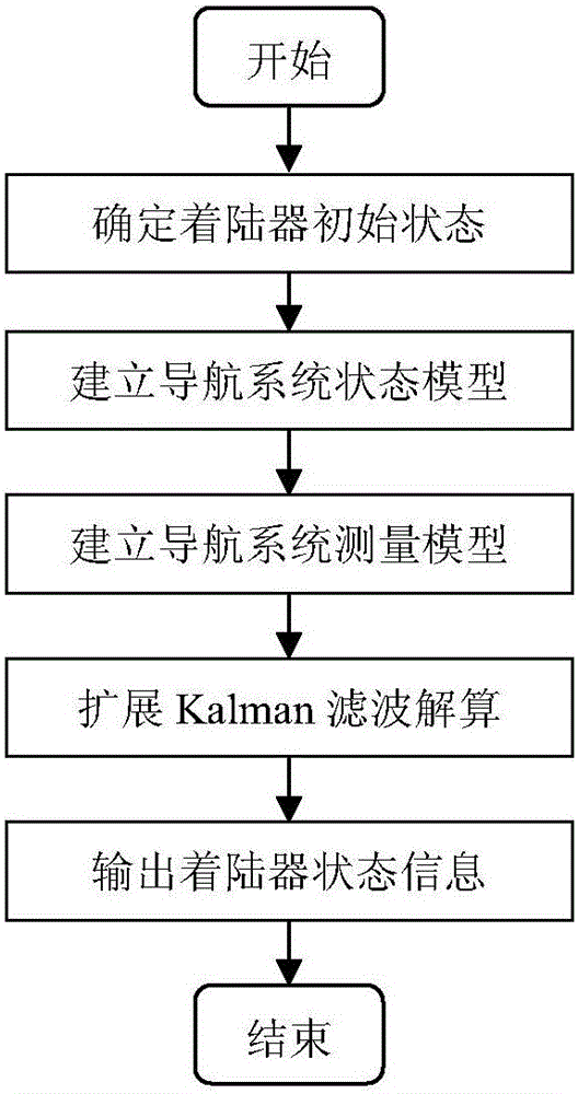
Figure 1 
Figure 2 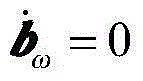
Figure 3
Abstract
Description
technical field
[0001] The invention relates to a navigation method for a planetary dynamic descent section based on TDS and image measurement, and belongs to the technical field of deep space exploration. Background technique
[0002] Future Mars exploration requires landers to achieve fixed-point soft landings. The power descent stage is the main controlled stage of the lander. Through a certain guidance algorithm, the lander can be controlled to fly to the predetermined target point to achieve a precise point landing, which must be based on the precise position and speed information provided by the navigation system. Therefore, constructing a navigation scheme that can accurately determine the position and velocity of the lander is the basis for the success of the fixed-point landing mission.
[0003] Previous Mars landing missions used radar altimeters to measure the height information of the lander during the power descent, but the speed information was measured differ...
Examples
Embodiment Construction
[0041] In order to better illustrate the purpose and advantages of the present invention, the content of the invention will be further described below in conjunction with the accompanying drawings and embodiments.
[0042] This example is aimed at the navigation scheme based on TDS and image measurement in the Mars dynamic descent section, combined with the distance measurement and speed measurement information of three-beam TDS, and the angle information between the sight lines of three feature points, the extended Kalman filter is used for filtering calculation to realize High-precision navigation on powered descents. The specific implementation method of this example is as follows:
[0043] Step 1: Establishment of the state model of the Mars power descent section
[0044] The state model of the lander is established in the fixed coordinate system of the landing point. Lander state x includes position vector r = [x,y,z] T , Velocity vector v=[v x ,v y ,v z ] T , atti...