
A method for recommending surrounding points of interest for saving computing resources of on-board terminals of connected vehicles
A vehicle-mounted terminal and computing resource technology, applied in the field of network communication, can solve the problems of small number of POIs, single return category, and no actual consideration of location, etc., and achieve the effect of improved sorting, reasonable sorting, and comprehensive types
Patent Information
- Authority / Receiving Office
- CN · China
- Patent Type
- Patents(China)
- Current Assignee / Owner
- Publication Date
- 2021-05-11
Smart Images
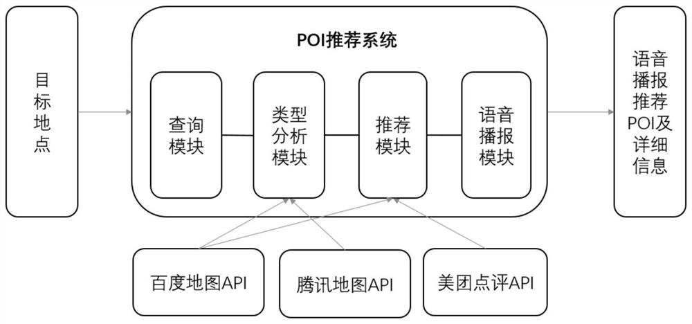
Figure 1 
Figure 2 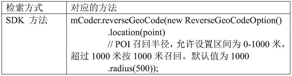
Figure 3
Abstract
Description
technical field
[0001] The invention relates to the field of network communication, in particular to a method for recommending peripheral interest points that saves computing resources of a vehicle-mounted terminal of a networked vehicle. Background technique
[0002] In today's world, under the background of the multi-mode development of the Internet and the trend of industrial intelligence, the traditional manufacturing industry is gradually transforming and upgrading to "smart manufacturing". In this context, the automobile industry is developing towards intelligence and networking driven by technologies such as mobile Internet, big data, and cloud computing. As a new direction of innovation and development, connected cars will bring the automobile industry into a period of rapid development of multi-field and large-scale system integration, and play a role in improving traffic efficiency and car driving experience. At present, the material and cultural life of Chinese p...
Examples
Embodiment Construction
[0055] The following is attached figure 1 The present invention is described in further detail.
[0056] The specific development process of software development is as follows:
[0057] Step 1: Get the longitude and latitude of the target geographic point by geocoding, and use the longitude and latitude as parameters to perform inverse geocoding to obtain the official recommended POI group used by Baidu Maps to describe the target geographic point. Baidu Maps officially recommends a total of 10 POI groups, which are not distinguished by default, and are sorted according to the distance from the target geographic point (distance parameter size).
[0058] Step 2: Make statistics on the types and quantities of all POIs in the officially recommended POI group, and obtain the types and weights of POIs used to describe the target geographic point. The type of POI describing the target geographic point is divided into a first-level industry classification and a second-level industr...