
Satellite image ship component detection method based on key point regression
A satellite image and detection method technology, applied in the field of satellite image recognition, can solve problems such as coarse attribute granularity and target rotation change, and achieve the effect of alleviating the long tail effect and expanding the sample space
Patent Information
- Authority / Receiving Office
- CN · China
- Current Assignee / Owner
- Publication Date
- 2022-07-22
Smart Images
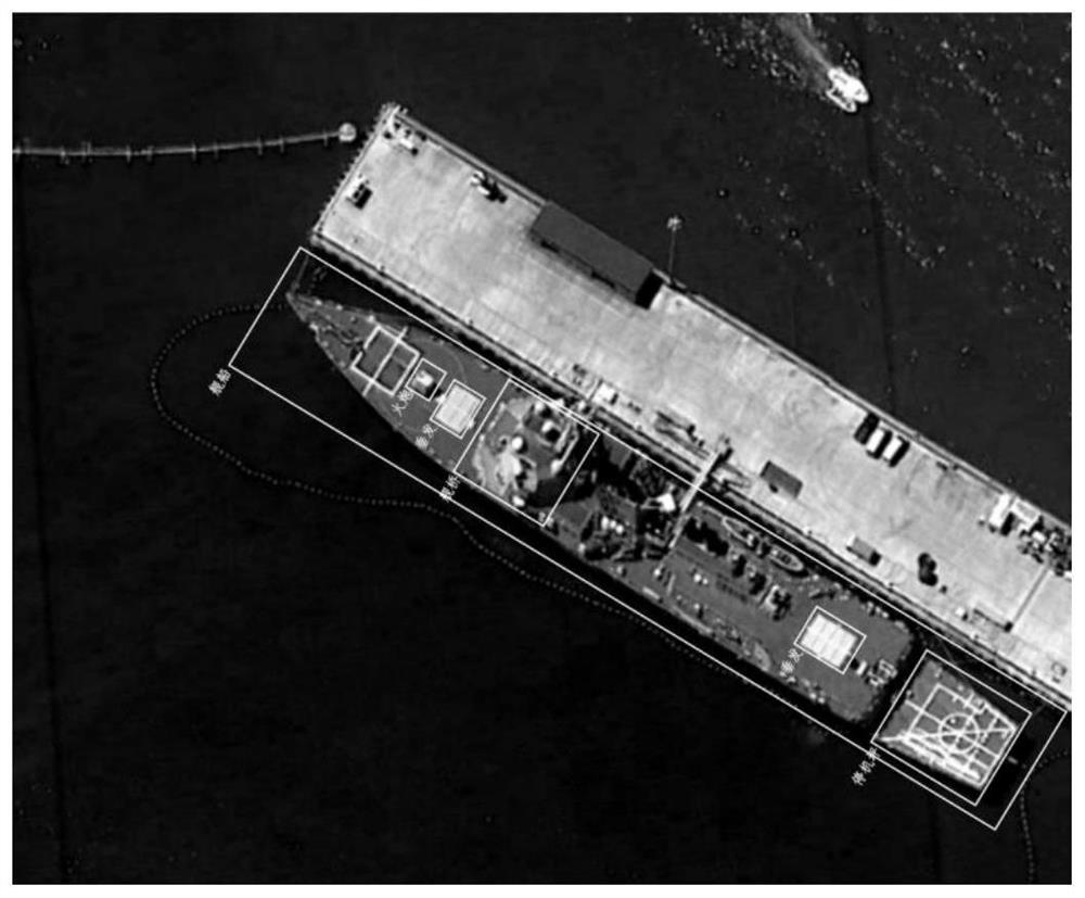
Figure 1 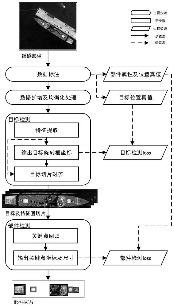
Figure 2 
Figure 3
Abstract
Description
technical field
[0001] The invention belongs to the field of satellite image recognition, and more particularly relates to a satellite image ship component detection method based on key point regression. Background technique
[0002] Ships are an important carrier of maritime transportation, and are of great significance to military reconnaissance, environmental protection, marine detection and other fields. As an important technology of maritime situational awareness, ship target detection is the premise of ship target tracking and state estimation, and has broad application prospects in military and civilian fields. With the rapid development of remote sensing technology, the use of satellite images for ship target detection has the advantages of all-day, all-weather, and no airspace restrictions. However, compared with natural scene images, satellite images have the characteristics of large image size, insufficient resolution, poor imaging quality, target rotation change...
Examples
Embodiment Construction
[0040] At present, some ship target detection methods based on deep learning technology have been improved in data enhancement, feature extraction, feature reuse, loss function design, etc., which alleviates the problems of insufficient resolution of satellite images and small and few targets to a certain extent. However, the detection accuracy of ship targets still needs to be improved. In addition, the existing detection methods can only detect the ship target attribute and position distribution, and cannot determine the key points of the ship and the key components of the ship. Therefore, the present invention proposes a satellite image ship component detection method based on key point regression. The specific flow chart is as follows: figure 2 shown. Examples of satellite imagery ship targets and component annotations are: figure 1 shown.
[0041] The specific embodiments and basic principles of the present invention will be further described below with reference to t...