

Map building method and map system
A technology for establishing methods and maps, which is applied in special data processing applications, instruments, electrical digital data processing, etc., can solve problems affecting user experience, slowing down database access speed, etc., to reduce storage space, increase usage rate, and speed up positioning speed effect
- Summary
- Abstract
- Description
- Claims
- Application Information
AI Technical Summary
Problems solved by technology
Method used
Image

Examples
Embodiment Construction
[0021] The present invention will be further described in detail below in conjunction with the accompanying drawings and specific embodiments.
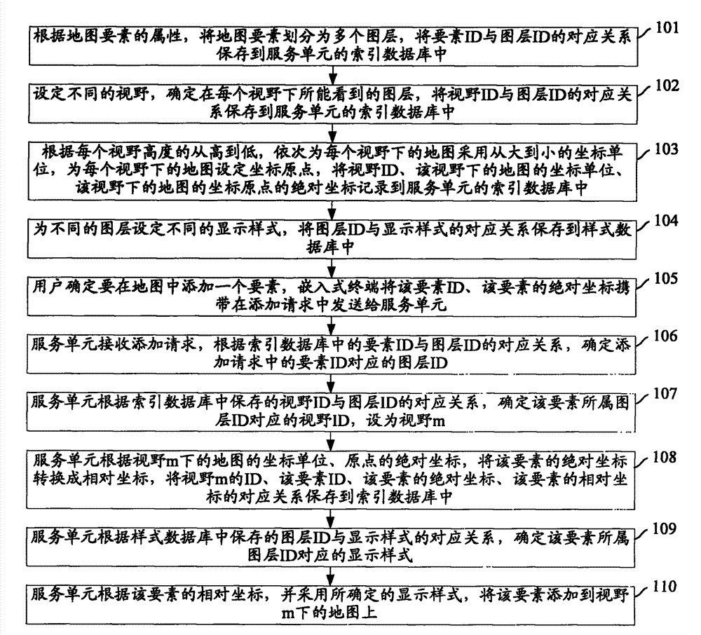
[0022] figure 1 The flow chart of the map creation method provided by the embodiment of the present invention, such as figure 1 As shown, the specific steps are as follows:
[0023] Step 101: Divide the map elements into multiple layers according to the attributes of the map elements, and store the correspondence between element IDs and layer IDs in the index database of the service unit.
[0024] A layer can be: a base terrain layer, a city management part layer, and so on. Among them, the basic terrain layer can be further divided into: road layer, green map layer, building layer, etc., and the city management component layer can be further divided into: road surface layer, manhole cover layer, etc. Each layer contains multiple elements. For example, the manhole cover layer contains all manhole covers, and each manhole cover is a...
PUM
 Abstract
Description
Claims
Application Information