Method and device for obtaining latitude and longitude of violation location by using driving trajectory

A technology of driving trajectory, longitude and latitude, applied in the field of communication, can solve the problem of inaccurate knowledge of illegal locations, and achieve the effect of solving illegal addresses

Active Publication Date: 2019-09-24
万安懋昇信息科技有限公司
View PDF11 Cites 4 Cited by
  • Summary
  • Abstract
  • Description
  • Claims
  • Application Information

AI Technical Summary

Problems solved by technology

[0007] The main purpose of this application is to provide a method and device for obtaining the latitude and longitude of illegal locations through driving tracks, so as to solve the problem of inaccurate knowledge of illegal locations

Method used


Image

  • Method and device for obtaining latitude and longitude of violation location by using driving trajectory
  • Method and device for obtaining latitude and longitude of violation location by using driving trajectory

Examples


Embodiment Construction

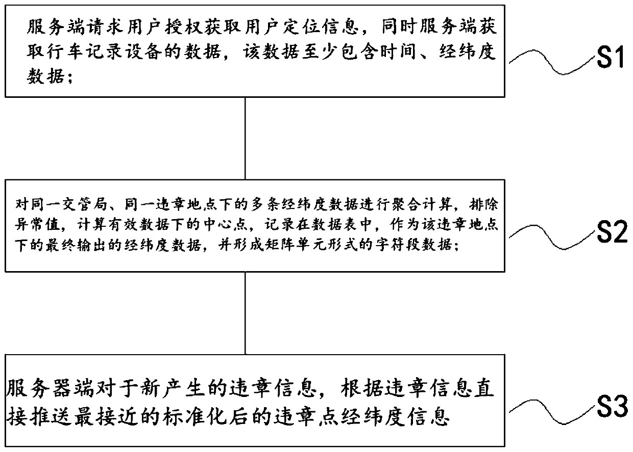
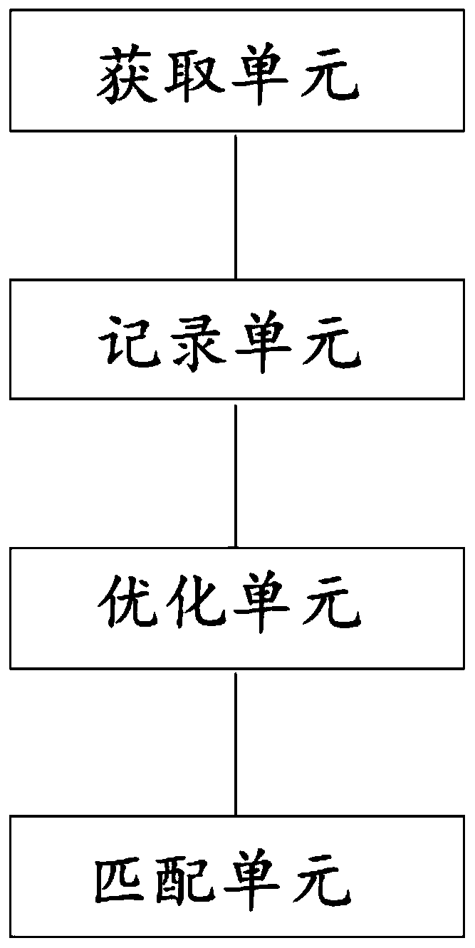
[0045] In order to enable those skilled in the art to better understand the solution of the present application, the technical solution in the embodiment of the application will be clearly and completely described below in conjunction with the accompanying drawings in the embodiment of the application. Obviously, the described embodiment is only It is an embodiment of a part of the application, but not all of the embodiments. Based on the embodiments in this application, all other embodiments obtained by persons of ordinary skill in the art without creative efforts shall fall within the scope of protection of this application.

[0046] It should be noted that the terms "first" and "second" in the description and claims of the present application and the above drawings are used to distinguish similar objects, but not necessarily used to describe a specific sequence or sequence. It should be understood that the data so used may be interchanged under appropriate circumstances for...


PUM


Abstract

The present invention discloses a method and device for obtaining the latitude and longitude of a violation location by using a driving trajectory. The method comprises the steps of: requesting, by a server, an authorization from a user to obtain the user location information, and obtaining, by the server, the data of a driving recording device, wherein the data at least includes time and latitude and longitude data; performing an aggregation calculation on the multiple pieces of latitude and longitude data at the same traffic management bureau and at the same violation location, removing abnormal values, calculating a central point of the valid data, recording the central point in a data table as the final output latitude and longitude data at the violation location, and forming character field data in the form of a matrix unit; retrieving, by the server, matching character field data for notification for the newly entered violation information. In the embodiment of the present application, the method realizes a technical effect of accurately locating the violation point by obtaining the data of the positioning device, thereby solving the technical problem that a user does not know the violation location.

Description

technical field [0001] The present application relates to the field of communications, and in particular, to a method and device for obtaining the latitude and longitude of violation locations through driving trajectories. Background technique [0002] For a long time, the traffic control department has used pure text descriptions for the locations of violations, such as "S32 Shenjiahu Expressway (downlink) near 53KM section", "Gudai Road, Hechuan Road, about 100 meters east", such descriptions are not accurate and intuitive. [0003] 1. It takes up to 14 days from the occurrence of the violation to the entry. Over time, it is often difficult for car owners to recall the location of the violation based on text alone, especially in remote and unfamiliar places, which increases the cost of violation inquiries; [0004] 2. Different cities have the same road name, such as Renmin Avenue. If you join the car owner’s self-driving tour and pass through multiple cities, there will b...

Claims


Application Information

Patent Timeline
Patent Type & Authority Applications(China)
IPC IPC(8): G01C21/28G08G1/00
CPCG01C21/28G08G1/205
Inventor 王熙吴峰郭伟
Owner 万安懋昇信息科技有限公司
Why Eureka
Try Eureka