

Method for Enhancing a Three Dimensional Image from a Plurality of Frames of Flash Lidar Data
a three-dimensional image and flash lidar data technology, applied in the field of three-dimensional image enhancement, can solve the problems of insufficient spatial resolution, precision, and single frame or mosaic of flash lidar data, and achieve the effect of safe and precise spacecraft landings and enhanced flash lidar data
Active Publication Date: 2012-02-09
NASA
View PDF1 Cites 45 Cited by
- Summary
- Abstract
- Description
- Claims
- Application Information
AI Technical Summary
Benefits of technology
[0008]It is one aspect of the present invention to provide an image processing technique, applicable to flash LIDAR data, to enhance the flash LIDAR data, permittin
Problems solved by technology
Through theoretical and simulation analysis, it has been determined that a single frame or mosaic of flash LIDAR
Method used
View moreImage
Smart ImageViewing Examples

Examples
 PUM
 Abstract
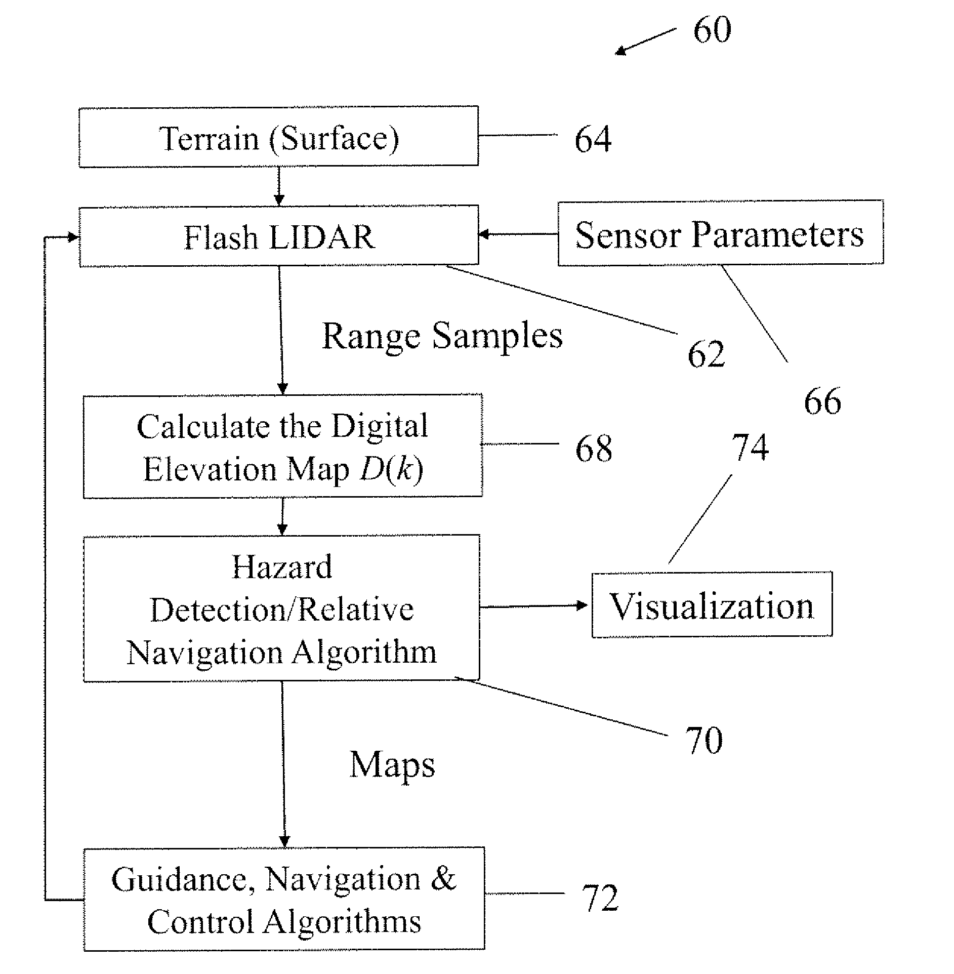
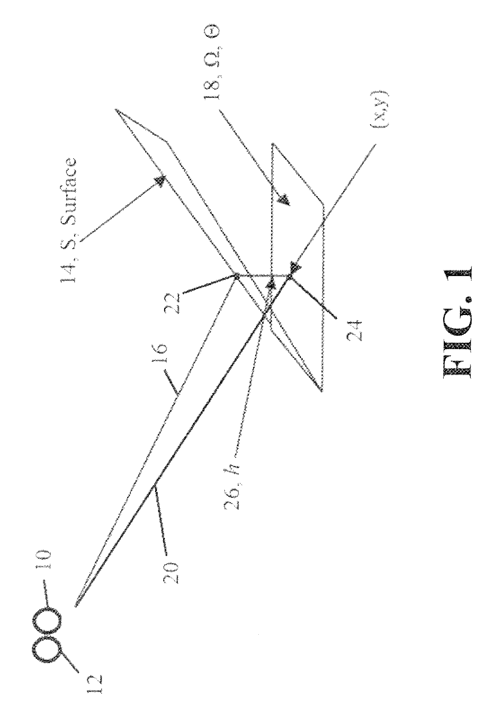
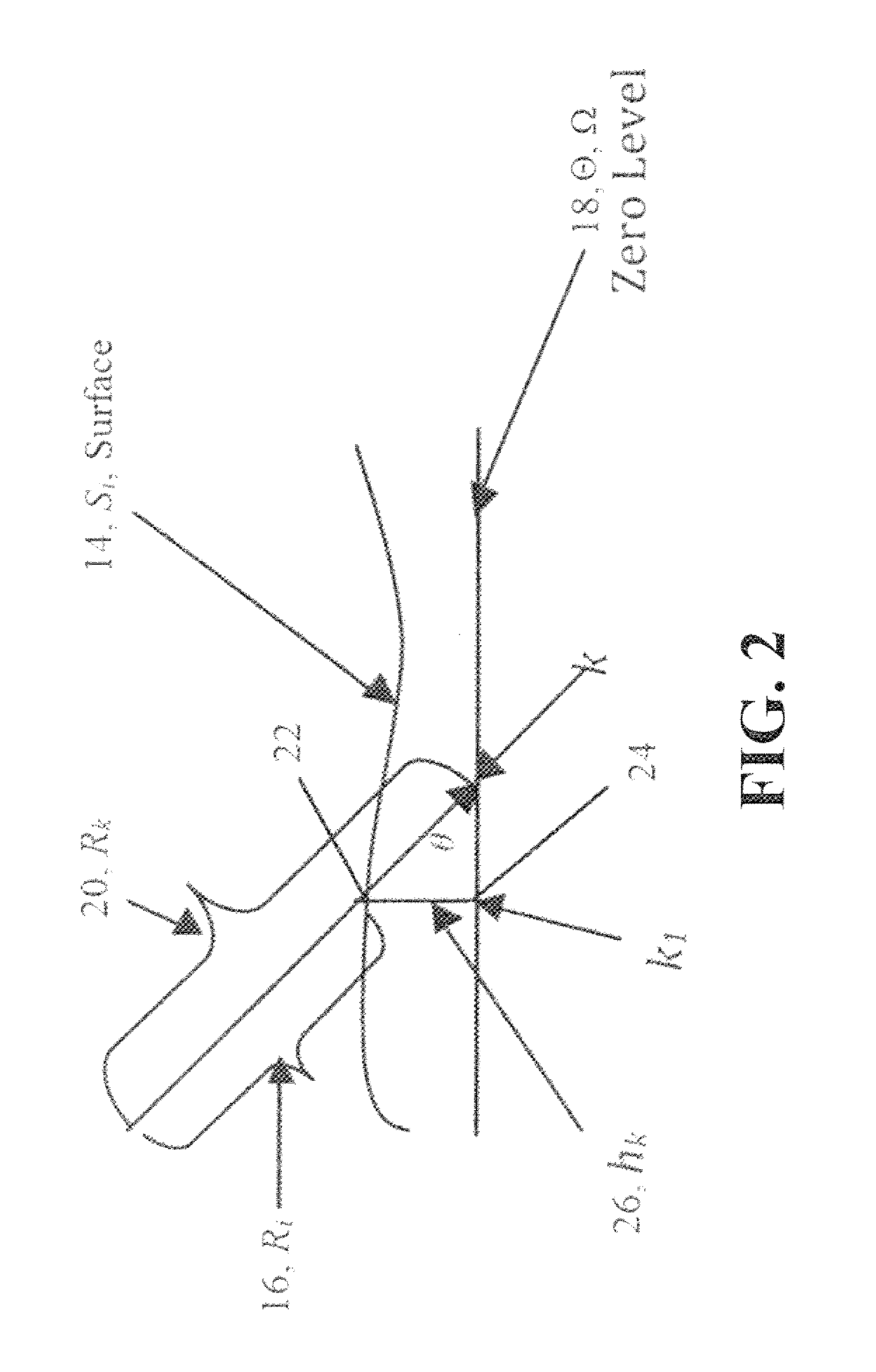
A method for enhancing a three dimensional image from frames of flash LIDAR data includes generating a first distance Ri from a first detector i to a first point on a surface Si. After defining a map with a mesh Θ having cells k, a first array S(k), a second array M(k), and a third array D(k) are initialized. The first array corresponds to the surface, the second array corresponds to the elevation map, and the third array D(k) receives an output for the DEM. The surface is projected onto the mesh Θ, so that a second distance Rk from a second point on the mesh Θ to the detector can be found. From this, a height may be calculated, which permits the generation of a digital elevation map. Also, using sequential frames of flash LIDAR data, vehicle control is possible using an offset between successive frames.
Description
CROSS-REFERENCE TO RELATED PATENT APPLICATIONS[0001]Pursuant to 35 U.S.C. §119, the benefit of priority from U.S. Provisional Patent Application Ser. No. 61 / 357,224, with a filing date of Jun. 22, 2010, is claimed for this non-provisional application. This application is also a continuation-in-part of and claims priority to U.S. patent application Ser. No. 13 / 046,030, filed on Mar. 11, 2011, which claims priority to U.S. Provisional Patent Application Ser. No. 61 / 313,271, filed on Mar. 12, 2010. The contents of the foregoing applications are hereby incorporated by reference in their entireties.STATEMENT REGARDING FEDERALLY SPONSORED RESEARCH OR DEVELOPMENT[0002]The invention was made by employees of the United States Government and may be manufactured and used by or for the Government of the United States of America for governmental purposes without the payment of any royalties thereon or therefore.FIELD OF THE INVENTION[0003]The present invention concerns a method for creating a Di...
Claims
Login to View More Application Information
Patent Timeline
 IPC IPC(8): G01C3/08G01S17/894
CPCG01S7/4808G06T19/00G06T17/05G01S17/89G01S17/894
InventorVANEK, MICHAEL D.AMZAJERDIAN, FARZINBULYSHEV, ALEXANDER
OwnerNASA