
UAV-based fire location method and system
A positioning method and UAV technology, applied in the field of UAV-based fire field positioning methods and systems
Patent Information
- Authority / Receiving Office
- CN · China
- Patent Type
- Patents(China)
- Current Assignee / Owner
- Publication Date
- 2021-06-11
Smart Images
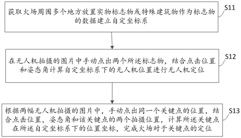
Figure 1 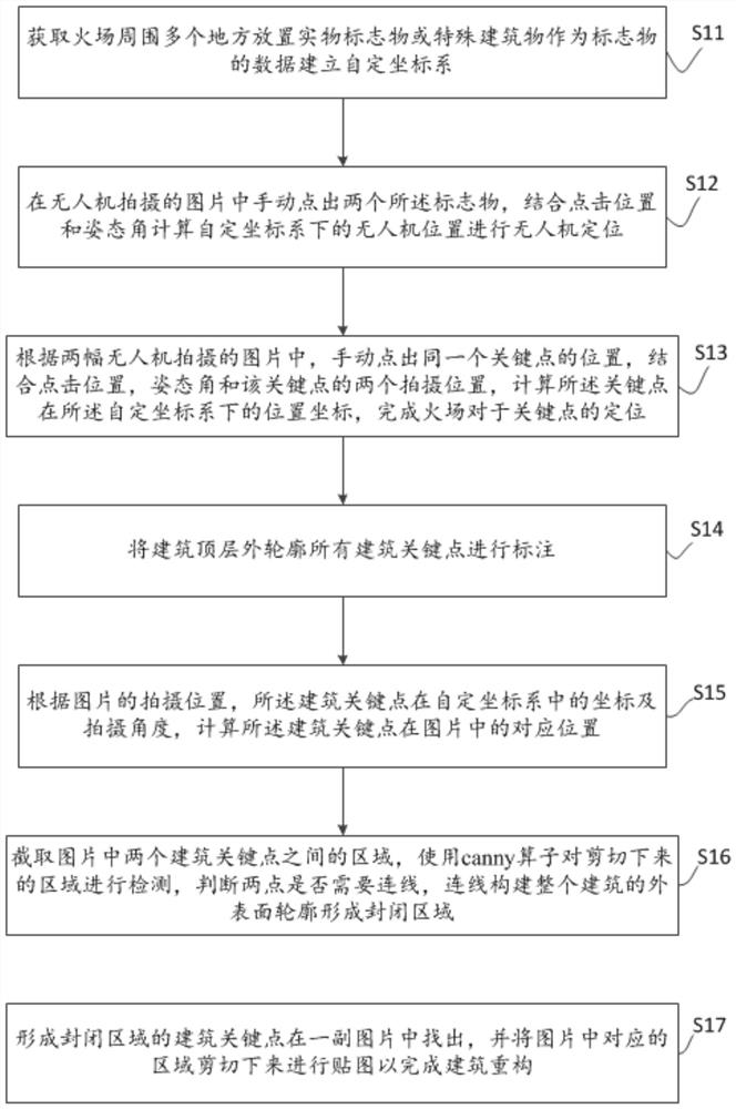
Figure 2 
Figure 3
Abstract
Description
technical field
[0001] The invention relates to the technical field of unmanned aerial vehicles and fire detection, in particular to a method and system for locating fire sites based on unmanned aerial vehicles. Background technique
[0002] As the saying goes: "Water and fire are merciless", the handling of fire is still a worldwide problem today. Fires are sporadic, frequent, and sudden, and the fire is easy to spread. When a fire occurs, firefighters need to investigate the fire scene as soon as possible, determine the fire situation, make tactical deployments for the on-site building structure, and look for rescue targets and rescue routes. Only when the fire commander has a comprehensive and detailed understanding of the fire situation in a timely manner can he make correct judgments and deployments to achieve the goal of controlling the spread of the fire and reducing economic losses and casualties.
[0003] At present, the method of fire detection is often that the ...
Examples
Embodiment Construction
[0043] The following will clearly and completely describe the technical solutions in the embodiments of the present invention with reference to the accompanying drawings in the embodiments of the present invention. Obviously, the described embodiments are only some, not all, embodiments of the present invention. Based on the embodiments of the present invention, all other embodiments obtained by persons of ordinary skill in the art without creative efforts fall within the protection scope of the present invention.
[0044] see figure 1 , is a schematic flowchart of a UAV-based fire location method according to Embodiment 1 of the present invention. The method includes steps as follows:
[0045] Step S11: Obtain the data of placing physical markers or special buildings as markers in multiple places around the fire scene to establish a self-defined coordinate system.
[0046] Specifically, when a fire occurs, disaster relief personnel evacuate the scene and conduct a simple su...