
Seismic survey method of the subsoil
Patent Information
- Authority / Receiving Office
- US · United States
- Current Assignee / Owner
- Publication Date
- 2015-02-03
Smart Images
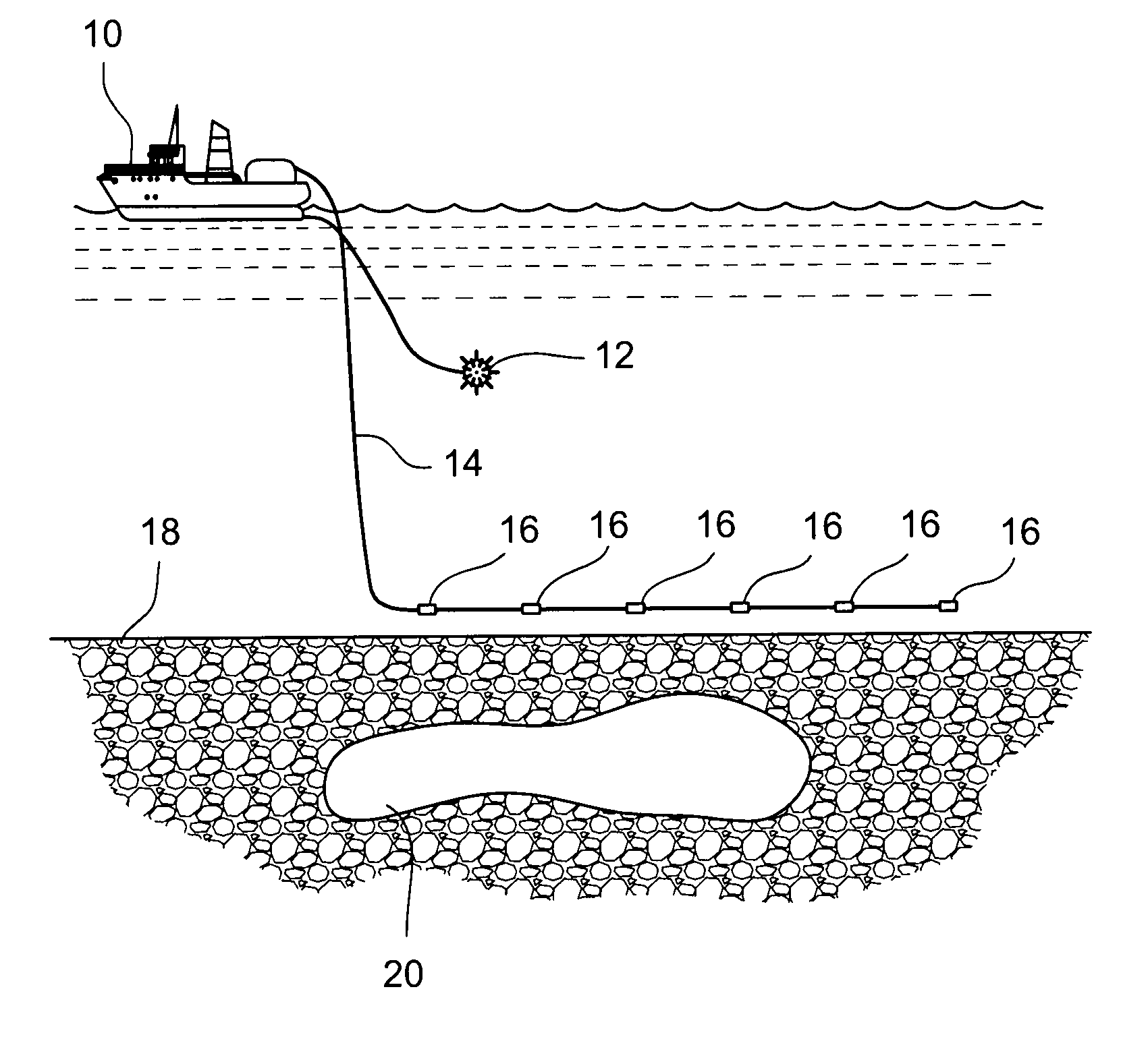
Figure 1 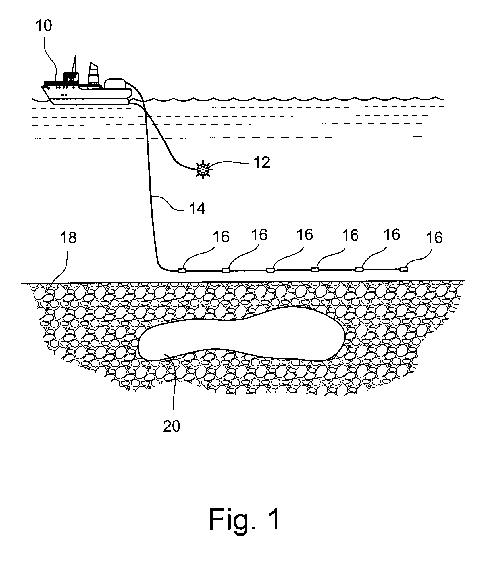
Figure 2 
Figure 3
Abstract
Description
BACKGROUND
[0001] 1. Field of the Invention
[0002] The present invention relates to a seismic survey method of the subsoil and, more specifically, a survey method of the subsoil which uses data obtained from seismic responses generated from various seismic sources.
[0003] 2. Description of Related Art
[0004] In order to identify geological structures in the subsoil, in particular potential hydrocarbon traps, effecting so-called seismic acquisition campaigns is known, in which seismic waves are used for effecting measurements of the non-invasive type. In a seismic acquisition campaign, seismic waves are generated by means of artificial sources which can be obtained with explosives, vibrating mechanical devices, air cannons or with any other device suitable for generating seismic waves.
[0005] Seismic wave sources are positioned in multiple positions on the surface of the land or sea, above the area to be surveyed. These sources are activated to generate seismic waves which propagate in depth, ...
Examples
Embodiment Construction
[0021]With reference in particular to FIG. 1, this shows a seismic ship and the relative equipment that allow to implement the seismic survey method of the subsoil, in particular beneath a sea bottom, according to the present invention. During a marine seismic acquisition, the seismic ship 10 tows behind it, immersed in water, a seismic source 12, consisting for example of an air cannon or other sound wave generators, and one or more cables 14. Seismic sensors 16, in particular hydrophones, are arranged along each cable 14. The length of the cables 14 and the distance between the hydrophones 16 are parameters established on the basis of the objectives of the seismic survey.
[0022]The cables 14 extend along the navigation line of the ship 10 and are possibly directed through the use of suitable directing devices (not shown). During the same seismic acquisition campaign, more than one ship can also be used, which move in coordination, towing further seismic sources 12 and / or cables 14 ...