Display method of electronic map and terminal thereof

An electronic map and display method technology, applied in the field of geographic information, can solve the problems of incomplete map information, intuition, lack of map information, etc.

Active Publication Date: 2012-06-27
SHENZHEN CARELAND TECH
View PDF6 Cites 20 Cited by
  • Summary
  • Abstract
  • Description
  • Claims
  • Application Information

AI Technical Summary

Problems solved by technology

[0003] The purpose of the embodiments of the present invention is to provide an electronic map display method and terminal, aiming at solving the

Method used


Image

  • Display method of electronic map and terminal thereof
  • Display method of electronic map and terminal thereof
  • Display method of electronic map and terminal thereof

Examples


Embodiment Construction

[0036] In order to make the object, technical solution and advantages of the present invention clearer, the present invention will be further described in detail below in conjunction with the accompanying drawings and embodiments. It should be understood that the specific embodiments described here are only used to explain the present invention, not to limit the present invention.

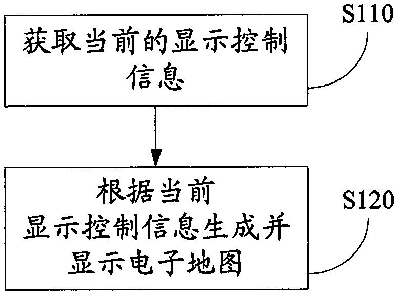
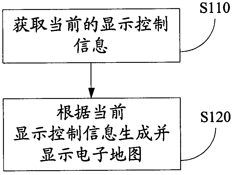
[0037] figure 1 The implementation flow of an electronic map display method provided by the embodiment of the present invention is shown, and the details are as follows:

[0038] Step S110, acquiring current display control information, including at least the current map display scale, map display angle of view, and display position information, the display position information being the current navigation position or map browsing position.

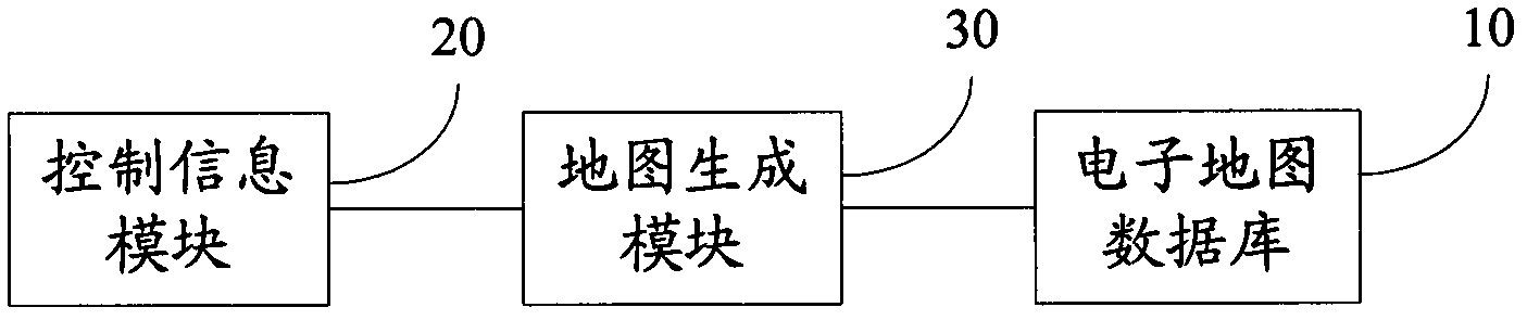
[0039] In specific implementation, the map display method of this embodiment can be implemented on the location service terminal, and the location service te...


PUM


Abstract

Applicable to the field of electronic maps, the invention provides display method of an electronic map. The method includes: acquiring current display control information, which comprises a current map display scale, a map display view angle as well as display position information; generating and displaying an electronic map according to the current display control information, with the electronic map composed of road information and three-dimensional block information. Specifically, the road information contains abstract roads, which are generated based on center lines formed by connecting each road recording point that can reflect road elevation information; and the three-dimensional block information includes three-dimensional urban buildings. Correspondingly, the embodiment of the invention also provides an electronic map display terminal. Through the embodiment of the invention, electronic map display can be realized, so that users can more visually understand urban geographical environment information.

Description

technical field [0001] The invention belongs to the field of geographical information, in particular to an electronic map display method and a terminal. Background technique [0002] In recent years, with the continuous popularization and development of the Internet and navigation applications, electronic maps have risen rapidly due to the use of the Internet and navigation hardware as the carrier. Maps have gone from paper to the Internet, personal computers, and vehicle and handheld devices. People can easily search for places of interest, driving routes and bus routes in the electronic map, and provide reference suggestions for travel arrangements. As we all know, we live in a real three-dimensional real world, and the traditional two-dimensional map only simplifies the projection of all kinds of geographical objects in three-dimensional space to the two-dimensional plane, resulting in the third-dimensional direction (that is, the vertical direction). The lack of geometr...

Claims


Application Information

Patent Timeline
IPC IPC(8): G01C21/00
Inventor 张文星
Owner SHENZHEN CARELAND TECH
Why Eureka
Try Eureka