
Map change detection device, map change detection method, and program
a technology of change detection and detection method, applied in the field of map change detection device, can solve the problems of not being able to detect new buildings, failure to match images, and failure to detect originally demolished houses, etc., and achieve the effect of keeping costs down
Patent Information
- Authority / Receiving Office
- US · United States
- Patent Type
- Applications(United States)
- Current Assignee / Owner
- Publication Date
- 2008-12-04
- Estimated Expiration
- Not applicable · inactive patent
Smart Images
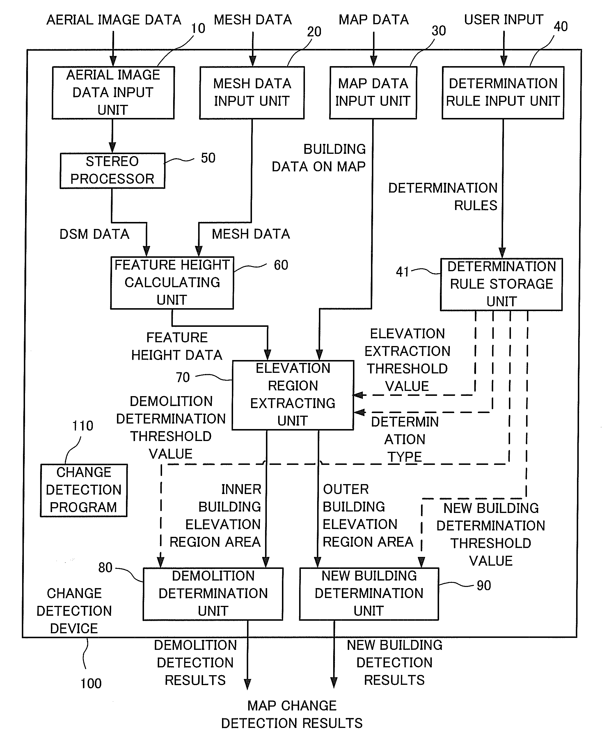
Figure 1 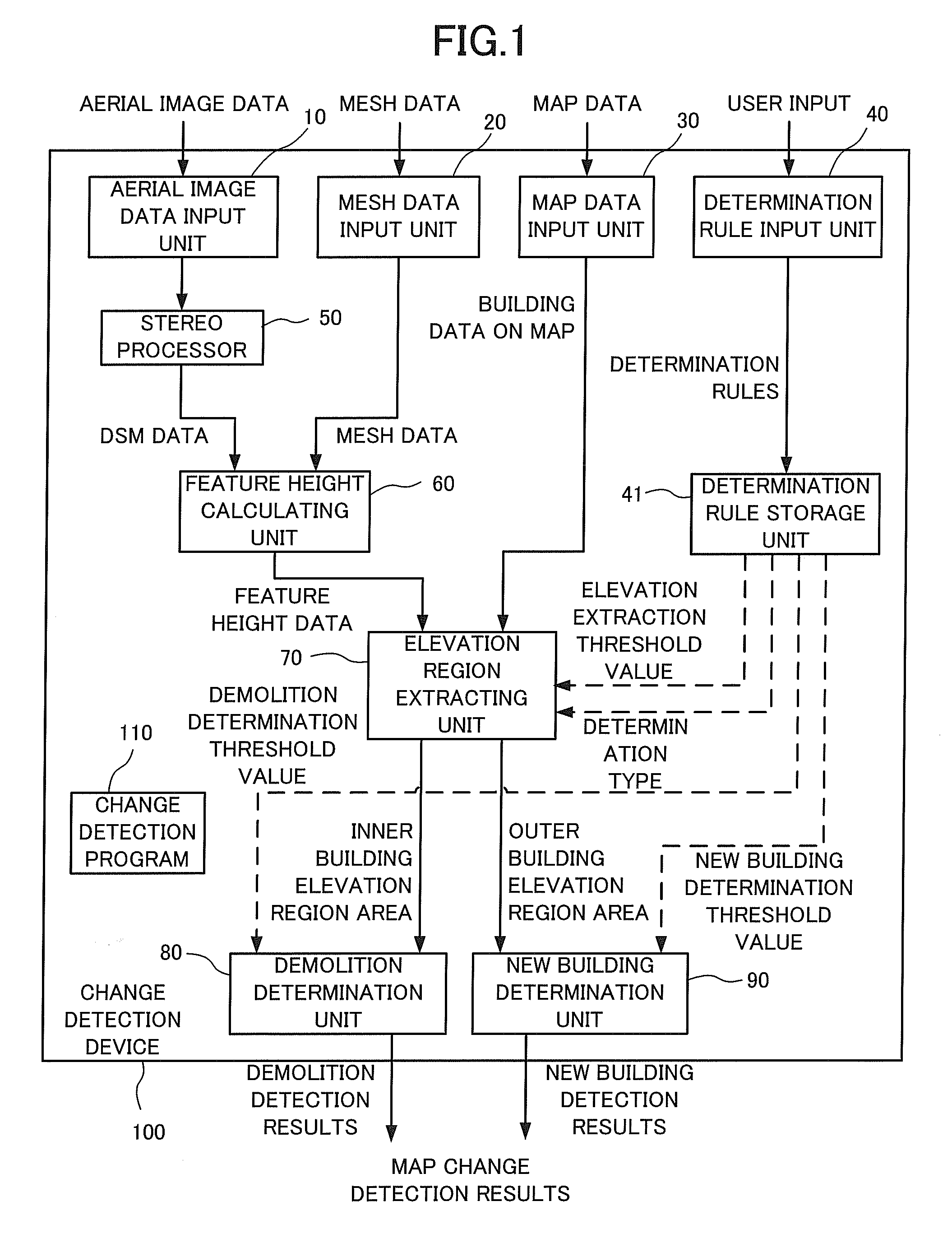
Figure 2 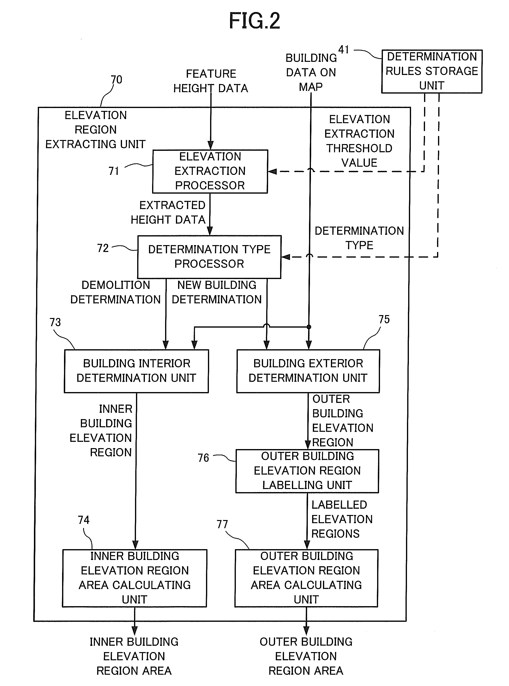
Figure 3
Abstract
Description
[0001] This application is based upon and claims the benefit of priority from Japanese patent application No. 2007-145971, filed May 31, 2007, the disclosure of which is incorporated herein in its entirety by reference.BACKGROUND OF THE INVENTION
[0002] 1. Field of the Invention
[0003] The present invention relates to a map change detection device that detects changes such as changes in houses and buildings on a map. The present invention more specifically relates to a map change detection device, a map change detection method, and a map change detection program that detect changes in houses and buildings etc. on a two-dimensional map using digital surface layer model data obtained from a stereo image.
[0004] 2. Description of the Related Art
[0005] As a method of detecting changes in maps, a method of detecting changes in housing exists where a map is projected onto aerial photographs. Changes in housing are then detected by comparing the buildings on the map and the buildings on the aerial...
Examples
applied example
[0140]An applied example explained in the following is an example of a specific application to a change detection device shown in the embodiment of the present invention. The applied example adopts the same basic configuration and basic operation as the embodiment. The following is mainly a description of points of distinction with the embodiment, with aspects of the configuration and operation that are common to the embodiment being omitted from the description as appropriate.
[0141]A detailed description for a process up to extracting extracted feature height data is given with reference to FIG. 11 to FIG. 15.
[0142]FIG. 11 is a schematic view showing an example of a situation on the ground in the real world. FIG. 11 shows a real world partial cross-section, with features existing on undulating geographical features.
[0143]FIG. 12 is a schematic view showing DSM data generated by stereo matching processing from aerial images taken partially in the real world shown in FIG. 11. The DSM...