
Laser Scanner System And Registration Method Of Point Cloud Data
Patent Information
- Authority / Receiving Office
- US · United States
- Current Assignee / Owner
- Publication Date
- 2018-01-04
Smart Images
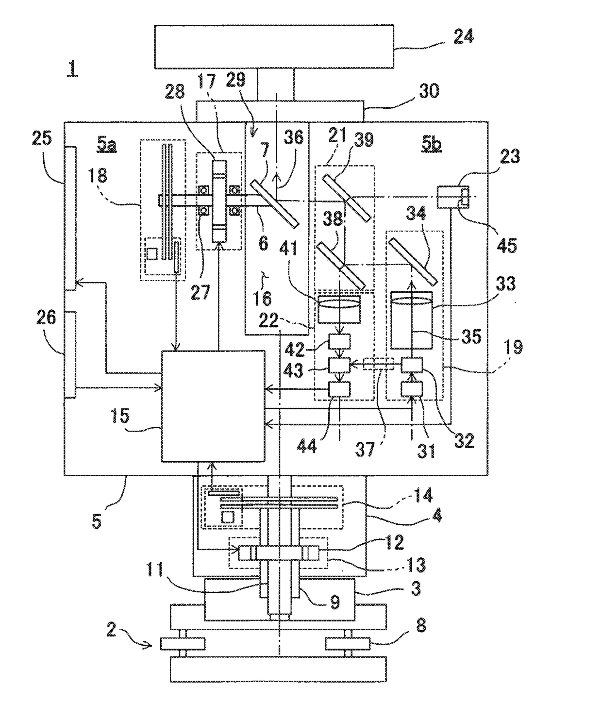
Figure 1 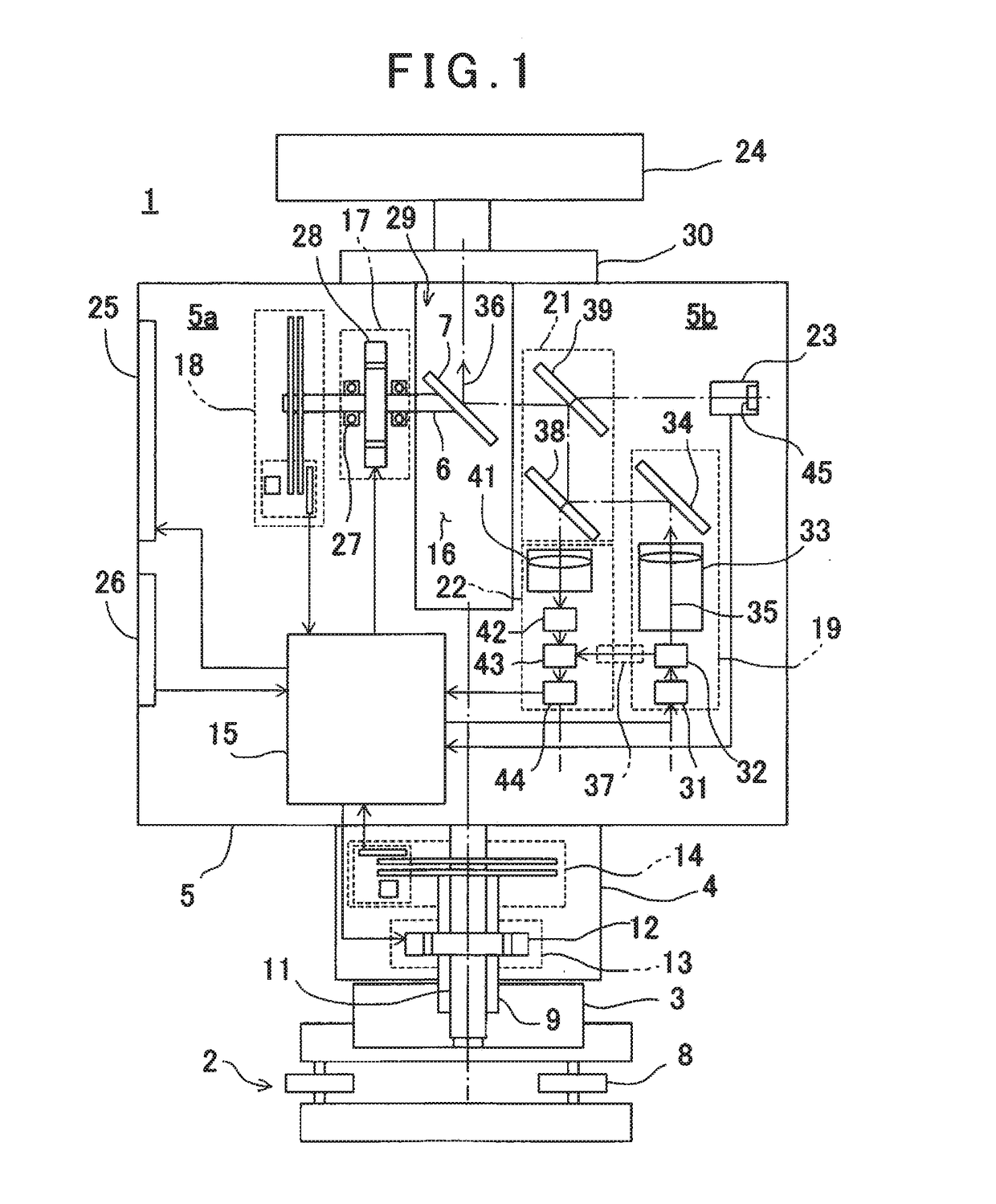
Figure 2 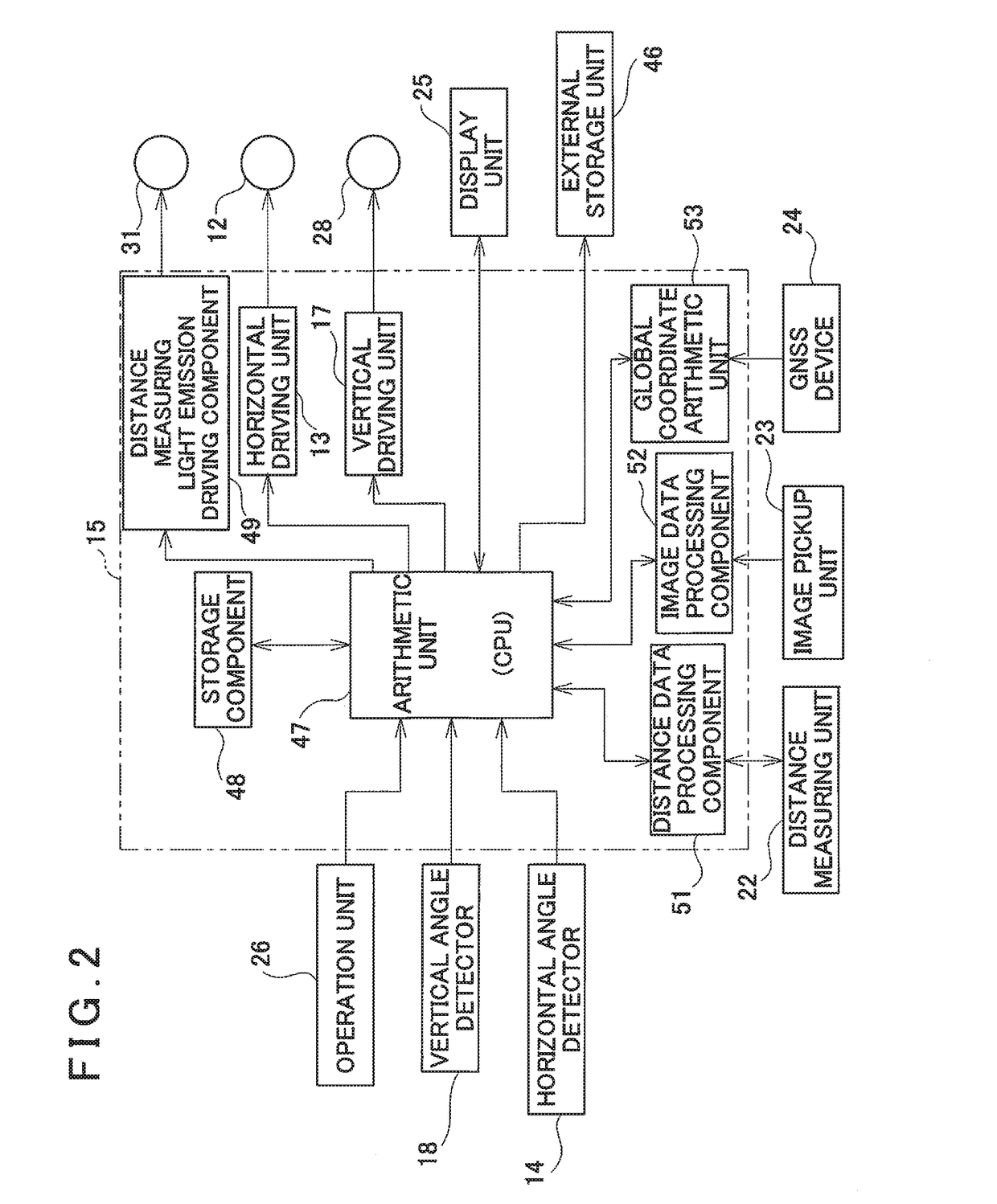
Figure 3
Abstract
Description
BACKGROUND OF THE INVENTION
[0001] The present invention relates to a laser scanner system which acquires point cloud data, acquires the point cloud data from a plurality of points by the laser scanner and integrates a plurality of point cloud data as point cloud data of the same coordinate system and a registration method of the point cloud data.
[0002] As a measuring instrument for acquiring three-dimensional data of an object to be measured, a laser scanner is used. The laser scanner scans a distance measuring light and acquires point cloud data of an object to be measured or a range to be measured. Based on the point cloud data as acquired, a shape and the three-dimensional data of the object to be measured can be determined.
[0003] Further, in a case where the object to be measured is a structure such as a building or the like, if a measurement is performed from one direction, point cloud data of a shaded portion cannot be acquired. For this reason, the point cloud data of the object...
Examples
Embodiment Construction
[0022]A description will be given below on an embodiment of the present invention by referring to the attached drawings.
[0023]First, referring to FIG. 1 and FIG. 2, a description will be given on a three-dimensional laser scanner used in the present embodiment.
[0024]As shown in FIG. 1, a laser scanner 1 is installed via a tripod 10 (see FIG. 3). The laser scanner 1 comprises a leveling unit 2 attached on the tripod 10, a base unit 3 provided on the leveling unit 2, a frame unit 5 provided on the base unit 3 via a horizontal rotary unit 4 so as to be rotatable in a horizontal direction and a scanning mirror 7 provided on the frame unit 5 so as to be rotatable around a vertical rotation shaft 6 as a center in a vertical direction (an elevation direction).
[0025]The leveling unit 2 has, e.g., one supporting pin (not shown) and two adjusting screws 8. When the adjusting screws 8 are adjusted so that a tilt sensor (not shown) provided on the frame unit 5 detects a horizontality, a levelin...