
Real time perception obstacle evading system and method for unmanned hydrographical survey ship obstacles
An obstacle and surveying ship technology, which is applied in the field of real-time obstacle avoidance system for unmanned channel surveying ships, can solve the problems of large manpower and material resources, personal safety, low work efficiency, etc., achieve safe and smooth work, reduce use costs, improve The effect of safety factor and work efficiency
Patent Information
- Authority / Receiving Office
- CN · China
- Current Assignee / Owner
- Publication Date
- 2017-06-30
- Estimated Expiration
- Not applicable · inactive patent
Smart Images
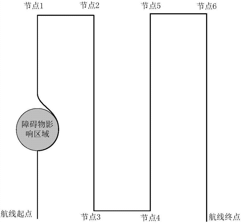
Figure 1 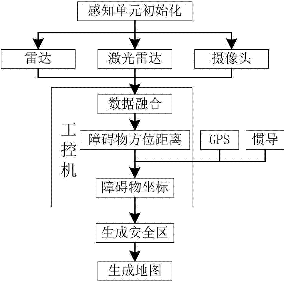
Figure 2 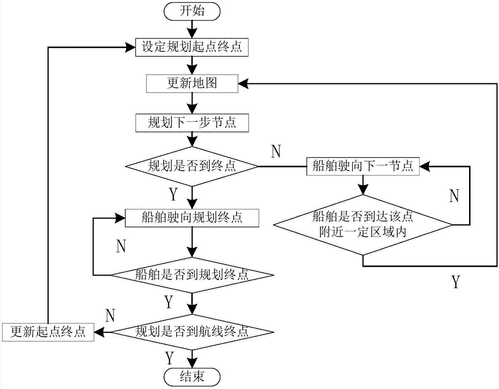
Figure 3
Abstract
Description
technical field
[0001] The invention belongs to the field of environment perception and path planning, and in particular relates to a real-time obstacle avoidance system and method for an unmanned channel measuring ship. Background technique
[0002] In recent years, with the advancement of science and technology, more and more new technologies have been applied to hydrographic survey operations, greatly improving the efficiency of hydrographic survey. Channel measurement provides ship drivers with the position and height of obstacles such as reefs in the channel by measuring the underwater topography, which is very important for safe and smooth shipping. At present, most of the waterway survey work is done manually, which requires a lot of manpower and material resources, and the work efficiency is low, and it is easy to cause personal safety problems when measuring shoals and depressions. Measurement work, but it requires a special person to monitor whether there are obst...
Examples
Embodiment Construction
[0030] The present invention will be further described below in conjunction with specific examples and accompanying drawings.
[0031] The invention provides a real-time obstacle avoidance system for an unmanned waterway surveying ship, which includes:
[0032] The ship positioning unit is used for real-time positioning of the ship and obtaining the real-time coordinates of the ship. In this embodiment, GPS and inertial navigation system are used.
[0033] Environmental awareness units such as figure 2 As shown, it is used to sense obstacle information within a certain range by using at least two kinds of environmental perception sensors, data fusion of obstacle information detected by each environmental perception sensor, target matching and superimposition for detection overlapping areas, and combined with ship real-time Coordinates, generate an obstacle map, center on the detected obstacle position, set a circular area with a certain radius as the obstacle-affected area ...