

A method for drawing dynamic arrows in the drawing of military symbols
An arrow and dynamic technology, applied in the field of 3D geographic information drawing, can solve problems such as cumbersome drawing methods, difficult drawing personnel, and inability to clearly express battlefield situation information, and achieve the effect of vivid battlefield situation information and fast rendering methods
- Summary
- Abstract
- Description
- Claims
- Application Information
AI Technical Summary
Problems solved by technology
Method used
Image

Examples
Embodiment Construction
[0093] The present invention will be further described below in conjunction with the accompanying drawings and embodiments.
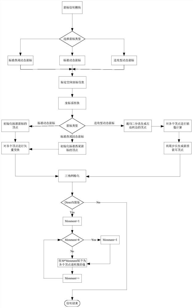
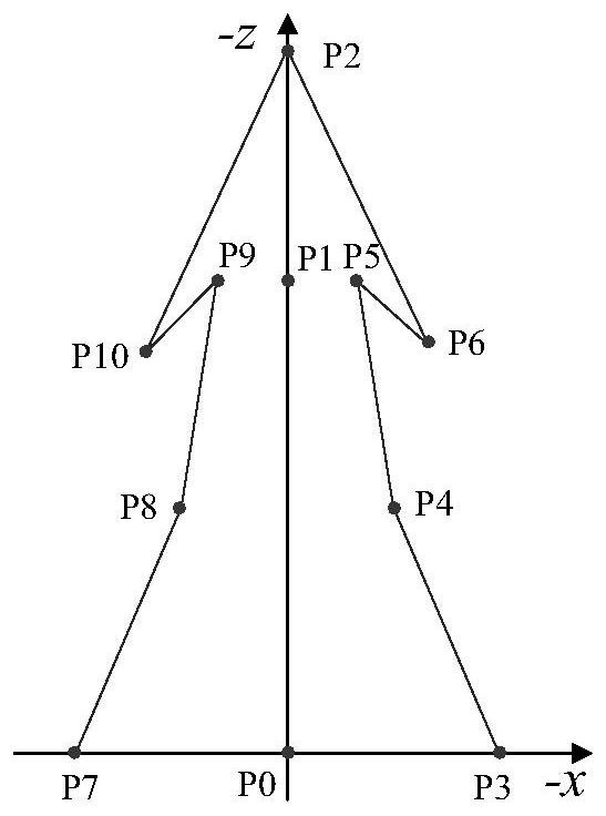
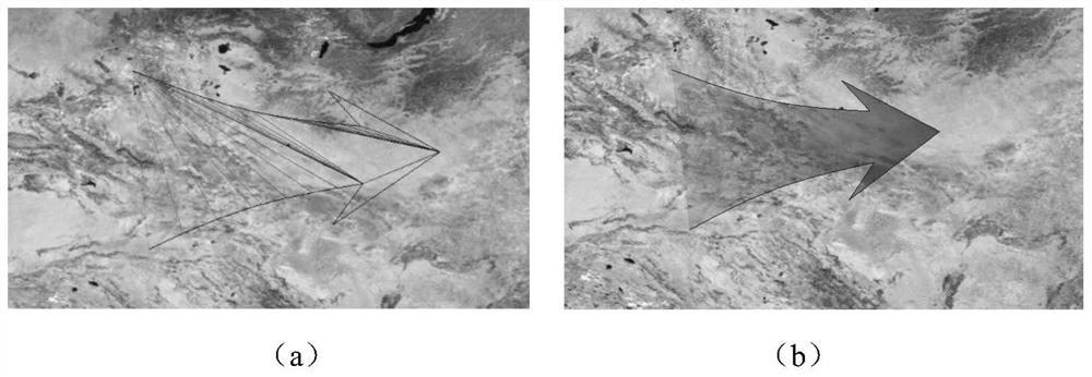
[0094] The dynamic arrows drawn by the present invention are all composed of basic triangular primitives formed by many vertices, and the present invention includes the drawing of standard dynamic arrows (standard swallowtail dynamic arrows) and offensive dynamic arrows:
[0095] Step 1. According to the simulated battlefield environment and battlefield situation, select the corresponding dynamic arrows to draw in the three-dimensional geographic information system military standard library drawing interface, and the present invention performs standard dynamic arrows, standard swallowtail dynamic arrows and offensive dynamic arrows. If you draw a standard dynamic arrow, go to step 2; if you draw a standard dovetail dynamic arrow, go to step 3; if you draw an offensive dynamic arrow, go to step 4;
[0096] Step 2. The steps of standard dynamic arrow plot...
PUM
 Abstract
Description
Claims
Application Information