

Farming landscape space structure loss evaluation method
A technology of spatial structure and evaluation method, applied in data processing applications, forecasting, instruments, etc.
- Summary
- Abstract
- Description
- Claims
- Application Information
AI Technical Summary
Problems solved by technology
Method used
Image

Examples
Embodiment Construction
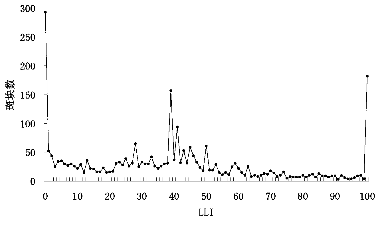
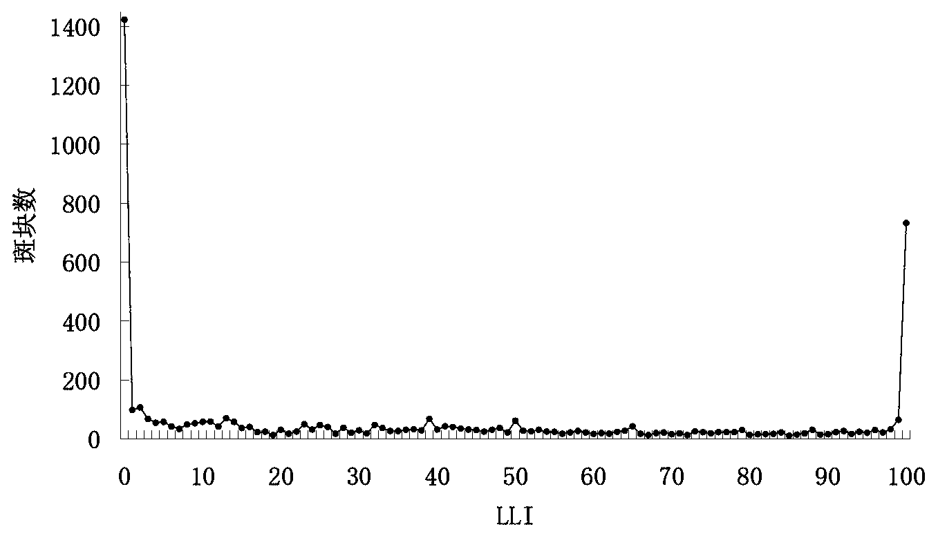
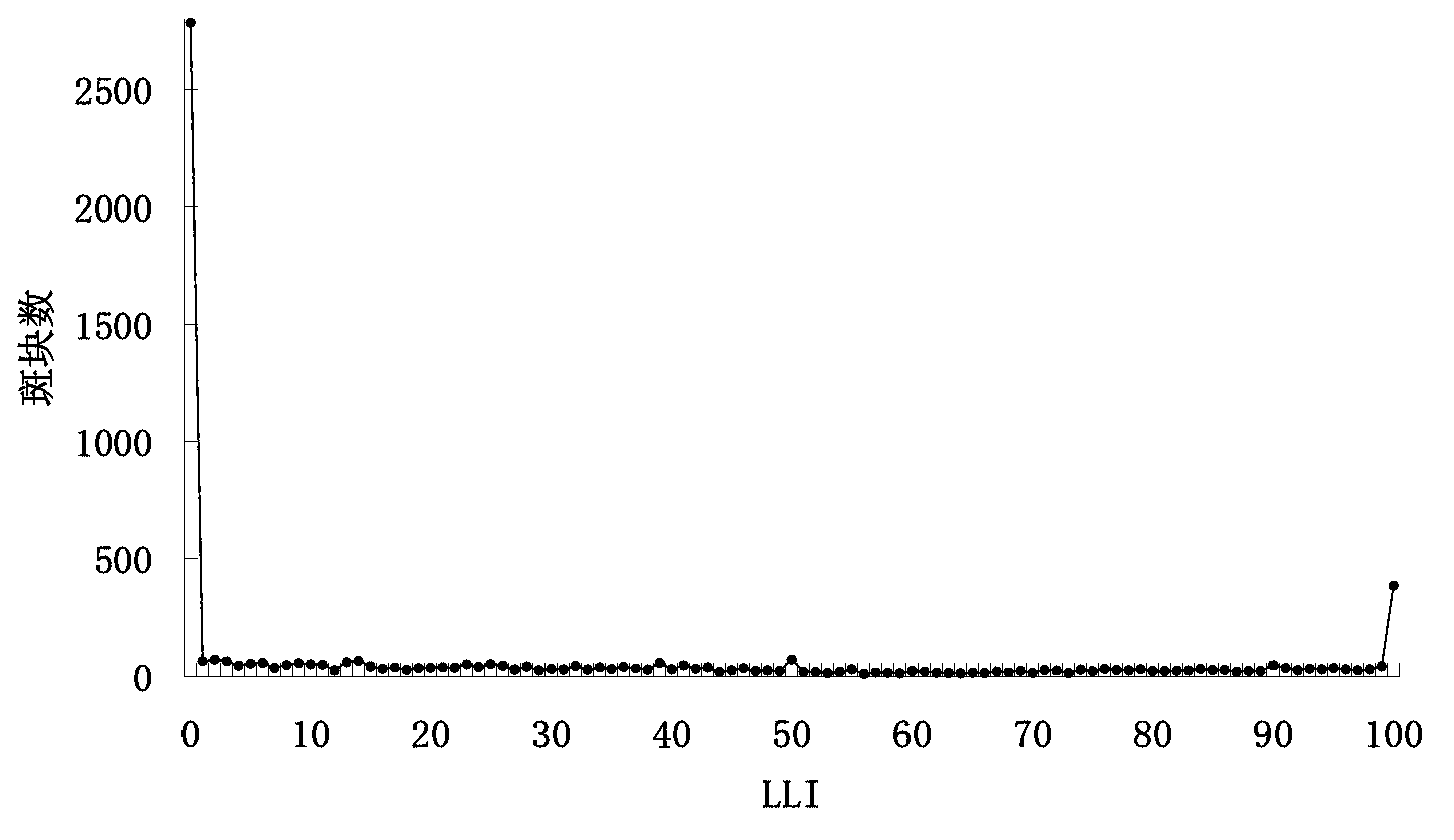
[0038] According to the vector land use data of different time phases, use the Features to Raster in ArcGIS software (that is, the vector data rasterization function) to convert it into raster data with a resolution of 30m×30m, and then use the Raster Calculator (that is, the raster data to Data calculation function) to extract the landscape information of cultivated land reduction in Zhuhai City during 1973-1988, 1988-1998, and 1998-2008. Convert the raster data into vector data through the Raster To Features of ArcGIS (that is, the function of converting raster data into vector data), and extract the information layer of the reduced cultivated land. Then use Feature Envelop to Polygon (that is, the function of generating the smallest bounding box from vector data) to generate the smallest bounding box for the newly reduced cultivated land landscape patch. If the patch is rectangular, its smallest bounding box needs to be enlarged. Then, the generated bounding box and the ori...
PUM
 Abstract
Description
Claims
Application Information