

Long-distance high-precision elevation transfer aiming target plate
A high-precision, long-distance technology, applied in the direction of height/horizontal measurement, measuring devices, instruments, etc., can solve the problems that the GPS leveling method cannot be implemented according to the specifications, cannot meet the observation requirements at the same time, and the accuracy and reliability are difficult to guarantee. Low power, convenient power supply and low cost
- Summary
- Abstract
- Description
- Claims
- Application Information
AI Technical Summary
Problems solved by technology
Method used
Image

Examples
Embodiment Construction
[0022] In order to make the object, technical solution and advantages of the present invention clearer, the present invention will be further described in detail below in conjunction with the accompanying drawings and embodiments. It should be understood that the specific embodiments described here are only used to explain the present invention, not to limit the present invention.
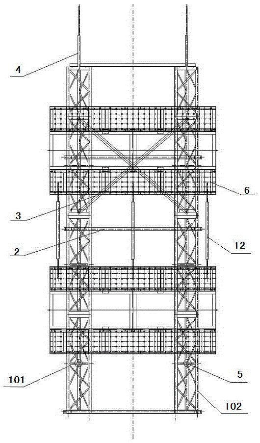
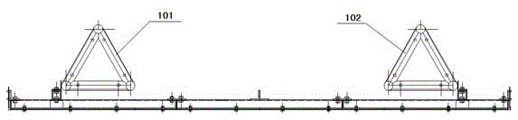
[0023] In a preferred embodiment of the present invention, as Figure 1 to Figure 5 As shown, the long-distance high-precision elevation transfer sighting target board includes the sighting assembly 6, the adjustment rod 12 and the support truss 1, the sighting assembly 6 is fixedly arranged on the support truss 1, the level of the sighting assembly is controlled by a spirit level, and the adjustment rod 12 is arranged between two groups of aiming components 6 .
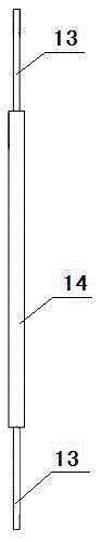
[0024] The illuminating assembly 6 includes a white light box 10 and a black light baffle 8 , and the two black light baffles 8 are res...
PUM
 Abstract
Description
Claims
Application Information